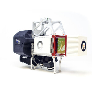
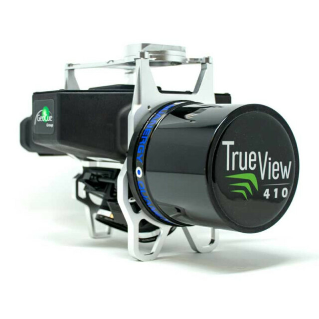
True View 410
UAV LIDAR + Dual Camera System
The True View 410 3D Imaging Sensor (3DIS) is the first solution in the True View series. The True View 410 combines a Quanergy M8 Ultra laser scanner with dual mapping cameras, providing an integrated sensor platform for collecting 3D point clouds and color imagery in a single flight.
GeoCue Group Inc.
Madison, US
Description
The True View 410 is a unified imaging/LIDAR solution that provides everything needed to collect and process concurrently collected imagery and laser scanned data. Post-processing software (True View Evo) is included to process raw sensor data to a geocoded, colorized point cloud, an orthomosiac and final products such as volumetrics, gridded elevation data, contour features, cross-sections and so forth (all the features of LP360 Advanced).
The top-level specifications of the True View 410 are:
- Quanergy M8 Ultra multi-return (up to three returns per pulse) laser scanner
- Effective laser range – 75m
- Pulse Repetition Rate (PRR) – 420,000 outgoing pulses per second in a 360° field of view (FOV), about 100,000 in a usable 90° FOV
- Dual 20 MP Sony Exmor 1” sensor cameras with mechanical shutters, electronic mid-exposure pulse (for GNSS synchronization) and fixed focus lenses. This camera is custom built for GeoCue.
- Fused imagery FOV from dual oblique cameras – 120°
- Applanix APX-15 Position and Orientation System (POS)
- Rigid milled aluminum main frame
- Operating modes – Imagery only, laser data only, combined imagery/laser (default)
- Data transfer via USB memory stick (USB Mass Storage, UMS)
- > 1 Hour battery life
- System is controlled via a plain text configuration file
- System operation and power is totally independent from the drone platform
- System mass is about 2.25 kg (including battery)
- Optional mounting kit for the DJI Matrice M600
True View 410 is available as a traditional purchase or as an “evergreen” Hardware as a Service (HaaS) subscription model.
Specifications
-
Application
-
Main applications
General purpose UAV-based topographic survey
Training, maintanence and support
All available
Distinguishable features
Integrated dual cameras with FOV matched to LIDAR, full-post-processing software
-
Measurement Characteristics
-
Scanning method
360 rotating
Range accuracy [mm]
20
Scanning Speed [measurements p second]
430
multiple pulses in air
N
Min. pulse frequency [Hz]
430,000
Max. pulse frequency [Hz]
430,000
Max. field of view [degrees]
120
Max. number of recorded echoes per pulse
3
Recording of intensity of return signal [bits]
8
-
Physical Properties
-
Height [cm]
17.5
Length [cm]
30
Width [cm]
16.7
Weight [kg]
2.25
Water and dust proof
Resistant
-
Laser Pulse Characteristics
-
Wavelength [nm]
905
Min. range of laser pulse [m]
3
Max. range of laser pulse [m]
150
-
Power Supply
-
Power consumption
30 W
Power requirements
RRC-2054 Battery (included)
Type of battery
Lithium Ion
Operation time on single battery [minutes]
60
-
Positioning System
-
Number of GNSS positioning sensors
1
Type of GNSS positioning sensors
Applanix APX-15
Typical positioning accuracy [cm]
1
Heading, Pitch and Role internally captured
Y
Type of INS or IMU
Applanix APX-15
-
Operation Characteristics
-
Camera included
Yes
Mounting
dovetail mount
Requirements for compatible UAVs
Any drone capable of carrying 2.25 kg
Camera specifications
Dual, 20 MP each, mechanical shutter, electronic mid-exposure pulse, fixed focus lens
Control and user interface
USB
-
Data and Software
-
Included software
Yes
Type of storage
SSD
Max. storage space [mb]
256
-
General
-
Year of last update
2020
Year of introduction
2019
Related products


