
Description
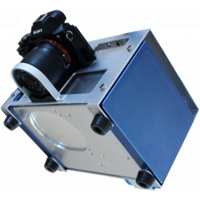
Introduction of the Sky-Lark UAV LiDAR System, a lightweight LiDAR surveying equipment developed bySurestar featuring a 70-degree vertical field of view.
Specifications
-
Application
-
Main applications
TopographyTransmission line surveySurface mining measurementCivil engineeringEmergency surveyRail road and oil pipe line surveyBeach surveyCorridor mapping
Training, maintanence and support
free maintainence and system upgrade during warranty period.
-
Measurement Characteristics
-
Range accuracy [mm]
10
multiple pulses in air
Y
Min. pulse frequency [Hz]
50000
Max. pulse frequency [Hz]
600000
Max. field of view [degrees]
70
Max. number of recorded echoes per pulse
4
Recording of intensity of return signal [bits]
12
-
Physical Properties
-
Height [cm]
20
Length [cm]
34.6
Width [cm]
25.4
Weight [kg]
7.2
Water and dust proof
Y
-
Laser Pulse Characteristics
-
Laser Class
1
Wavelength [nm]
1550
Beam divergence [mrad]
0.35
Min. range of laser pulse [m]
3
Max. range of laser pulse [m]
800
-
Power Supply
-
Power requirements
24V
Power consumption
typ.80W
Operation time on single battery [minutes]
120
-
Positioning System
-
Type of INS or IMU
MEMS IMU
-
Operation Characteristics
-
Camera included
Optional
Camera specifications
SONY A7; Canon D5
-
General
-
Year of last update
2017
Year of introduction
2017


