
RTL-400
MEMS-based LiDAR system designed for small UAVs
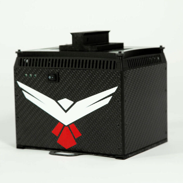
The RedTail LiDAR System is a MEMS-based LiDAR system designed specifically to be flown on small UAVS up to 400 ft. The RTL-400 evenly distributes all points to the ground, generating high-resolution, highly accurate point clouds. Incorporating technology licensed from the U.S. Army Research Laboratory, the RTL-400 has a line scan rate of 400 lines per second, a PRR of 400,000 pulses per second, and offers a 3D line scan mode and a 2D raster scan mode, which can be selected on the fly.
RedTail LiDAR Systems
Fairmont, US
Description
RedTail LiDAR Systems' RTL-400 was designed specifically to provide high-resolution 3D images of objects on the ground from small drones flying at an altitude up to 400 feet.
Developed with technology licensed from the U.S. Army Research Laboratory (ARL), the RTL-400 provides unique scanning capabilities for a wide range of applications – from precision agriculture to construction site monitoring and management.
The RTL-400 incorporates an innovative microelectromechanical system (MEMS) mirror-based laser scanner that rapidly and evenly distributes laser pulses to the ground, moving side-to-side 400 times each second. This rapid line scan rate, coupled with a laser pulse rate of up to 400,000 pulses per second, yields point clouds that are unprecedented in resolution and density.
Unlike other LiDAR systems, the RTL-400 can be operated in two scanning modes. In addition to the line scan mode, the RTL-400 offers a 30 x 30-degree raster scan mode for “stand and stare” missions. The scanning mode can be selected on the fly, providing drone operators unmatched operational flexibility when planning and flying their missions.
Learn more at https://www.redtaillidar.com/
About RedTail LiDAR Systems
RedTail LiDAR Systems is a division of 4D Tech Solutions, Inc., a company focused on providing innovative technology-based solutions to address government and commercial customer needs. RedTail LiDAR System’s in-house technical expertise – coupled with a full suite of software and hardware design and manufacturing tools – allows us to develop custom LiDAR solutions for manned and unmanned vehicle applications. 4D Tech Solutions, Inc. is a Service-Disabled Veteran-Owned, HUBZone-certified small business.
For more infromation contact:
Bryson Begley
Marketing Manager
(304)-306-2396
Specifications
-
Application
-
Main applications
RedTail Point Cloud Generator
Training, maintanence and support
Contact RedTail Lidar Systems support for more information.
-
Measurement Characteristics
-
Scanning method
MEMS based mirror
Range accuracy [mm]
15
Scanning Speed [measurements p second]
400
multiple pulses in air
N
Min. pulse frequency [Hz]
200,000
Max. pulse frequency [Hz]
400,000
Max. field of view [degrees]
35
Max. number of recorded echoes per pulse
3
-
Physical Properties
-
Height [cm]
19.05
Length [cm]
19.56
Width [cm]
15.49
Weight [kg]
2.13
-
Laser Pulse Characteristics
-
Laser Class
Class IIIb
Wavelength [nm]
1550
Standard pulse length [ns]
2
Beam divergence [mrad]
0.2
Min. range of laser pulse [m]
3
Max. range of laser pulse [m]
120
-
Power Supply
-
Power consumption
50 watts
Power requirements
18-24 Volt DC Source
Type of battery
LiPO
-
Positioning System
-
Number of GNSS positioning sensors
2
Type of GNSS positioning sensors
N/A
Typical positioning accuracy [cm]
2.2
Heading, Pitch and Role internally captured
Y
Type of INS or IMU
Applanix APX-18
-
Operation Characteristics
-
Camera included
Optional
Mounting
Customizable for UAV platforms
Requirements for compatible UAVs
N/A
Control and user interface
RedTail Ground Control Station
-
Data and Software
-
Type of storage
flash card
Max. storage space [mb]
256
Included software
RedTail Point Cloud Generator Tool/Installer
-
General
-
Year of last update
2020
Year of introduction
2019


