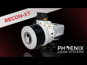

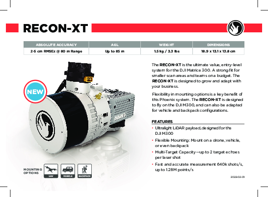
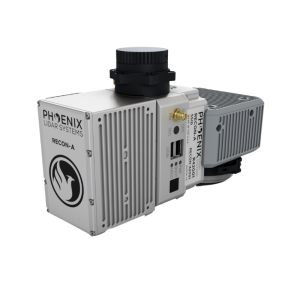
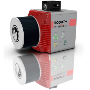
RECON-XT
Great Value Meets Great Performance
The RECON-XT is the ultimate value, entry-level system for the DJI Matrice 300.
Phoenix LiDAR Systems
Austin, US
Description
A strong fit for smaller scan areas and teams on a budget. The RECON-XT is designed to grow and adapt with your business. Flexibility in mounting options is a key benefit of this Phoenix system. The RECON-XT is designed to fly on the DJI M300, and can also be adapted for vehicle and backpack configurations.
Features:
-
Ultralight LiDAR payload, designed for the DJI M300
-
Flexible Mounting: Mount on a drone, vehicle, or even backpack
-
Multi-Target Capacity—up to 2 target echoes per laser shot
-
Fast and accurate measurement 640k shots/s, up to 1.28M points/s
Quick Specs:
-
Absolute Accuracy = 2- 5 cm RMSEz @ 80 m
-
Intraswath Precision = 4.5 cm RMSDz @ 80 m
-
Weight = 1.8 kg / 3.9 lbs
-
Dimensions = 20.7 x 12.1 x 15.7 (cm)
-
Pulse Rate = 5/10/20 Hz, up to 3 returns
-
Max DJI M300 Flight Time = 33 Minutes
Do you have questions about this product?
- Questions about price, availability, and/or retailers
- Questions about technical specifications and usage
- Questions about suitability for your project or application
Specifications
-
Application
-
Main applications
Vegetation Penetration Utility Infrastructure Open Pit Mining Forestry Construction Site Monitoring Cultural Preservation Glacier & Snowfield Mapping Land Erosion
-
Measurement Characteristics
-
Scanning Speed [measurements p second]
1280000
Max. field of view [degrees]
360
Max. number of recorded echoes per pulse
2
-
Physical Properties
-
Height [cm]
13.8
Length [cm]
18.9
Width [cm]
13.1
Weight [kg]
1.5
-
Laser Pulse Characteristics
-
Laser Class
Class 1
Wavelength [nm]
905
Max. range of laser pulse [m]
120
-
Positioning System
-
Number of GNSS positioning sensors
1
Typical positioning accuracy [cm]
0.5
-
Operation Characteristics
-
Mounting
DJI Skyport V2
Camera included
Yes
Camera specifications
24MP
Control and user interface
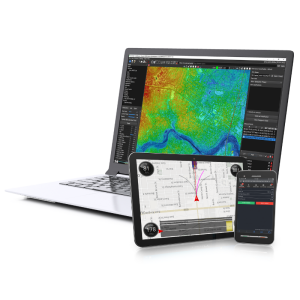
Payload Web Interface
-
Data and Software
-
Type of storage
flash card
Max. storage space [mb]
256000
-
General
-
Year of last update
2021
Year of introduction
2021
Documents
Brochure
recon-xt.pdf
852 KB
Other documents
-
RECON-XT SpecSheet852 KB
Videos
