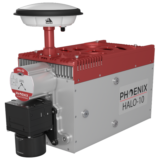
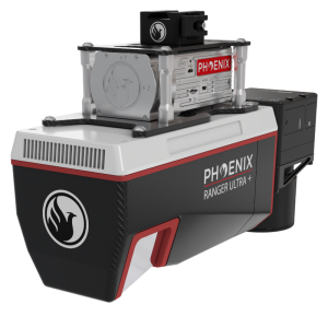
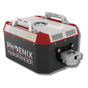
HALO-H10
The Ultimate City Scale Mapping System
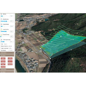
Take your mapping capabilities to new heights with the HALO series LiDAR scanners. Designed for high-altitude, high-efficiency mapping, these scanners make it easy to complete city-scale LiDAR projects with swath widths up to 4,000 m.
Phoenix LiDAR Systems
Austin, US
Description
The HALO series LiDAR scanners are made for high altitude high efficiency mapping. City scale lidar projects are easily achievable with swath widths reaching 4,000 m. Selectable measurement rates up to 1 MHz and line speed up to 250 per second can be tuned to meet challenging pulse density specification.
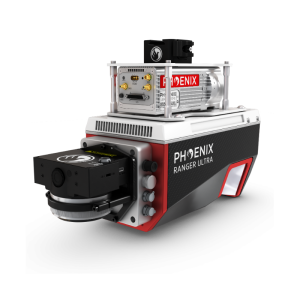
The HALO-10 is available in two different models; the HALO-10CM and HALO-10LR. The CM variant is designed for city and corridor mapping applications. The LR variant is a general-purpose longer range mapping system and can accommodate greater terrain relief due to its higher maximum flying heights.
Features
-
High density 1 MHz mapping
-
Narrow 0.3 mrad beam divergence results in excellent accuracy & precision
-
1030 nm laser wavelength for better measurement probability through various environmental conditions
-
An 80° field of view for quick coverage of wide areas
Quick Specs
-
Intraswath Precision = 6 cm RMSDz @ 750 m
-
Weight = ~30 kg / 66 lbs
-
Dimensions = 51.9 x 21.6 x 24.8 cm
-
Pulse Rate = 100 - 1125 kHz, viirtually unlimited returns
-
Laser Range = 2500 m @ 20% reflectivity
Do you have questions about this product?
- Questions about price, availability, and/or retailers
- Questions about technical specifications and usage
- Questions about suitability for your project or application
Specifications
-
Application
-
Main applications
general mapping, utilities mapping, agriculture and forestry monitoring, open pit mining operations
Training, maintanence and support
Provided by Phoenix LiDAR Systems
Distinguishable features
longest ranging Phoenix LiDAR System
-
Measurement Characteristics
-
Range accuracy [mm]
30
Scanning Speed [measurements p second]
1000000
multiple pulses in air
Y
Min. pulse frequency [Hz]
100000
Max. pulse frequency [Hz]
1125000
Max. field of view [degrees]
80
Max. number of recorded echoes per pulse
virtually unlimited
-
Physical Properties
-
Height [cm]
24.8
Length [cm]
51.9
Width [cm]
21.6
Weight [kg]
30
-
Laser Pulse Characteristics
-
Laser Class
Class 3B
Wavelength [nm]
1030
Beam divergence [mrad]
0.3
Max. range of laser pulse [m]
4300
-
Power Supply
-
Power consumption
Max 155w
Power requirements
12-28V DC
-
Positioning System
-
Number of GNSS positioning sensors
1
Type of GNSS positioning sensors
GPS+GLONASS+BEIDOU+GALILEO
Typical positioning accuracy [cm]
1
Heading, Pitch and Role internally captured
Y
Type of INS or IMU
Various
Gyroscopes Bias In-Run stability [deg p hr]
Various
-
Operation Characteristics
-
Camera included
Optional
Mounting
Helicopter or fixed wing aircraft
Camera specifications
Various
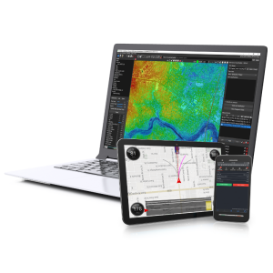
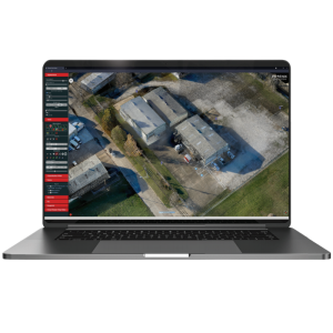
Control and user interface
Phoenix LiDAR System's SpatialExplorer
-
Data and Software
-
Type of storage
SSD
-
General
-
Year of last update
2023
Year of introduction
2023
