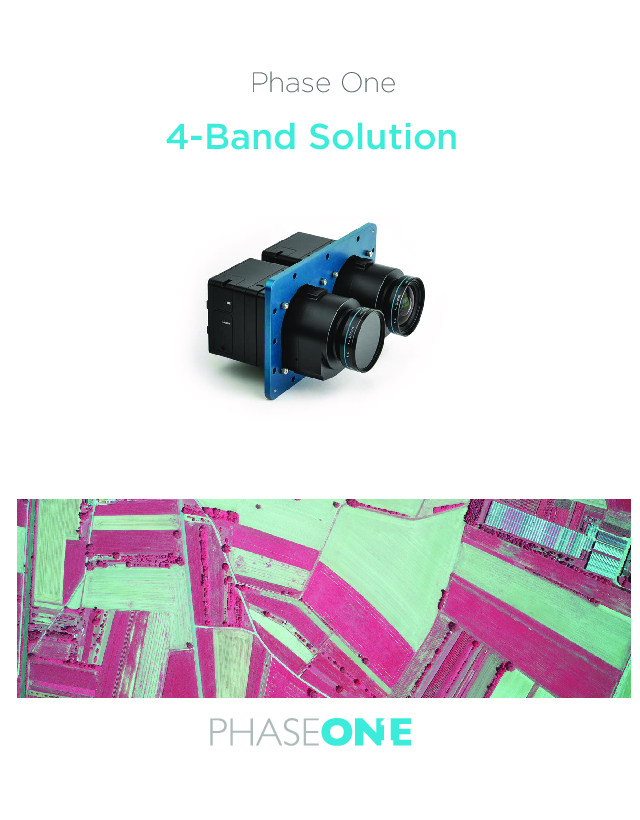
4-Band Multi-Spectral Solution
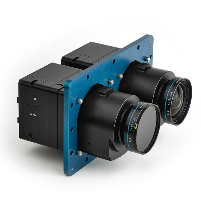
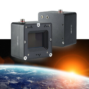
A fully automatic solution developed for capturing and processing 4-Band imagery, using two high-resolution (RGB & NIR), Phase One aerial cameras, specifically designed for the photogrammetric airborne market. Offering 4-Band multi-spectral solutions for markets such as Agriculture, Forestry and Environmental Monitoring by generating distortion-free images and performing fine co-registration of pixels from the NIR to the RGB images.

Phase One A/S
Frederiksberg, DK
Description
Phase One's 4-Band multispectral solution incorporates an innovative batch-processing tool that automates and thus simplifies the four band aerial image generation process. Adding a fourth band of near infrared (NIR) image data to three band colour (RGB) image data yields multispectral information that is very useful in vegetation studies -- in applications ranging from crop metrics for optimization, to vegetation health, environmental contamination and city observations for green site monitoring. The solution is composed of two synchronized Phase One metric aerial cameras mounted side by side on a specially designed base plate, a Phase One iX Controller and Phase One iX Capture software. Images are captured in NIR and RGB bands simultaneously, and processed automatically to generate distortion-free images and perform fine co-registration of the pixels from NIR to the RGB images – including processing different image sizes – with seven different output options, including multispectral CIR images.
Do you have questions about this product?
- Questions about price, availability, and/or retailers
- Questions about technical specifications and usage
- Questions about suitability for your project or application
Specifications
-
Operation Characteristics
-
Platforms (e.g. Helicopter, fixed wing)
Helicopter, Fixed wing. Lightweight and compact: easy to install in small aerial platforms
Min. flying height [m]
0
Max. flying height [m]
30000
Operating temperature: min. [°C]
-10
Operating temperature: max. [°C]
40
-
Multi- & Hyperspectral Sensor Characteristics
-
Numer of spectral channels
4
CCD or CMOS
CMOS
Type of CCD or CMOS
na
Image resolution
Up to 11608 x 8708MP
Sensor arrangement/method
one sensor
Pixel size [µm]
4.6
Aperture
depends on lens F/28-F/-22
Focal length of available lenses [mm]
32 to 240
Dynamic range [bits]
16
Frame rate (f/s)
2
Most narrow wavelength captured [nm]
410
Most wide wavelength captured [nm]
830
-
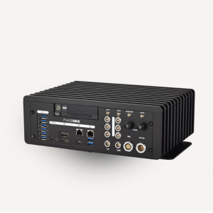
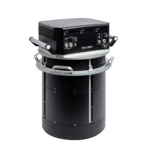
Camera Controller
-
Length [m]
0.29
Width [m]
0.225
Height [m]
0.109
Weight [kg]
4.6
Power requirements
28 V DC
Type of data storage
File
Disc capacity [GB]
2000
Number of discs
2
Type of GNSS/INS positioning system
Supports any NMEA system.Supports several leading systems in event mode
-
Software
-
Export data formats
tiif, jpeg
Type of mission planning software
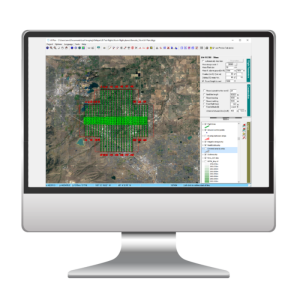
not included
Type of postprocessing software
iX Capture
-
Thermal Sensor Characteristics
-
Accuracy of temp. measurement
NA
-
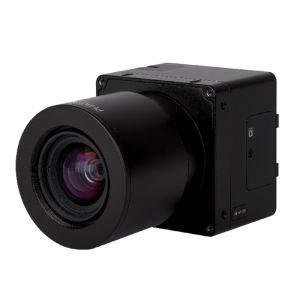
Camera Unit
-
Camera unit Length [m]
0.18
Camera unit Width [m]
0.09
Camera unit Height [m]
0.09
Power requirements
10W
-
General
-
Year of last update
2017
Year of introduction
2016
Type
Multispectral imaging
-
Application and Use
-
Training facilities
optional
Main applications
Agriculture, Forestry, Environmental Monitoring & Research. With the increasing demand for combined NIR and RGB aerial imagery, for applications such as crop analysis for growth optimization, vegetation health and environmental contamination as well as projects including city observation for green site monitoring.
Distinguishable features:
Phase One has developed a fully automatic solution for capturing and processing 4-Band multispectral imagery, using two high-resolution, Phase One aerial cameras, specifically designed for the photogrammetric airborne market. The software automatically generates distortion-free images and performs fine co-registration of pixels from the NIR to the RGB images, including processing different image sizes. 1 frame = 0.6s
Documents
Brochure
4band-brochure-letter-lr1.pdf
1.69 MB
Other documents
-
Product Manual (156)362.08 KB
-
Monitoring Dead Tress and Preserving the Green in Yosemite Park5.61 MB
Videos

