PAS Pana
Most productive wide–area camera solution for aerial mapping
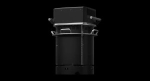
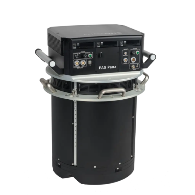
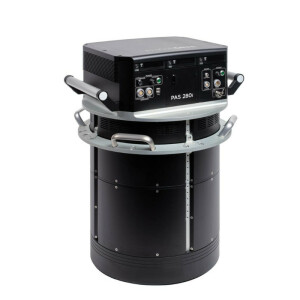
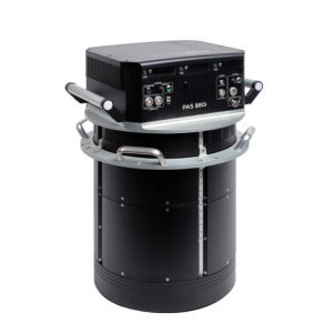
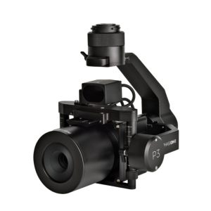
PAS Pana is a 7-camera wide-field camera system consisting of 5 RGB cameras with 150 mm lenses, and 2 NIR cameras with 70 mm lenses. It is a mapping system designed to provide effective performance in country-wide area mapping. Its large swath of 48,800 pixels allows to capture country-wide areas while keeping flying lines, hence flying time at the minimum.

Phase One A/S
Frederiksberg, DK
Description
PAS Pana offers various resolution options to suit diverse needs. It delivers exceptional high resolution at 2.5 cm Ground Sample Distance (GSD) for intricate details and up to 30 cm GSD for rapid wide-area coverage. This flexibility allows you to customize it to meet specific mission requirements, whether focusing on fine details or wide coverage.
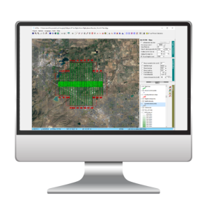
PAS Pana also grants you full data ownership, freeing you from content program constraints. When paired with the entire iX Suite workflow, it ensures effortless data quality control from the outset. PAS Pana is fully integrated with iX Suite: iX Plan, iX Flight Pro and iX Process. iX Suite offers the most effective workflow and supports mapping projects from planning to execution and processing.
Country wide-area mapping solution
Achieve the highest productivity
PAS Pana is a mapping system designed to provide outstanding performance fueled by high-quality data collection. Its large swath of 48,800 pixels enables capturing maximum area in minimal time. In addition, when operated with iX Suite, the level of efficiency reaches a completely new standard. With our proprietary raw image format IIQ, importing has never been smoother, saving you tremendous image conversion time.
Adjust resolution to your needs
By offering a wide range of resolution options, spanning from incredibly high resolution with 2.5 cm GSD to accommodating fast wide area coverage with up to 30 cm GSD, PAS Pana empowers you to achieve optimal results based on your specific geospatial mapping needs, whether it entails fine details or broad coverage.
Embrace the freedom to choose
With PAS Pana, you have the freedom to use your aircraft without any restrictions. It seamlessly integrates into any type of aerial photography aircraft, thanks to its plug-and-play design. By simply pairing PAS Pana with our recognized iX Suite software, data quality assurance from the earliest stage has never been so easy. And for delivering your final product, we provide you with the flexibility to choose any preferred post-processing software supporting multi-head systems.
Own your data
PAS Pana breaks free from content program restrictions, offering unparalleled flexibility for any type of larger projects. Its high adaptability caters to your unique requirements, providing the versatility needed to tackle diverse mapping endeavors.
Do you have questions about this product?
- Questions about price, availability, and/or retailers
- Questions about technical specifications and usage
- Questions about suitability for your project or application
Documents
Brochure
PAS-Pana_Fact-Sheet_Display_EN_2023[1].pdf
587.11 KB
![PAS-Pana_Fact-Sheet_Display_EN_2023[1].pdf](https://geo-matching.com/media/0nvK4wbp.jpg)
Videos

