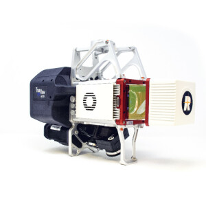
TrueView 720
New class with 3 LiDAR + imagery sensors
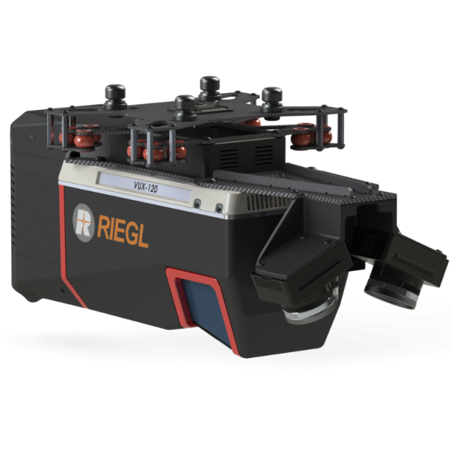
TrueView 720 is our fourth generation RIEGL integration. This is the system for high point density corridor mapping. Using the RIEGL VUX-120 with 3 lidar scanners (oriented nadir and +10 degrees forward and -10 degrees backward) and 3 oblique/nadir cameras for extremely detailed data collection in one flight path.
GeoCue Group Inc.
Madison, US
Description
When scanning power lines, users will be able to capture the poles vertically, front and back. The system can be integrated with drones, airplanes, or helicopters. Ask about custom camera configurations to cover your specific needs.
| Specification | Value |
|---|---|
| Data Collection | LiDAR + Imagery |
| LiDAR Scanner | RIEGL VUX-120 |
| LiDAR Beams/Returns | Up to 5 per outgoing pulse |
| LiDAR Range - usable | 720 m for targets with > 20% reflectivity |
| Positioning and Orientation System | Applanix APX-20, ask for other IMU options available |
| Pulse Repetition Rate | Up to 2.4 Mhz (selectable) |
| Accuracy | Typical: 1cm* |
| Precision | Typical: 0.5 cm* |
| Camera Sensor | Triple 1” sensor with mechanical shutter, hardware mid-exposure pulse, 60 MP combined, RGB. Ask for further custom camera integration. |
| System Operation Temperature Range | -10° to 40° C |
| Mass | 3.4 kg |
* 1 σ @ 150 m range under Riegl test conditions
Specifications
-
Operation Characteristics
-
Camera included


