
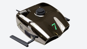
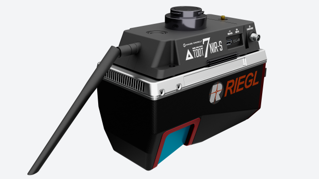
TDOT 7 NIR-S
The TDOT 7 NIR-S integrates high-performance GNSS with the cutting-edge RIEGL laser unit. This advanced laser scanning system stands as a pinnacle of high-performance engineering.
Description
Integrates TDOT system and RIEGL laser unit
Created as a high-performance laser scanning system
Integrates our proud laser scanning system “TDOT” with RIEGL’s “VUX120” which has amazing performance of up 2,400,000 pulses per second and 400 lines.
Seamless process from flight to data output is realized by utilizing the high-performance GNSS/INS navigation system, which is a feature of the TDOT series.
The long-awaited high-end laser scanner system “TDOT 7 NIR-S” was created.
GNSS/INS
Achieving Higher Surveying Performance.
Highly accurate positioning of the position, attitude, and direction of the drone.
Built-in high-performance GNSS/INS combined navigation system with improved data output rate.
Laser viewing angle for highly accurate elevation values
The requirement for drone laser surveying is accuracy of elevation.
The surveying accuracy of elevation values is the accuracy of GNSS plus the laser ranging accuracy, but the farther the scan angle is from the vertical direction, the greater the surveying accuracy of the attitude at the time of laser irradiation affects the accuracy of elevation values.
With a FOV (field of view) of 100°, the VUX120 is a lean laser scanner that can provide elevation values that are less affected by the attitude accuracy of this drone.
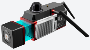
Units equipped with a visible camera and a thermal camera is available as an option.
Visible camera can generate orthoimages and add color information to the acquired point cloud data.
A thermal camera is used to detect temperature information that cannot be determined by a 3D point cloud.
It performs a visualization effect that visualizes relationships, characteristics, and trends that have not been seen before.
Seamless kinematic processing
TDOT series provides a system that seamlessly builds a series of tasks, from automating optimal trajectory analysis using fixed stations that require knowledge to outputting point cloud data.
TDOT 7 NIR can perform conventional kinematic processing without RTK.
Product specification
- Model name:TDOT 7 NIR-S
- Size (approx.):W220 x H180 x D115 mm(Excluding camera unit)
- Weight (approx.):2.7kg
- GNSS:GPS, GLONASS, Galileo, QZSS (Michibiki), BeiDou
LASER SCANNER SPEC
- Laser scanner module:RIEGL VUX-120-23
- Maximum Pulse repetition rate PRR:2400kHz
- Maximum number of echo return:~32
- Minimum Range:5m
- Accuracy:10mm
- Precision:5mm
- Maximum scan speed (lines/sec):50~400
- Laser class / Wavelength:Class 1 / Near infrared
- Beam spread angle:0.4mrad
INS*
- Positional accuracy:5mm
- Heading:0.03°
- Pitch/Roll:0.006°
- Speed:0.01m/sec.
Do you have questions about this product?
- Questions about price, availability, and/or retailers
- Questions about technical specifications and usage
- Questions about suitability for your project or application
