
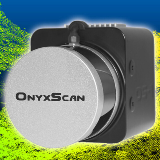
OnyxScan Advanced LiDAR Systems
Fully automated advanced LiDAR systems for UAV-LiDAR surveying
Our OnyxScan LiDAR is the result of more than 10 years of research and development in the unmanned systems domain. Since 2008 we focused our efforts to make UAV remote sensing as realistic as possible. Made for surveyors our UAV embedded LiDAR systems are easy to use, reliable and versatile, aiming to sustain your investment.
AltiGator
Waterloo, BE
Description
Compact and lightweight, our OnyxScan OS-1 ULTRA LiDAR is ready to be embedded on any unmanned or manned vehicle.
The OnyxScan OS-1 ULTRA is foreseen with 32 channels, has a range up to 200 meters and generates up to 1.200.000 returns per second in dual return mode.
The OS-1 ULTRA LiDAR genertates a high points density. This is particularly interesting for aircraft that need to fly at a higher altitude and speed. This is the case for airplanes which have a higher stall speed than other drones.
An RGB camera can be optionally mounted on the OnyxScan OS-1 ULTRA LiDAR, thanks to our specific camera mount, to allow combining laser sensing together with photogrammetry.
Additionally, we also provide a complete UAV-LiDAR turnkey, innovative and efficient solution.
Specifications
-
Measurement Characteristics
-
Range accuracy [mm]
30
multiple pulses in air
Y
Max. number of recorded echoes per pulse
2
-
Laser Pulse Characteristics
-
Laser Class
1
Wavelength [nm]
903
Max. range of laser pulse [m]
100
-
Positioning System
-
Number of GNSS positioning sensors
1
Heading, Pitch and Role internally captured
Y
-
Operation Characteristics
-
Camera included
-
General
-
Year of last update
2019
Year of introduction
2018


