LiDARMill
Cloud-Based Automated LiDAR Processing Software
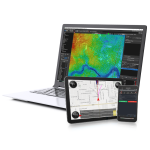
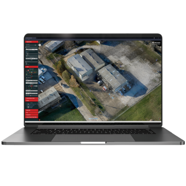
LiDARMill is Phoenix LiDAR's cloud-based post processing solution for users who want survey-grade results with minimal cost in software and training. It is a highly automated tool that takes your data through all of the major steps in the necessary workflow: trajectory processing, calibration, flight line optimization, adjustment to control, camera calibration and bundle adjustment, automated and AI classification, product creation, final reporting, and the creation of a sharable 3D data viewer.
Phoenix LiDAR Systems
Austin, US
Description
LiDAR acquisition is only half the job. Our goal is to decrease the time and cost for users to process their raw data into a calibrated point cloud with basic ground/non-ground classification. Meet LiDARMill, the first cloud-based LiDAR post-processing platform that enables surveying teams to take advantage of precision laser mapping without investing in expensive post-processing software and training.
Processing your LiDAR data in the cloud has never been easier. View your data, track project status, and invite clients to view point clouds – all from your LiDARMill dashboard with faster turnaround times and lower overhead costs. LiDARMill can be customized to serve any size organization, from small survey teams to government departments with heavy post-processing requirements.
Specifications
-
Hardware/software requirements
-
List software environment, e.g. Microstation
Web browser
-
Other
-
Support
Support desk, and detailed documentation
Training
Y
Distinguishing features
Cloud based post processing and delivery of LiDAR + Imagery datasets, including calibration, colorization, AI classification, product creation (DEM, Contours, etc.), accuracy reporting, web viewing, and more..
-
Files and Registering
-
Input formats
Phoenix LiDAR raw data, plus .las, .laz, .cls, .cts, .fls, .fts, .cl, .ct, .rls, .rts, .fl, .ft, .rl, .rt, .pof, .poq, .out, .tif ...
Output formats
.las, .laz. .shp, .html...
Geo-referencing
Y
Stitching multiple scans
Y
-
Pre-processing and Automatic Filtering
-
Image matching facilities
Y
Removal of individual outliers
Y
Removal of vegetation
Y
Removal of buildings
Y
Bare ground DEM generation
Y
-
Manual Measurements
-
3D Coordinates extraction
Y
Length and Height
Y
Angle
Y
Distance
Y
Area
Y
-
Interoperability
-
Assigning colour from imagery to points
Y
-
General
-
Source of Point Clouds
Airborne Lidar, Indoor TLS, Outdoor TLS, Photogrammetric, Radar
Year of initial introduction
2017
Year of last update
2022
Modules
Navlab, Fuser
Supported Systems
Any Phoenix LiDAR System, and many others
-
Automatically Generated Products
-
Regular Grid DEMs
Y
Contour Lines
Y
-
Visualisation and Editing
-
Zoom, pan and rotate
Y
Fly-throughs
Y
Point Reduction
Y


