
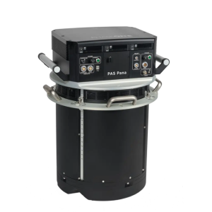
Description
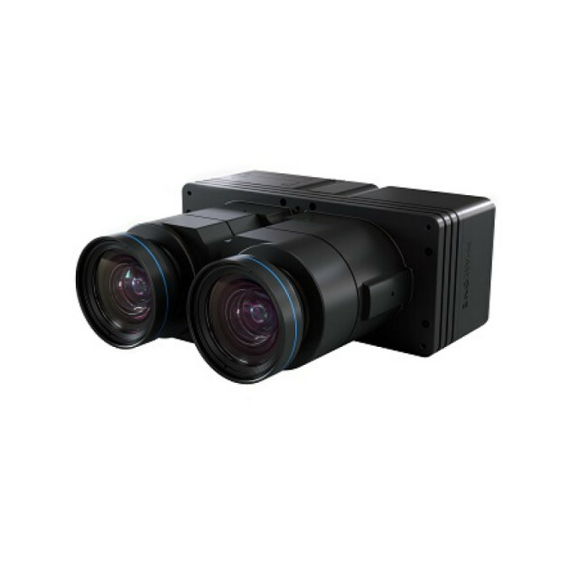
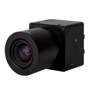
Phase One 190MP Aerial Camera series is the latest Phase One innovation to offer large format metric camera functionality. The iXU-RS1900 dual lens aerial camera is an advanced large format metric camera, with technology designed specifically for the toughest demands of aerial imaging projects.. Developed with leading experts and engineers in the field, the iXU-RS1900 offers exceptional imaging/ aerial coverage, high accuracy and image quality, presenting an excellent alternative to traditional large format cameras in diverse aerial mapping applications such as: remote sensing, precision agriculture, disaster management and monitoring. The new camera is characterized by small pixel size (4.6 µ), large image area (190 MP), high image capture rate of 0.6 sec and exposure time of up to 1/2000, a focal length of 90 mm, and optional NIR channel. The iXU-RS1900 relatively small size, light weight and low power consumption makes it compatible with all types of light aviation vehicles. These factors significantly reduce the operational costs of mapping projects, and make it an ideal camera for use as a standalone camera for photogrammetric work , as a component for LIDAR systems and a NADIR camera for Oblique systems, or as part of an array of multiple cameras.
Do you have questions about this product?
- Questions about price, availability, and/or retailers
- Questions about technical specifications and usage
- Questions about suitability for your project or application
Specifications
-
Application
-
Main applications
Developed with leading experts and engineers in the field, the iXU-RS1900 offers exceptional imaging/ aerial coverage, high accuracy and image quality, presenting an excellent alternative to traditional large format cameras in diverse aerial mapping applications such as: remote sensing, precision agriculture, disaster management and monitoring.Corridor Mapping; Photogrammetric Mapping over large areas; Nadir Orthophotography; LiDAR Augmentation; Oblique Imagery; emergency/disaster response; tactical/security mapping; remote sensing; commercial ortho production; Remote Sensing; Coastal; Forestry; Agriculture
Distinguishable features
iXU-RS 190 MP Aerial System’s Unique Capabilities• Large image coverage• Aerial survey productivity increased by 43% (versus 100MP platforms)• High stereoscopic accuracy due to large FOV along flight• Flight at higher speed due to highly sensitive CMOS sensors and very short exposure time• Large forward overlap for 3D City modeling and denseDSM due to high image capture rate• Small size and light weight enable the use of light aircraft for mapping
Training facilities
Yes
-
Uncertainty
-
Geometric calibration
Y
Radiometric calibration
Y
Precision [pixels]
190MP
-
Data storage
-
Type of storage
SSD
Storage Replaceable
Y
-
Sensor Characteristics
-
Number of lenses
2
Lenses: focal lengths [mm]
90, 90&50
Lenses: interchangeable
N
Type CCD
CMOS
Pixel size [µm]
4.6
Megapixels
190
CCD RGB
Y
Charged Coupled Device (CCD) IR
Y
Max. shutter speed [s]
0.0005
Dynamic range [bits]
16
CCD along track format [pixel x pixel]
11540
CCD across track format [pixel x pixel]
16470
Data collection rate [megapixel/s]
316
Max. across-track FOV [deg]
45.7
-
Operation Characteristics
-
Helicopter
Y
Fixed-wing
Y
Warm-up time [s]
0
Forward motion compensation
Y
In flight pre-view
Y
Max. acquisition duration [h]
No limitation
Temperature controlled pod
N
Platform
-
Software
-
On board image storage format(s)
Phase One RAW / IIQ
Type of mission planning software
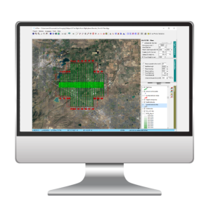
iX Plan or Third Party software
Type of postprocessing software
iX Capture or Third party software
-
General
-
Year of introduction
2017
-
Hardware
-
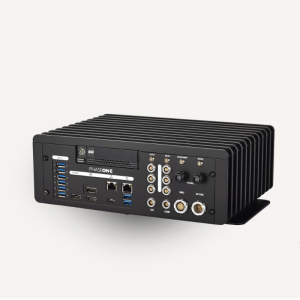
Camera unit Weight [kg]
4.7
Camera unit Length [m]
0.218
Camera unit Width [m]
0.225
Camera unit Depth [m]
0.097
Power requirements
12 – 30 V DC; 20w
Type of GNSS/ INS positioning system
Compatible with Applanix, Novatel, IGI, GGS, VectorNav, NMEA
Documents
Brochure
aerialsolution-brochure-letter-latest-updated-lr1.pdf
4.55 MB
Other documents
-
Product Manual (166)94 KB
