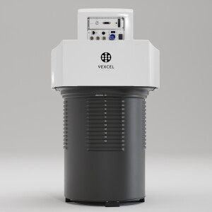
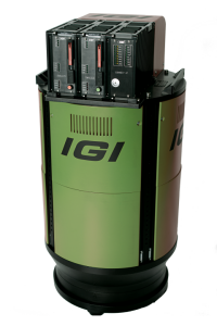
Description
Specifications
-
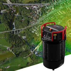
Application
-
Training facilities
Yes
Main applications
3D city views, emergency/first response operations, community planning, utilities, insurance and property assessment.
Distinguishable features
High frame rate, no physical shutters to break down, high shutter speeds, low noise, and fully automated workflow. Ability to reconfigure to stereo or NIR stereo. Nadir.33 b/h ratio , The largest distance between flight lines of almost any oblique sensor
-
Uncertainty
-
Precision [pixels]
0.5
Geometric calibration
Y
Radiometric calibration
Y
-
Data storage
-
Type of storage
SSD
Storage capacity [GB]
Up to 8 TB
Storage Replaceable
Y
-
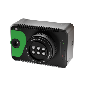
Sensor Characteristics
-
Number of lenses
8
Lenses: focal lengths [mm]
4 x 85 (nadir) & 4 x 100 (oblique) or all 50
Lenses: interchangeable
N
Type CCD
Kodak KAI-29050
Pixel size [µm]
5.5
Megapixels
222
Dynamic range [bits]
12
CCD RGB
Y
Charged Coupled Device (CCD) IR
Y
CCD along track format [pixel x pixel]
8592 x 12500
CCD across track format [pixel x pixel]
6576 x 4350
Max. integration time [s]
1.0
Max. shutter speed [s]
0.0005
Data collection rate [megapixel/s]
222
Max. across-track FOV [deg]
75
-
Operation Characteristics
-
Helicopter
Y
Fixed-wing
Y
Typical flying height [m]
762
Max flying height[m]
10000
Max. acquisition duration [h]
24
Forward motion compensation
Y
In flight pre-view
Y
Temperature controlled pod
N
-
Software
-
On board image storage format(s)
Raw
Type of mission planning software
Compatible with any, Topoflight available
Type of postprocessing software
Isis Earth
-
General
-
Year of introduction
2013
Last update
2014
-
Hardware
-
Camera unit Weight [kg]
16.8
Camera unit Length [m]
0.434
Camera unit Width [m]
0.333
Camera unit Depth [m]
0.333
Power requirements
28v DC (110v - 240v AC with ground power adaptor)
Type of GNSS/ INS positioning system
Compatible with any GPS/GNSS