

About Vexcel Imaging
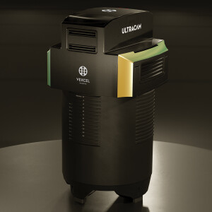
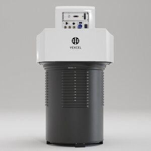
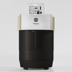
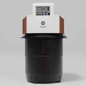
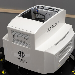
Vexcel Imaging is a global leader in aerial imaging, known for developing cutting-edge aerial cameras, mapping systems, and photogrammetric processing software. The UltraCam 4th generation system lineup includes the high-precision Premium line, renowned for its exceptional quality and accuracy. This line comprises the highly successful UltraCam Eagle 4.1, UltraCam Osprey 4.1, and UltraCam Condor 4.1. The UltraCam Merlin 4.1 models form the Fundamental line, designed to meet fundamental imaging needs of aerial applications. The Integrated line is represented by the UltraCam Dragon 4.1, combining LiDAR with nadir and oblique image data. Covering all aspects of airborne photogrammetry, our portfolio is complemented by the UltraMap photogrammetric processing software, automating data product generation. This includes point clouds, digital surface and terrain models, orthophotos, and 3DTINs. We take pride in offering world-class support and maintaining a commitment to continuous product development.
This end-to-end technology is the basis for the Vexcel Data Program (VDP), the world’s largest aerial imagery and geospatial data library providing organizations with location-based insight and intelligence. Industry-leading UltraCam sensors provide up-to-date high-resolution vertical and oblique imagery along with other digital representations of the world, and precision geometry enabling AI and machine learning. The Vexcel Data Program allows businesses and organizations to make better strategic decisions through intelligent imagery to uncover crucial location insights. VDP is powering the Geospatial Insurance Consortium (GIC), an initiative launched by the National Insurance Crime Bureau (NICB) to provide its 1,100 members with best-of-breed aerial pre-disaster and post-disaster imagery.
“Vexcel Imaging products are my first choice in aerial equipment. Perfectly integrated and attuned, the different modules—mount, sensor, flight management — work in perfect harmony. Simply the most reliable systems I have ever operated! Thanks for a great product as always.””
Carl Stephan

Main office
-
Anzengrubergasse 8
8010 Graz
Austria -
+43 316 8490660
- http://www.vexcel-imaging.com/