


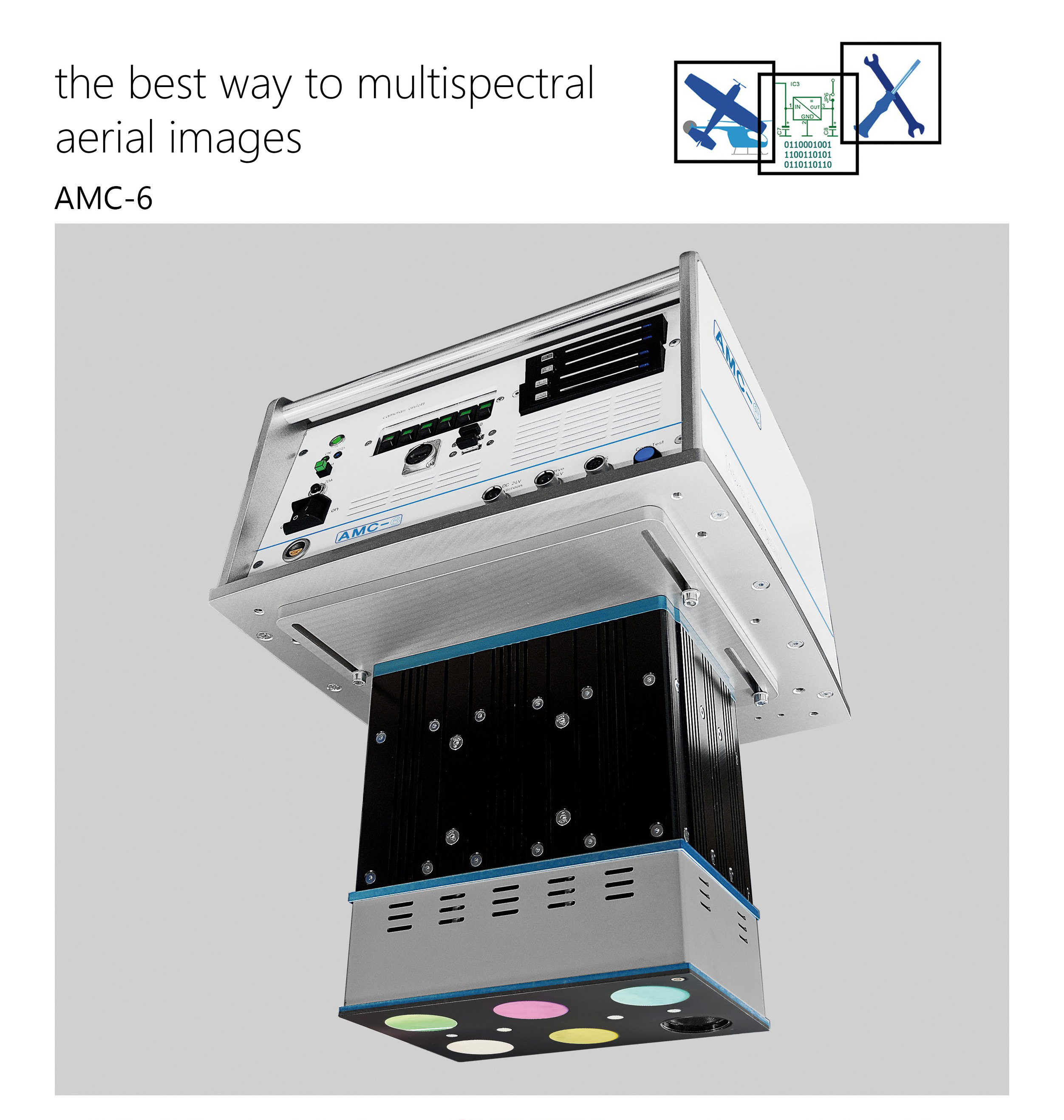


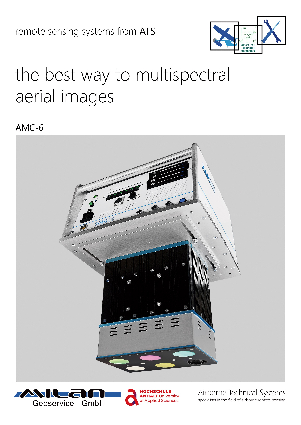
multispectral aerial camera AMC-6
High-resolution multispectral aerial camera AMC-6
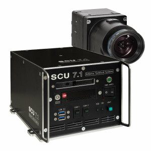
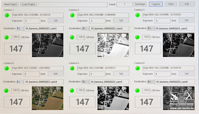
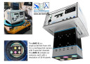
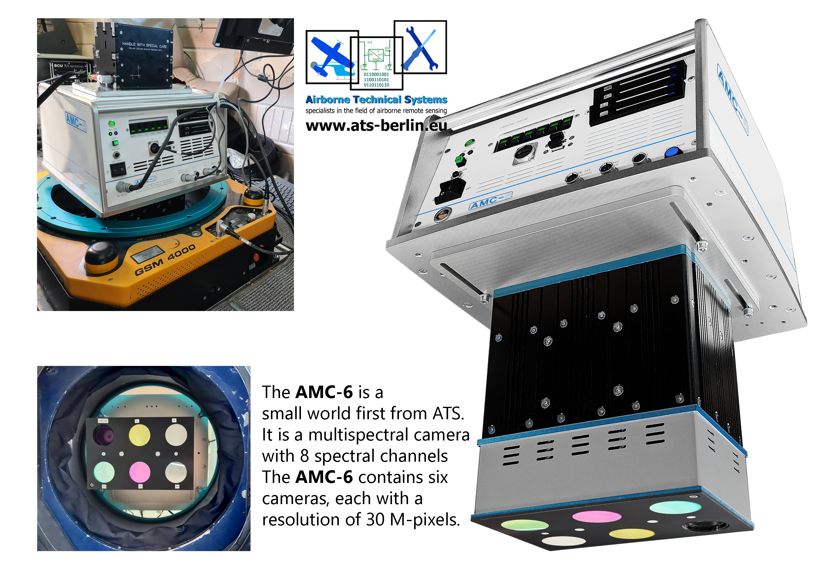
The AMC-6 multispectral camera system is a world first and has the highest resolution of any camera currently available for airborne remote sensing. The AMC-6 is a multispectral camera system with six cameras, each with 30 megapixels. The AMC-6 has eight spectral channels It is equipped with five monochrome cameras and one RGB camera.

ATS
Berlin, DE
Description
The AMC-6 is a multispectral camera system. It has six cameras with 30 megapixels each,
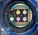
The AMC-6 contains five monochrome cameras and one RGB camera.
The spectral filters on the monochrome cameras can be changed according to requirements.
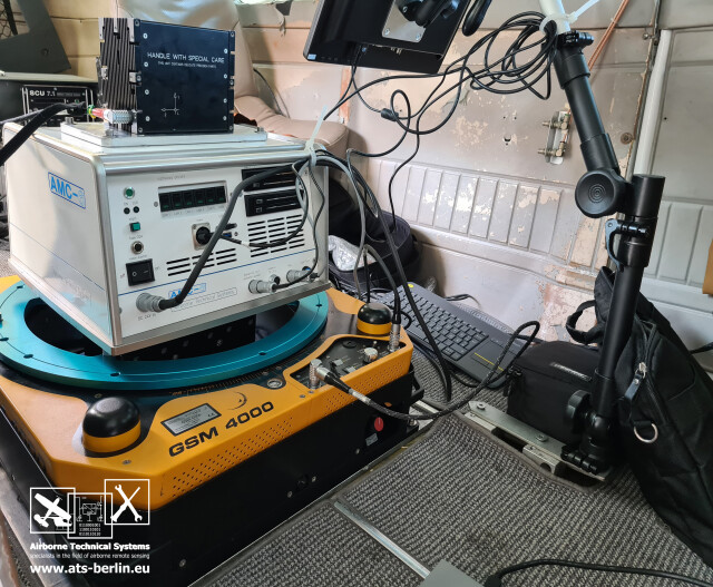
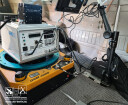
The AMC-6 can be mounted on all stabilisation platforms such as a GSM4000 from SOMAG. It can be controlled with all known flight management systems such as the CCNS/5 from IGI.The image data is stored on removable SSD hard drives and can be converted to Tiff format.If higher resolutions are required, the AMC-6 can also be equipped with cameras from Phase One.All spectral filters can be changed by the customer, even when the AMC-6 is installed in the aircraft. Application-specific filter sets, which can also be exchanged according to customer requirements, enable a wide range of applications such as
Environmental monitoring
water monitoring
Forest condition monitoring
precision farming
3D city models
Aerial Mapping & Surveying
Digital terrain and surface mode
Do you have questions about this product?
- Questions about price, availability, and/or retailers
- Questions about technical specifications and usage
- Questions about suitability for your project or application
Specifications
-
Application
-
Distinguishable features
High-resolution multispectral aerial camera AMC-6
Main applications
Acquisition of high-resolution multispectral aerial images
-
Uncertainty
-
Geometric calibration
yes
-
Data storage
-
Storage capacity [GB]
4x 4 TB
Storage Replaceable
Y
Type of storage
SSD
-
Sensor Characteristics
-
CCD along track format [mm x mm]
22,3 mm
CCD along track format [pixel x pixel]
6464
CCD across track format [pixel x pixel]
4882
CCD across track format [mm x mm]
16,4 mm
Lenses: interchangeable
yes
Lenses: focal lengths [mm]
50mm
Max. across-track FOV [deg]
25°
Max. integration time [s]
0,5 Sek
Max. shutter speed [s]
1/8000
Megapixels
6x 30
Number of lenses
6
Pixel size [µm]
3.45
Type CMOS
Sony IMX342, CMOS, APS-C
-
Operation Characteristics
-
Platform
Fixed-wing, Helicopter
Min. flying height [m]
100
Max. acquisition time [hr]
6
Helicopter
Y
Fixed-wing
Y
Typical flying height [m]
1000
Max. acquisition duration [h]
8
Forward motion compensation
N
In flight pre-view
Y
Temperature controlled pod
N
-
Software
-
On board image storage format(s)
Raw data
Type of postprocessing software
Raw data converter
Type of mission planning software
all known planning programmes
-
General
-
Year of introduction
2024
-
Feature Extraction and Mapping
-
3D superimposition
Y
Integration with 3D vector maps
Y
Integration with 2D vector maps
Y
-
Images and data
-
Digital Aerial Nadir Frames
Y
Export data formats
Image tiff data
Input image formats
Raw image data
Linear array sensors
Y
Oblique Images
N
-
Hardware
-
Camera unit Depth [m]
0.46
Camera unit Weight [kg]
25
Camera unit Length [m]
0.37
Camera unit Width [m]
0.35
Power requirements
DC 24V
-
Application areas
-
Select an application area:
Land Surveying and Cadastre, Cultural Heritage, Hydrography, Mining
-
Product characteristics
-
Choose characteristics:
Nadir, Panchromatic Imagery, Colour Imagery
Documents
Brochure
AMC-6 (3).pdf
1.74 MB
