


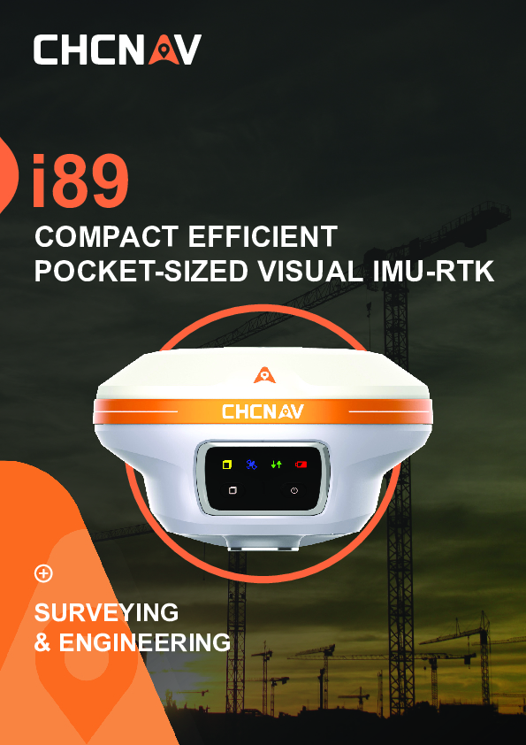
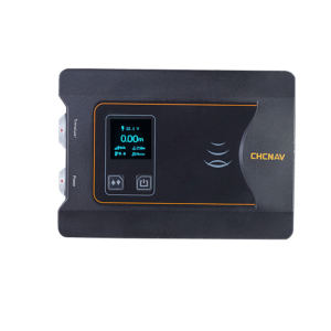
i89 COMPACT EFFICIENT POCKET-SIZED VISUAL IMU-RTK
Extreme GNSS performance, Visual power on top
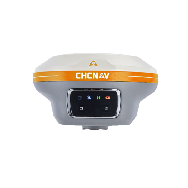
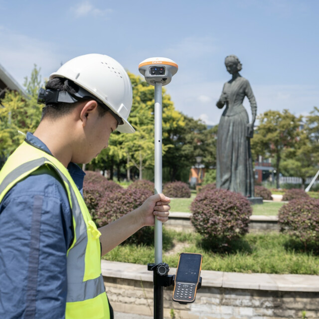
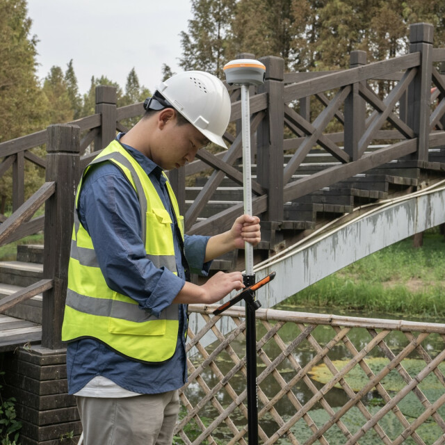
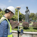
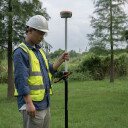
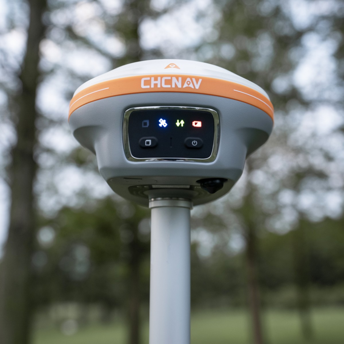
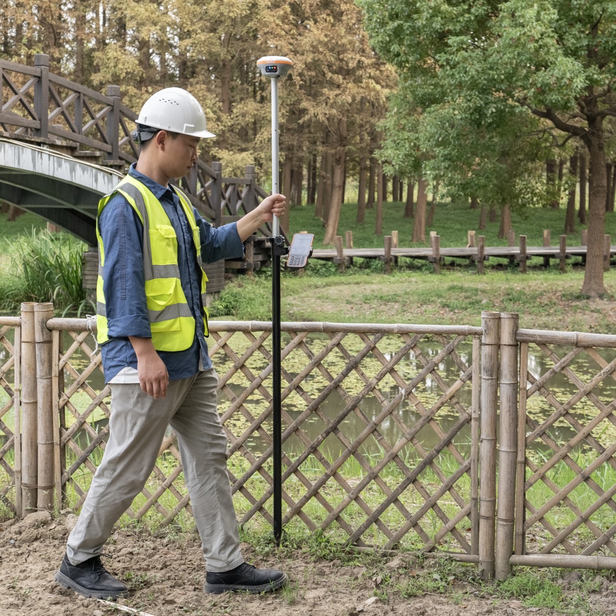
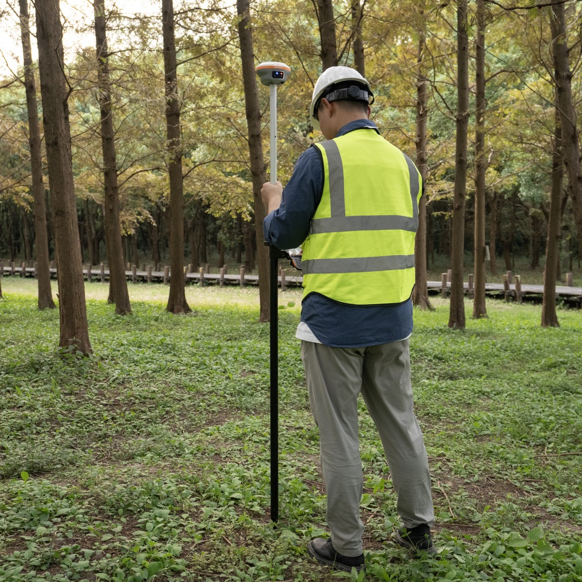
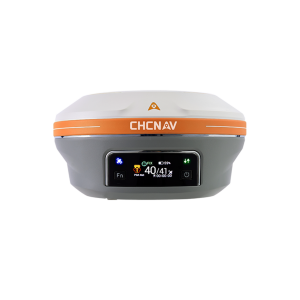
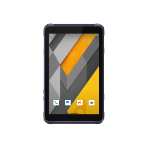
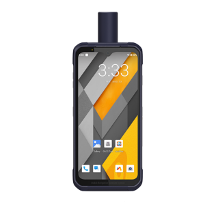
The i89 Visual IMU GNSS is a compact surveying tool equipped with a 1408-channel GNSS module, which enhances RTK availability, even in challenging environments. Its CHCNAV iStar2.0 software incorporates advanced ionospheric modeling algorithms, achieving high integrity RTK fix rate, particularly critical in regions of intense solar activity. The implementation of AUTO-IMU technology eliminates the need for manual initialization, streamlining field operations for increased efficiency. In addition, the i89 offers an impressive 16.5 hours of battery life and a lightweight 750g design, ensuring optimal productivity throughout various day-to-day surveying tasks. The i89 features Visual Surveying capabilities, providing accurate 3D coordinate extraction from real-world video and simplifying measurements in locations with signal obstructions, limited accessibility, or safety concerns. The combination of panoramic capture mode and integrated IMU significantly improves the accuracy and efficiency of photogrammetric surveys. In addition, the integrated AR visual navigation and stakeout features can cut the operator’s workload by half, regardless of their experience level in the field.

CHC Navigation | CHCNAV
Shanghai, CN
Description
ISTAR 2.0 & IONOSPHERE MITIGATION
Boost fix rate over 96% in ionospheric active regions
The i89 GNSS delivers unmatched performance with its 1408 channels and integrated SoC for full constellation tracking. Robust algorithms increase fix rates by 15%, even in harsh environments. CHCNAV iStar2.0 and ionospheric interference rejection technology provide an outstanding 96% reliable fix rate, ideal for low latitude regions with high ionospheric activity. Its narrow-band multipath mitigation ensures accurate RTK measurements, and its hybrid GNSS engine provides unmatched accuracy and reliability.
AR NAVIGATION & STAKEOUT
50% time savings for less experienced operators
The i89's AR visual navigation and staking simplify field operations, saving even the most inexperienced operators up to 50% of their time. By tightly integrating technologies, the i89's GNSS, IMU, and Visual systems are 10 times more reliable than standard gyroscopes-based GNSS. The 1.5 GHz processor enables seamless dual-camera operation, while 5.8 GHz adaptive Wi-Fi ensures fast AR data transfer. Virtual Pole Tip™ (VPT™) technology enables real-time visualization of points over the CAD project design. Versatile AR Stakeout supports a wide range of applications, including linear, CAD-based, boundary staking, and more.
VISUAL SURVEY EXCELLENCE WITH AR
Measure previously inaccessible points with precision
The i89 brings the power of vision to GNSS surveying, enabling accurate measurements of points where signals are obstructed, or access is difficult or unsafe. Its premium cameras extract survey-grade 3D coordinates from real-world video, offering efficiency and reliability. Dynamic panoramic capture mode with 85% overlap improves efficiency by 60% for exceptional accuracy. The integration of a high-precision IMU data into the video photogrammetry algorithm significantly improves point measurement performance.
AUTO-IMU TECHNOLOGY
Efficiency and Precision in Every Measurement
The i89's built-in, interference-free 200 Hz Auto-IMU eliminates the need for manual initialization and provides reliable measurements. Automatic pole tilt compensation guarantees accuracy to within 3 cm over a 60-degree tilt range, saving up to 30% time while maintaining accuracy.
16.5H BATTERY LIFE & IP68 DESIGN
Extended battery life, efficient and durable
The i89's high energy density battery provides up to 16.5 hours of operation. Its 18W intelligent, fast charge for a full battery charge in just 3 hours increases operational efficiency and further extends battery life. Its compact 750g design seamlessly fits GNSS, IMU, and two cameras into a pocket-sized receiver through optimal camera integration, reducing volume and height. It is IP68-rated and can withstand a 2m mast drop.
EFFICIENT 3D MODELING
Seamless 3D Modeling for Various Applications
i89's video photogrammetry algorithms enable 3D modeling of buildings and facades. It effectively allows the fusion of drone and GNSS RTK data for efficient 3D modeling over large areas, overcoming the typical distortions associated with drone-mounted cameras. In addition, the i89's compatibility with industry-standard 3D modeling software ensures flexibility and convenience for users.
Do you have questions about this product?
- Questions about price, availability, and/or retailers
- Questions about technical specifications and usage
- Questions about suitability for your project or application
Specifications
-
General
-
Depth [m]
0
Height [m]
0
Total Weight [kg]
0.75
Year of initial introduction
2023
Type
Land
-
Performance
-
No. channels
1408
SBAS differential signals
EGNOS (L1, L5)
Tracked satellite signals
GPS:L1C/A, L2C, L2P(Y), L5; GLONASS:L1, L2, L3; Galileo:E1, E5a, E5b, E6; BeiDou:B1I, B2I, B3I, B1C, B2a, B2b; QZSS:L1C/A, L1C, L2C, L5, L6
-
Environment
-
Humidity resistance
100% non-condensation
Operating temperature: min. [°C]
-40°C
Operating temperature: max. [°C]
65
Shock and vibration proof
Compliant with ISO 9022-36-08 and MIL-STD-810G- 514.6-Cat.24.
Water sand and dust proof
Prevent water vapor from entering under harsh environments
-
Communication: general
-
Communication ports
1 x USB Type-C port (external power, data download, firmware update), 1 x UHF antenna port (TNC female)
Bluetooth
Y
-
Communication: Protocols
-
NMEA output format
0183 output
RTCM standards for differential data
2.x; 3.x,
-
Communication: links
-
Radio modems
UHF radio
-
Horizontal uncertainty
-
Initialization time on the fly [s]
<10
phase: RTK kinematic (variable part) [ppm]
H: 8 mm + 1 ppm RMS V: 15 mm + 1 ppm RMS
phase: kinematic post processing (variable part) [ppm]
H: 3 mm + 1 ppm RMS V: 5 mm + 1 ppm RMS
phase: RTK rapid static (variable part) [ppm]
H: 2.5 mm + 0.5 ppm RMS V: 5 mm + 0.5 ppm RMS
-
Power
-
External power supply
5 V / 2 A
Operating time with internal power supply [hr]
16
Typical consumption [W]
2
-
Recording
-
Data capacity [MB]
8192
Memory medium
high-speed memory
Type of data (on board recording)
RTCM 2.x, RTCM 3.x, CMR input / output HCN, HRC, RINEX 2.11, 3.02 NMEA 0183 output NTRIP Client, NTRIP Caster
-
More information
-
Distinguishable features
AR visual navigation and stakeout
Documents
Brochure
i89_DS_EN (2).pdf
1.27 MB
Videos


