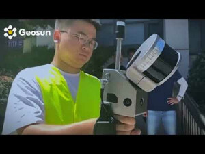
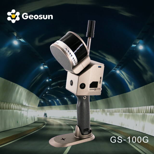
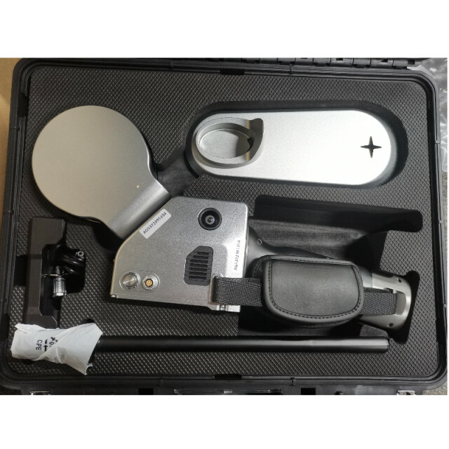


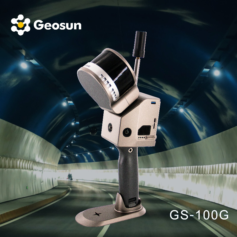
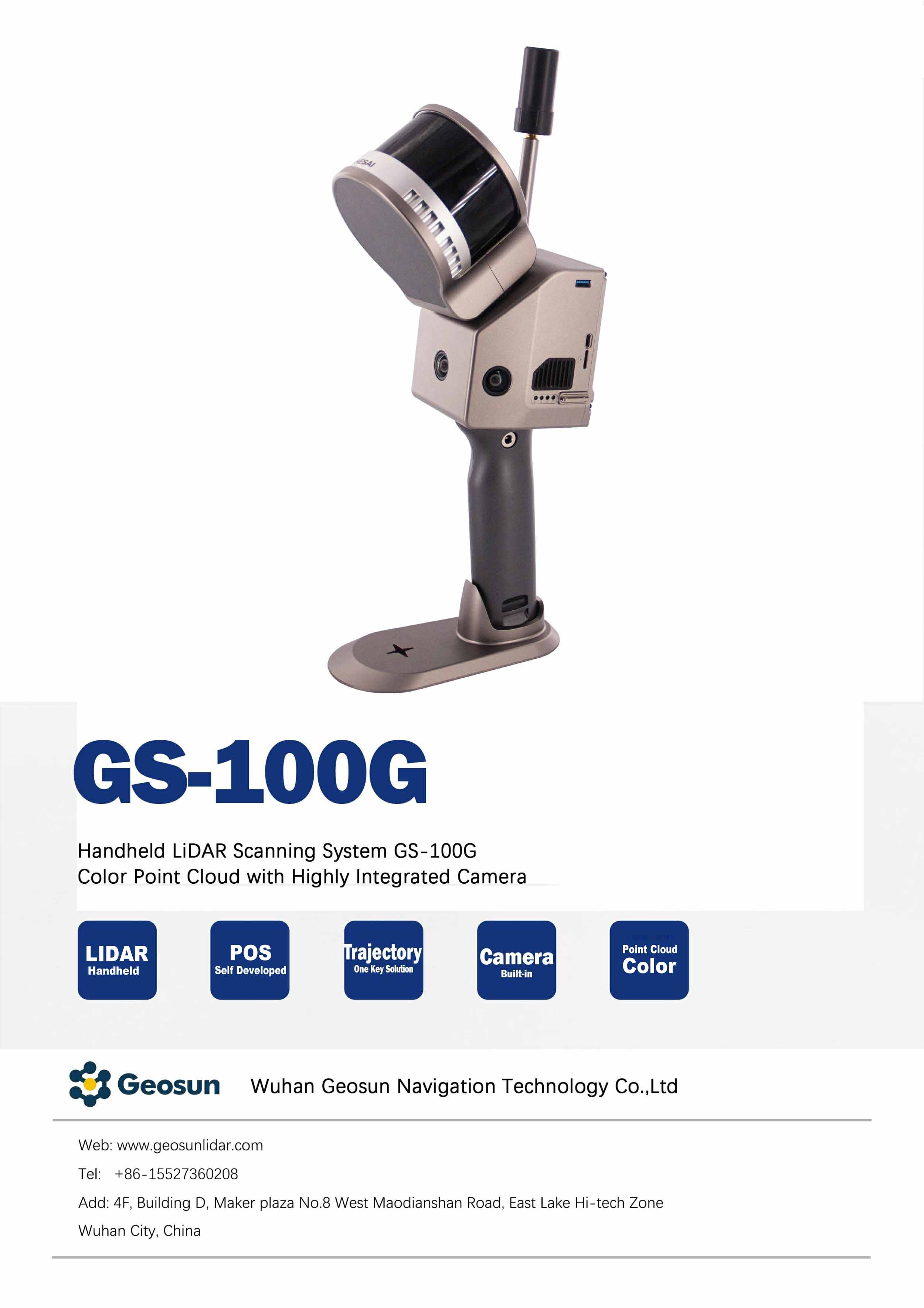
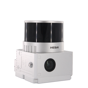
Geosun GS-100G RTK+SLAM Handheld LiDAR
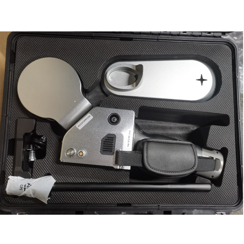
A simple design with small body so as to be light to carry.
Handheld LiDAR GS-100G is a suitable choice for no-fly zone or underground areas. It combines Hesai XT16 laser senor, three 50MP rgb cameras,high accuracy pos system and built-in batteries which can accurately capture details for a long time. Base on more than 20 years of experience in GNSS/INS positioning and attitude determination system, we developed our own property right trajectry software and provide life-long free.

Geosun Navigation
Wuhan, CN
Description
GS-100G is a kind of handheld LiDAR scanning system independently developed by Geosun company.It adopts a simple design with a small body, so as to be light to carry, easy to operate and flexible to install.With a variety of sensors, it can quickly capture a wide range of scene data, support multi-platform and multi-mode operation, and combine GNSS, INS, LiDAR and SLAM algorithms to achieve seamless survey of indoor and outdoor scenes.
|
System Parameter |
|
|
Point Cloud Accuracy |
5cm@100m without control point |
|
Weight |
1.8kg(with battery) |
|
Battery Parameter |
4.2V 3400mAh |
|
Storage |
Build-in Flash memory 64GB, Support microSD 256GB. |
|
Voltage Range |
12V-18V |
|
Dimension |
17.2*10.6*38.9cm |
|
Working Temperature |
-20℃-55℃ |
|
Carrying Platform |
Hand-held, Multi-rotor and Vehicle |
|
System Consumption |
25W |
|
POS Unit |
|
|
Model |
gSpin 210 |
|
Update Frequency |
200Hz |
|
GNSS Signal Type |
GPS L1/L2/L5, GLONASS L1/L2 BDS B1C/B1/B2/B2a/B2b/B3 GALELEO E1/E5b/E5a |
|
Position Accuracy |
Horizonal 0.02m Elevation 0.03m |
|
Pitch Accuracy |
0.015° |
|
Roll Accuracy |
0.015° |
|
Heading Accuracy |
0.040° |
|
Laser Unit |
|
|
Detection Range |
80m@10%,Max Range 120m |
|
Range Accuracy |
士1.5cm |
|
Channel |
16 |
|
Horizontal FOV |
360° |
|
Vertical FOV |
270° |
|
Points Rates |
Single echo 320,000 Points/Sec, Dual echo 640,000 Points/Sec. |
|
Camera Parameter |
|
|
Resolution |
3*5 MP |
|
FOV |
Horizontal 270° |
|
Shooting Mode |
Isochronous |
Do you have questions about this product?
- Questions about price, availability, and/or retailers
- Questions about technical specifications and usage
- Questions about suitability for your project or application
Specifications
-
General
-
Year of introduction
2022
Height [cm]
38.9
Depth [cm]
17.2
Width [cm]
10.6
Total Weight [kg]
1.8
-
Application
-
Main applications
Indoor and outdoor mapping
-
Scanning Characteristics
-
Max. vertical field of view [deg]
270
Data aquisition speed (points p/second)
640000
Laser Class
905nm class1
Max. horizontal field of view [deg]
360
-
Operation Characteristics
-
Operating temperature: min. [°C]
-20
Operating temperature: max. [°C]
55
-
Power
-
Battery type
lithium battery
Documents
Brochure
gfireeye-gs-100g.pdf
931.44 KB
Videos

