


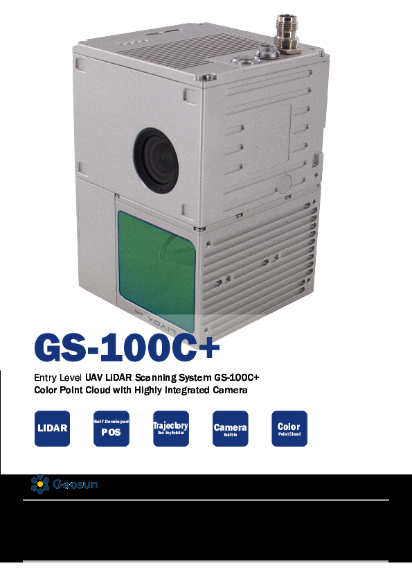
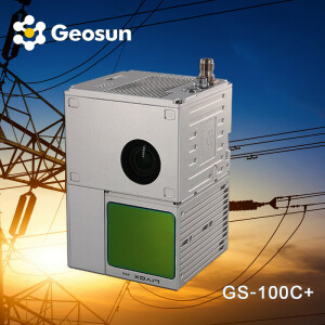
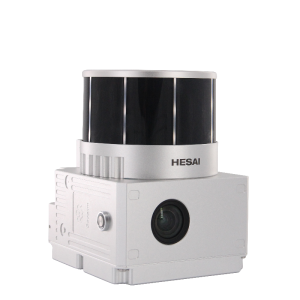
Geosun LiDAR GS-100C+
UAS Lidar Scanning System GS-100C+ Livox Avia Sensor High Accuracy Built-In 26MP RGB Camera
Entry-level LiDAR scaning system with low cost and suitable for different brands of uav One key data processing Lifetime free software

Geosun Navigation
Wuhan, CN
Description
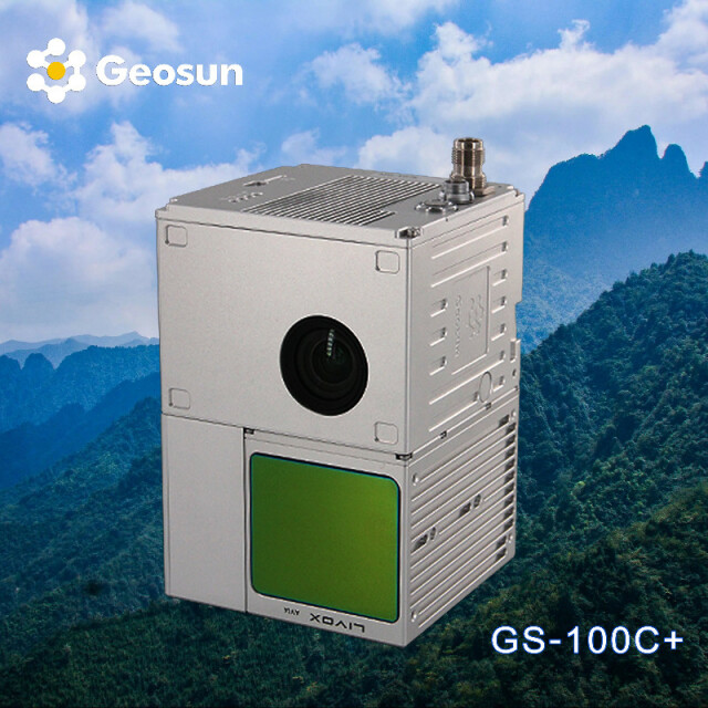
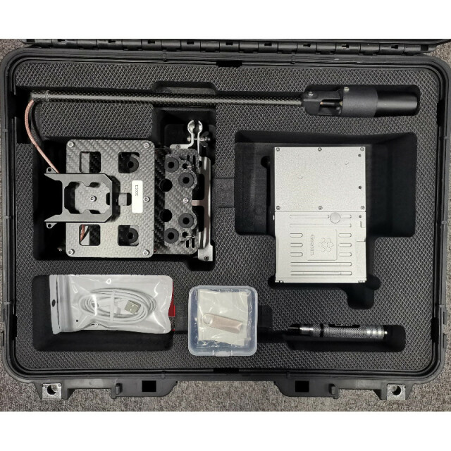
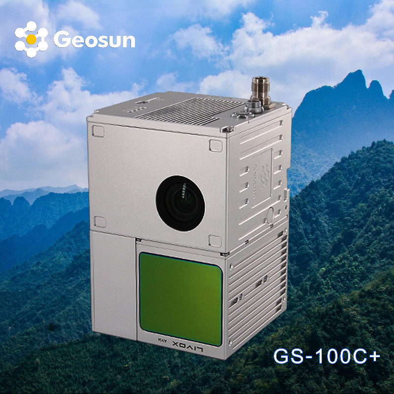
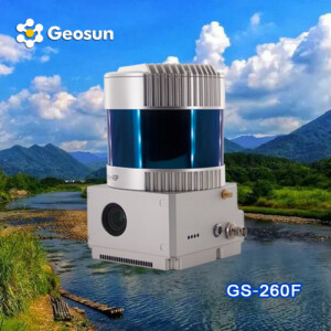
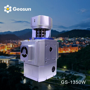
Geosun gAirHawk GS-100C+ is a lightweight and compact LiDAR point cloud data acquisition system that integrates the new generation Livox laser scanner, GNSS, IMU positioning and attitude determination system, and storage control unit. It is capable of real-time and dynamic collection of high-precision point cloud data and rich image information on a large scale. It finds wide application in acquiring 3D spatial information in surveying, electricity, forestry, agriculture, and land planning.
|
LiDAR Scanning System gAirHawk GS-100C+ |
||
|
Item Name |
System Parameter |
|
|
GS-100C+ Parameter |
Weight |
1015g |
|
Measuring accuracy |
Less than 10cm (110 m AGL) |
|
|
Power range |
12V~16V |
|
|
Working temperature |
-20℃~+55℃ |
|
|
Consumption |
Average 20W |
|
|
Support Platform |
Drone M300, M600 and GS-850 |
|
|
Storage |
64GB storage, maximum support 128GB TF card |
|
|
Lidar Unit |
Laser Model |
Livox Avia |
|
Measuring Range |
190m@10% Reflectivity |
|
|
Laser class |
905nm Class1 (IEC 60825-1:2014) |
|
|
Laser line number |
Equivalent to 64-beam |
|
|
Range Precision |
2cm |
|
|
data |
Triple-echo, 720,000 Points/Sec |
|
|
FOV |
70° the circular view |
|
|
POS Unit |
Update frequency |
200HZ |
|
Heading accuracy |
0.040° |
|
|
Pitch accuracy |
0.015° |
|
|
Rolling accuracy |
0.015° |
|
|
Position accuracy |
0.02 - 0.05m |
|
|
GNSS signal type |
GPSL1/L2/L5 GLONASSL1/L2 BDS B1/B2/B3 GAL E1/E5a/5b |
|
|
Pre-processing software |
POS software |
Output information: position, speed, attitude |
|
Point cloud software |
Output point cloud data format: LAS format, custom TXT format |
|
|
Built-in Camera |
FOV |
83 Degree |
|
Effective Pixel |
26 Mega Pixel |
|
|
Trigger event |
Distance or Time trigger |
|
Do you have questions about this product?
- Questions about price, availability, and/or retailers
- Questions about technical specifications and usage
- Questions about suitability for your project or application
Specifications
-
Application
-
Main applications
Aerial mapping for terrain, foresty, power line
Training, maintanence and support
24-hour service support, 12 months warranty
Distinguishable features
Free software one key processing,Multiple-platform,Aluminum alloy body,Easy installation
-
Measurement Characteristics
-
Scanning method
Repeated
Max. number of recorded echoes per pulse
Triple echo
multiple pulses in air
Y
-
Physical Properties
-
Height [cm]
9.1
Length [cm]
13.8
Width [cm]
9.4
Weight [kg]
1.025
-
Laser Pulse Characteristics
-
Laser Class
Class1 (IEC 60825-1:2014)
Wavelength [nm]
905
Max. range of laser pulse [m]
450
-
Power Supply
-
Power consumption
20W
Power requirements
12-24V
Type of battery
Power supply from drone battery
-
Positioning System
-
Type of GNSS positioning sensors
GPS L1/L2/L5,GLONASS L1/L2 BDS B1/B2/B3,GAL E1/E5a/E5b
Typical positioning accuracy [cm]
10
Heading, Pitch and Role internally captured
Y
-
Operation Characteristics
-
Camera included
Yes
Camera specifications
26 MP
Mounting
Yes
-
Data and Software
-
Included software
Yes
Type of storage
flash card
Max. storage space [mb]
131072
-
General
-
Year of last update
2022
Year of introduction
2021
Documents
Brochure
gairhawk-gs-100c-0.pdf
2.57 MB
Videos

