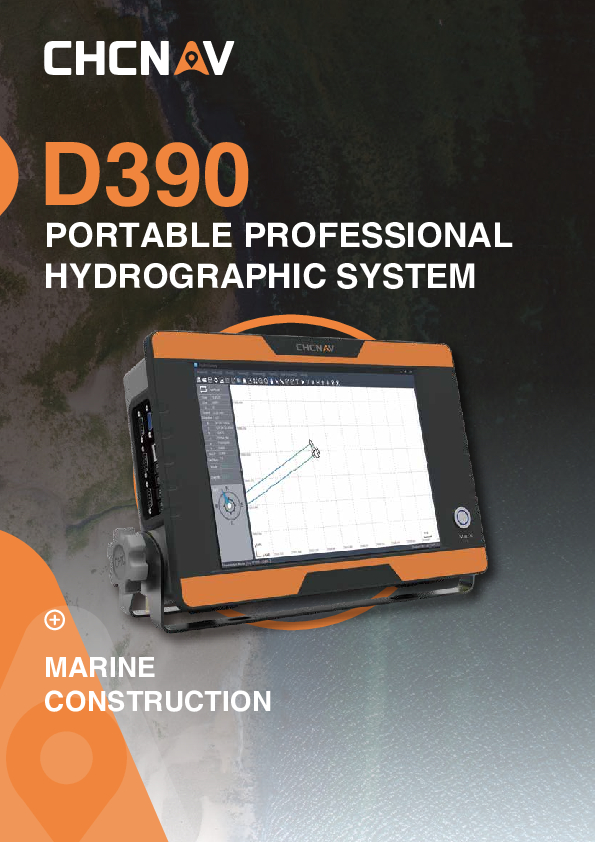
D390 echo sounder
Single Frequency Echo Sounder All-In-One System
The D390 is a cost-effective and rugged bathymetric solution that uses an advanced 200 kHz transducer to match different hydrographic conditions and significantly improve sounding performance and usability. The 7-degree beam angle provides focused directional and lateral resolution. In addition, the water depth recording frequency can be as high as 60 Hz. Using pulse width discrimination and automatic redundant data suppression enhances data accuracy and reliability.

CHC Navigation | CHCNAV
Shanghai, CN
Description
-
TURNKEY HYDROGRAPHIC SOLUTION
Cut down mission mobilisation costs by 20%
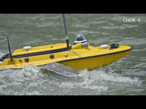
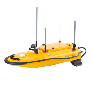
The D390 is a fully integrated and affordable single-frequency Echosounder solution combined with the performance of an industrial PC. Light, portable, and with a rugged IP66 aluminium alloy enclosure, the D390 is easy to set up and deploy in any remote location.
-
SIMPLIFIED SURVEY OPERATION
Fast learning curve
HydroSurvey7 manages your project within a single intuitive software from positioning and navigation to data acquisition and data processing and export in CSV format.
-
STANDARD DGNSS AND SENSORS INTERFACES
Full compatibility with NMEA data
The D390 is easy to pair with any GNSS RTK receiver outputting standard NMEA messages and offers enhanced compatibility with CHCNAV GNSS receivers.
-
ULTRA-FAST STARTUP WITHOUT LAG TIME
Achieve maximum productivity and save survey time.
The embedded Windows 10 operating system provides a fast boot and total operation stability. The D390 allows you to start your survey rapidly, save time and enable you to achieve results faster.
The D390 is a cost-effective and rugged bathymetric solution that uses an advanced 200 kHz transducer to match different hydrographic conditions and significantly improve sounding performance and usability. The 7-degree beam angle provides focused directional and lateral resolution. In addition, the water depth recording frequency can be as high as 60 Hz. Using pulse width discrimination and automatic redundant data suppression enhances data accuracy and reliability.
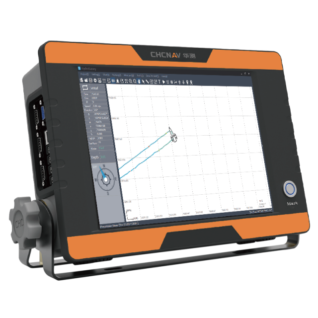
Easy to operate with its feature-rich CHCNAV HydroSurvey software, the D390 displays real-time depth readings and the survey project parameters on its 12-inch HD touchscreen. The standard serial interfaces for motion sensors and GNSS differential receivers allow centimetre position precision.
Do you have questions about this product?
- Questions about price, availability, and/or retailers
- Questions about technical specifications and usage
- Questions about suitability for your project or application
Specifications
-
General
-
Year of initial development
2020
Max. power consumption [W]
25
Min. external DC power [V]
10
Max. external DC power [V]
30
Weight in air [kg]
4.7
Width [m]
25.8
Length [m]
36.5
Height [m]
0.95
-
System integration
-
Supported external data inputs
-
Mode of operation
-
Software platform
Other, Tablet PC
Min. depth of operation [m]
0.15
Max. depth of operation [m]
300
Max. frequency [kHz]
200
Max. power output [W]
500
Depth resolution [m]
0.01
Max. sounding rate [Hz]
60
Accuracy
±0.01m + 0.1 % of depth
Draught Range
0 m to 9.9 m
Sound Velocity
1300 m/s to 1700 m/s
Operating System
Win 10
Memory Capacity
4 GB DDR3L 1600 MHz
Display
12-inch resistive touch screen
Software
HydroSurvey
Measuring Range
0.15 m to 300 m
Body Storage
32 G
Screen Resolution
1024 * 768
Working Environment
Ingress protection: IP66
Power Supply
DC or AC
Ping Rate
60 Hz
-
Performance
-
Transducer range
6.5 ° ± 1 °
-
User Interface
-
Main control
HydroSurvey
Menu languages
English, Russian
-
Other specifications
-
Internal data logging details
-
Output
-
Data output formats
User defined, CHCNAV, NMEA SDDPT/SDDBT, Original Waveform
Connectors
-
Environmental
-
Min. operating temperature [°C]
-30
Max. operating temperature [°C]
60
Min. storage temperature [°C]
-40
Max. storage temperature [°C]
70
-
Interface and User Interaction
-
Ethernet
support wifi
-
Logging unit
-
Portability
Portable
Weight [kg]
6.2
Documents
Brochure
d390-ds-en.pdf
800.73 KB
Videos


