


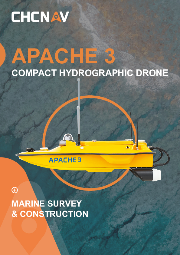
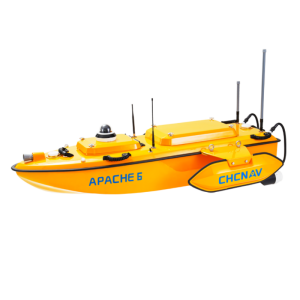
APACHE 3
Cost-Effective Single Beam Marine Drone
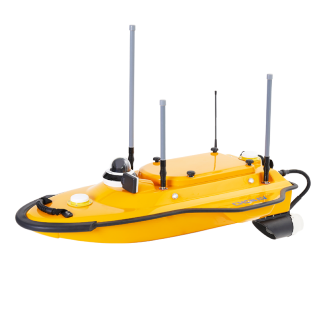
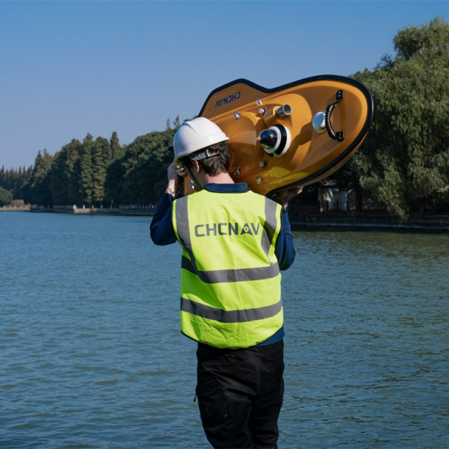
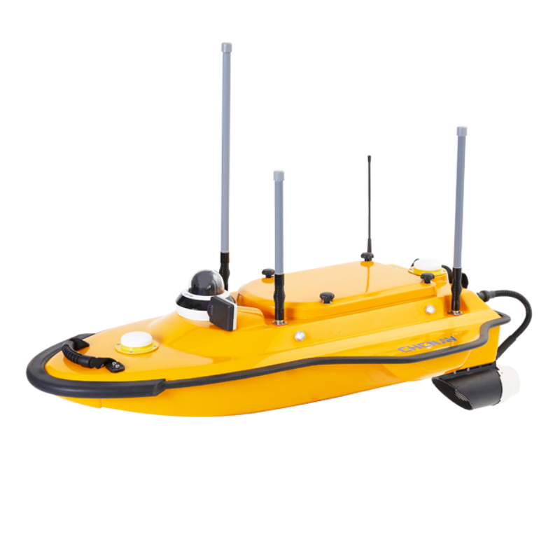
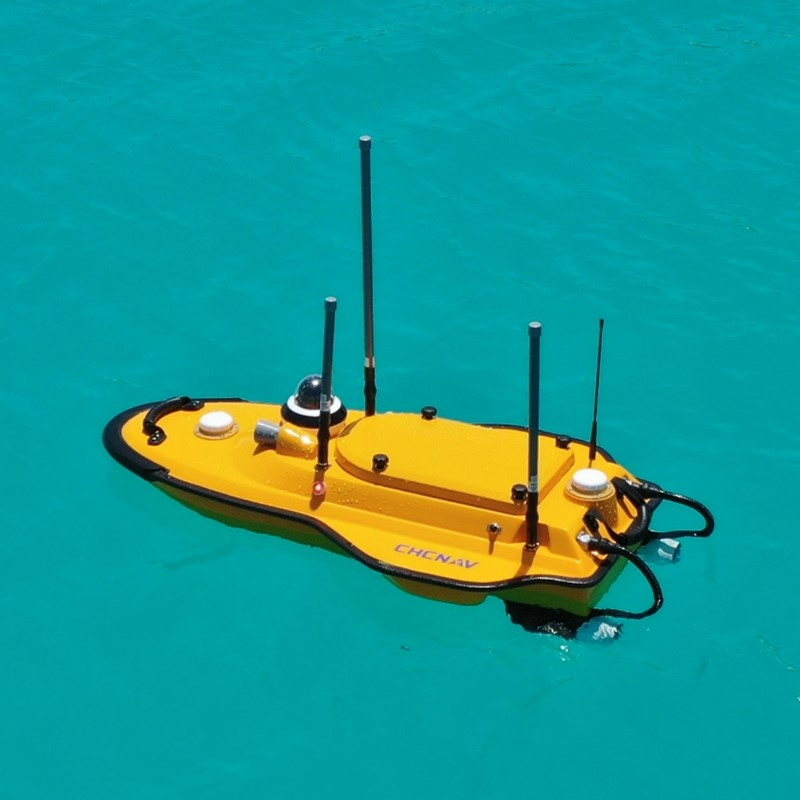
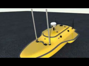
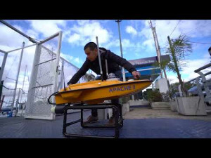
Portable USV solution for bathymetric survey. Featuring triple-hulled and shallow draught design, the APACHE 3 is a portable USV for bathymetric surveys of lakes, inland rivers and coastal areas. Its compact size and lightweight (1-meter length and 7 kg without instrument) allow one person to operate the system easily.

CHC Navigation | CHCNAV
Shanghai, CN
Description
-
ONE-MAN OPERATION
Allow one operator to cope with most of the remote deployment conditions.
Made of macromolecule polyester carbon fibre and Kevlar fiber-glass weighing 7 kg without sensors. It can be carried by a single person during the entire project, from on-site transport, installation, calibration, and mission processing.
-
MAINTAIN HIGH ACCURACY
Integrated IMU to overcome temporary GNSS outage
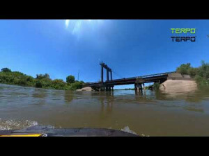
Integrating GNSS and IMU sensors provides accurate position and attitude data to compensate for hull sway on survey results. The Apache3 provides consistently high accuracy positions even during temporary GNSS outages while passing under bridges. Tight integration of GNSS and INS data eliminates outliers.
-
MAKE SURVEY POSSIBLE IN MOST WATER CONDITIONS
High-efficiency maritime design propulsion
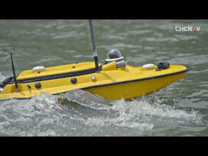
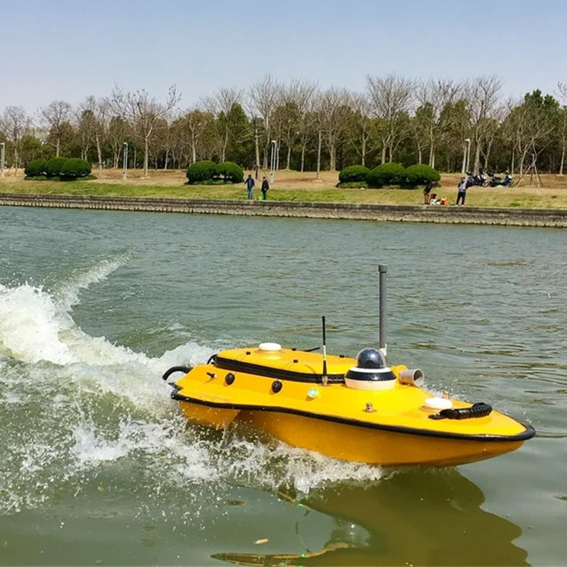
High-efficiency maritime design propulsion DC-injection rotary motor technology provides a 40% increase in energy conversion efficiency. The motor's high speed (7,000 rpm), anti-collision design with a sealed straw cover with oblique titanium alloy mesh, and anti-corrosion design (resistant to one month's immersion in seawater) make it extremely durable.
-
ABSOLUTE LINEAR TECHNOLOGY
Maintain a perfect straight sailing course even in complex current conditions
Integrate high precision GNSS positioning and heading technology to ensure high accuracy bathymetric survey in fully autonomous mode. With less than 1 m in length and pocket-hulled vessel design, the APACHE3 supports operation in shoals, channels, and shallow rivers for the bathymetric survey without running aground.
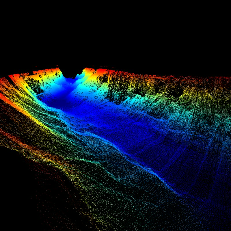
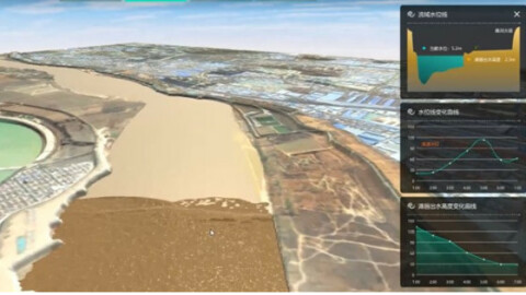
The APACHE3 is a portable shallow-draft hull with a Singlebeam Echosounder for bathymetric surveys of lakes, inland rivers, and coastal areas. The master control unit provides seamless 4G communication, removing the limitations of traditional network bridge base stations and transmission distances, and making hydrographic survey easier.
The APACHE3 USV combines a dual GNSS positioning and heading sensor, a stable and reliable hull attitude, and an IMU sensor, allowing uninterrupted survey while passing below bridges. The high efficiency 5 m/s motors and absolute straight-line technology allow a fully automatic pre-determined course in autonomous mode under adverse current and flow conditions.
Additionally to the standard package that includes the remote control boat, Singlebeam Echosounder, and GNSS IMU sensor, the Apache 3 USV can be equipped and delivered with the CHCNAV's water assessment sensor to measure water quality parameters, such as PH, temperature, conductivity, dissolved oxygen, and others. The obtained data can be effectively used by researchers and engineers.
Do you have questions about this product?
- Questions about price, availability, and/or retailers
- Questions about technical specifications and usage
- Questions about suitability for your project or application
Specifications
-
More information
-
Applications
Channel, river, lake, offshore construction; Dredging; Site selection of Dam, hydro power station.
Distinguishable features
Portable; Single personal operator; Absolute Linear Technology
Commercial Options
From Distributors
-
General
-
Length [m]
1
Width [m]
0.65
Min. weight of USV in air [kg]
7
Portable
Y
Draft [m]
0.1
Number of thrusters
2
Height [m]
0.3
Max. Weight of USV in air [kg]
25
Housing Material
Macromolecule polyester carbon fibre
-
Communication and Control
-
Type of Communication
UHF, Network Bridge
Data sent to shore
Network bridge and 4G for data, video and RTCM corrections
Auto- control
Yes
Control parameters sent to the USV
Coordinate & Depth
Max. Baud rate [Mb/s]
115200
-
Navigation and Payload
-
Navigation sensors - standard
INS
Payload sensors - standard
Single Beam Echo Sounder
Navigation sensors - optional
GNSS
-
Operations
-
Max. speed [kn]
11.67
Min. crew size
1
Min. required number of surface computers
1
Operational Area
Lakes, Inland Rivers, Coastal Areas
Max. Remote Operating Range {m}
1000
-
Energy and Propulsion
-
Propulsion
2 external
Energy Source
Li-ion Battery Cpacity: 30000mAh, 18.5V
Propulsion Power
700W
Endurance at nominal power [hr]
2
Documents
Brochure
apache-3-ds-en.pdf
865.55 KB


