CHCNAV | AlphaUni 20 LiDAR System
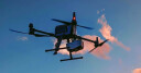
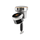
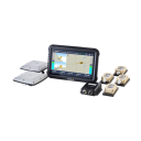
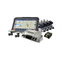
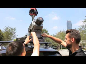
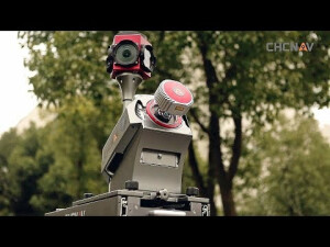
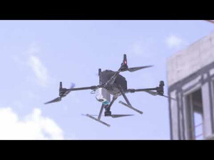
The AlphaUni 20 LiDAR System, Redefining Mobile Mapping and Democratizing 3D Reality Capture. Revolutionize your survey work with cutting-edge multi-airco processing and long-range capabilities. Capture up to 2 million points per second with 16 return numbers and 7 multi-period data processing. Overcome dense vegetation with a measuring range of 1450 meters and 5mm distance accuracy. Easily install on various airborne platforms and switch between vehicle-mounted and backpack modes. Achieve up to 45 minutes of flight time with the BB4 rotor drone. Boost your 3D management efficiency with integrated software. No control points needed, 100% increase in modeling efficiency. Experience the future of geospatial data collection with the AU20.
Products featured in this video
More from "CHC Navigation | CHCNAV"
Related articles