Description
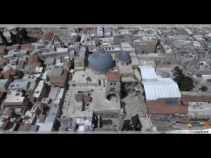
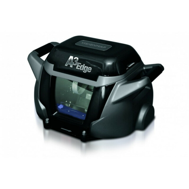
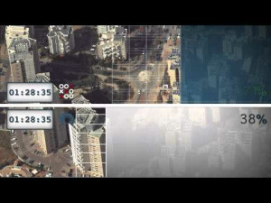
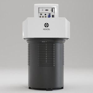
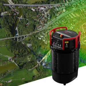
A3 Edge is VisionMap’s all-in-one large-format mapping and oblique camera system that completes your projects in a fraction of the time. Well-known for its incredible productivity, A3 Edge covers vast areas at record speed - collecting up to 1,000 km2 of high resolution imagery per hour. The camera utilizes a unique “sweep” mechanism that provides a wide FOV of up to 106° and a 78,000 x 9,600 pixel footprint - enabling wide flight line spacing, rapid coverage and simultaneous collection of vertical and oblique imagery. Its ability to capture high resolution imagery of rooftops and facades in the same flight makes the A3 Edge ideal for 3D city modeling. The camera’s dual 300 mm focal length telescopes, high resolution sensors and 7.4 um pixel size provide extremely high resolution per altitude, collecting, for example, 10 cm GSD imagery at 11,000 ft. (3,350 m). With a high dynamic range, A3 Edge provides colorful, sharp, high quality imagery. The A3 Edge camera is compact (42 kg) and easy to install on existing manned aircraft. Coupled with the fully-automatic LightSpeed Ground Processing System, A3 Edge provides final photogrammetric products at sub-pixel accuracy, up to five times faster than other commercial systems.
Specifications
-
Application
-
Training facilities
Yes
Main applications
Aerial survey;High resolution urban projects;Mapping projects;Wide area monitoring and mapping;Oblique projects;3D city modelling;Agriculture;Forestry
Distinguishable features
Highest image acquisition efficiency;Automatic processing; Vertical and oblique images in one flight by one camera; High resolution and accuracy from varying flight altitudes;
-
Uncertainty
-
Precision [pixels]
0.3
Geometric calibration
Y
Radiometric calibration
Y
-
Data storage
-
Type of storage
SSD
Storage capacity [GB]
1000
Storage Replaceable
Y
-
Sensor Characteristics
-
Number of lenses
2
Lenses: focal lengths [mm]
300
Lenses: interchangeable
N
Type CCD
Kodak KAI-16070
Pixel size [µm]
7.4
Megapixels
16
Dynamic range [bits]
12
CCD RGB
Y
Charged Coupled Device (CCD) IR
Y
CCD simultaneous
N
CCD along track format [mm x mm]
70 x 24
CCD along track format [pixel x pixel]
9,600 x 3,232
CCD across track format [mm x mm]
570 x 70
CCD across track format [pixel x pixel]
78,000 x 9,600
Max. integration time [s]
0.003
Max. shutter speed [s]
3
Data collection rate [megapixel/s]
250
Max. across-track FOV [deg]
106
-
Operation Characteristics
-
Helicopter
N
Fixed-wing
N
Min. flying height [m]
800
Typical flying height [m]
3000
Max flying height[m]
15000
Max. acquisition duration [h]
Unlimited
Warm-up time [s]
180
Forward motion compensation
Y
In flight pre-view
Y
Temperature controlled pod
Y
-
Software
-
On board image storage format(s)
JPEG2000, TIFF
Type of mission planning software
A3 Flight Planning; TopoFlight Mission Planner
Type of postprocessing software
LightSpeed
-
General
-
Year of introduction
2013
Last update
2015
-
Hardware
-
Camera unit Weight [kg]
42
Camera unit Length [m]
0.6
Camera unit Width [m]
0.6
Camera unit Depth [m]
0.5
Power requirements
28V; 150W (300 max)
Type of GNSS/ INS positioning system
Dual frequency GPS; No INS needed


