


Qinsy
Survey and Navigation. Pind and done.
Survey planning, acquisition, and real-time hydrographic data processing with the most stable package on the market.

QPS
Zeist, NL
Description
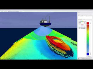
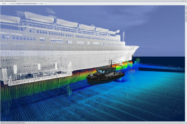
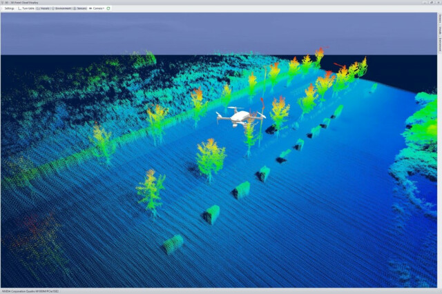
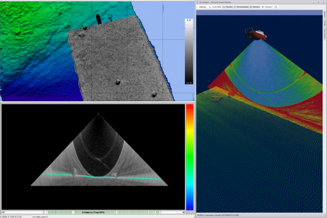
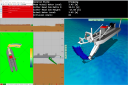
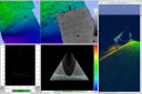
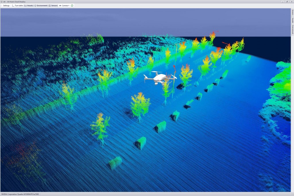
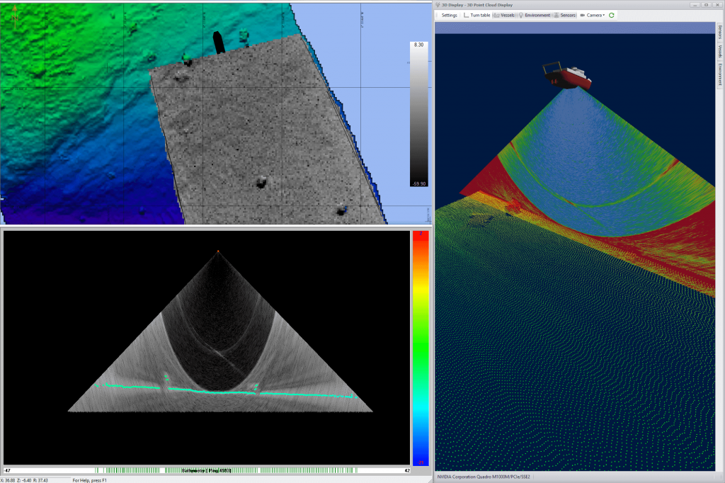
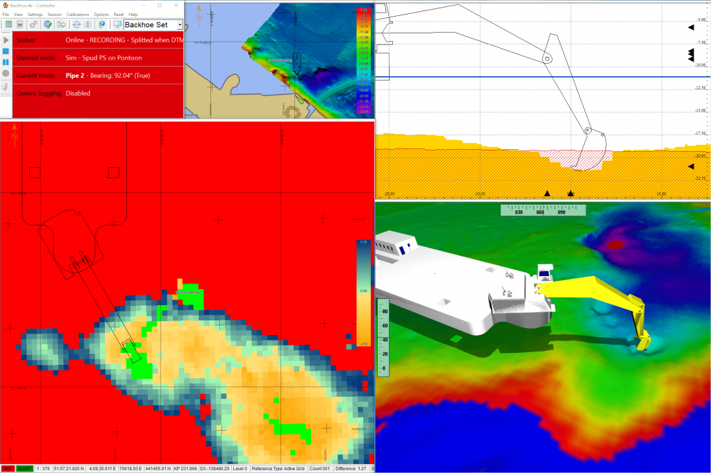
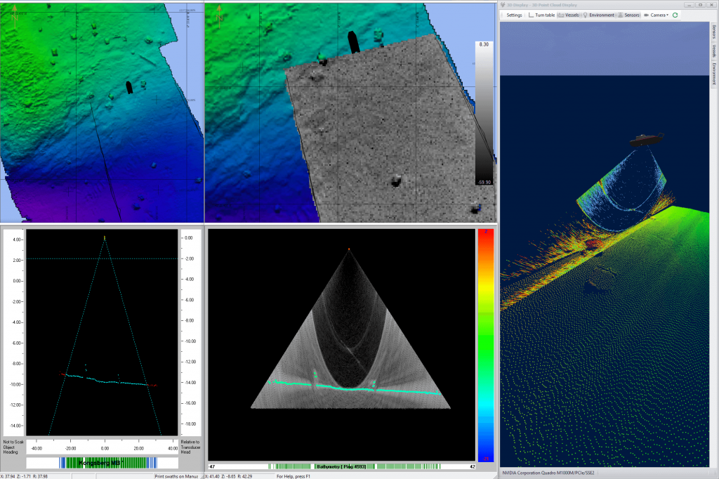
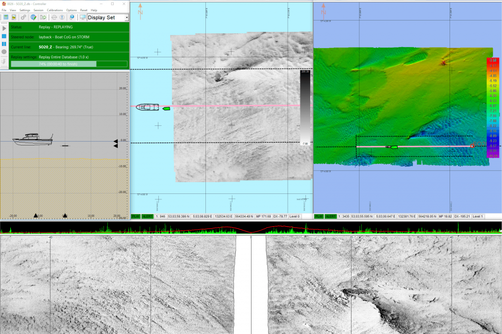
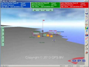
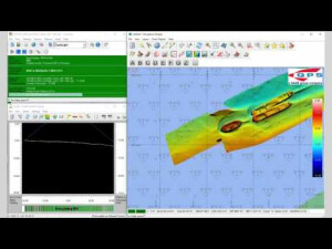
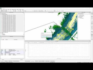
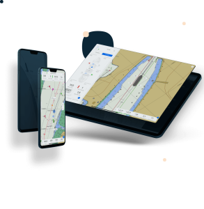
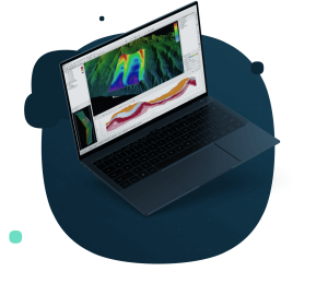
Qinsy is a survey planning, acquisition, and real-time hydrographic data processing solution, supporting a wide variety of industries. Qinsy is used for precise navigation, hydrographic surveying, construction surveys, inspection surveys and dredging and seismic surveys. Qinsy is the ultimate in client flexibility, with support to single beam, multibeam, laser, sidescan sonar, USBL, magnetometer, anchor handling and tug management, and seismic system workflows. With multi-object and multi-sensor support, clients can collect data from these systems simultaneously, while also tracking several objects. Numerous real-time, customizable displays include those for navigation, sensors, numeric, profiles, alerts, and 3D point clouds. Multiple calibration and online QA/QC tools ensure high-quality data acquisition, while real-time data processing and industry-renowned stability ensures maximum survey efficiency. Geodetic support includes an interactive user interface, datum transformations, and geoid model support. Qinsy is also highly focused on autonomy, with support to mission planning, remote display, and control, and dynamic "on-the-fly" line generation based on bathymetry collected on the previous line ensures complete coverage with no gaps. The global leader in dredging, applications include those for setup, configuration, monitoring, visualization, safety, and reporting. Additional Qinsy capabilities include tools to support rock dumping, rig moves, and pipe laying and pipe inspection. Also included is Survey Manager, for office-based functions, including project and line planning, plotting, and product generation.
Do you have questions about this product?
- Questions about price, availability, and/or retailers
- Questions about technical specifications and usage
- Questions about suitability for your project or application
Specifications
-
General
-
Area of Application
Near shore, Offshore, rivers, lakes and more
Operating System
Windows 10(64 Bit) or Windows 11
Year of latest version
2023
-
Geodetic Functionality
-
Ellipsoidal reference support (GRS80)
Y
Geographical coordinates (Lat, Long)
Y
Ground coordinates (E,N)
Y
Local datum support
Y
Separation model for vertical datum shift support
Y
Seven Parameter shift supported
Y
Supported coordinate systems
EPSG and more
Time-dependent Transformation Parameters (14param)
Y
-
Data / System Support
-
Supported singlebeam systems
https://qpssoftware.scrollhelp.site/dm/singlebeam-echosounder-01
Supported gyrocompass systems
https://qpssoftware.scrollhelp.site/dm/gyro-compass-05
Supported multibeam systems
https://qpssoftware.scrollhelp.site/dm/multibeam-echosounder-20
Supported magnetometer systems
https://qpssoftware.scrollhelp.site/dm/magnetometer-35
-
Online capabilities
-
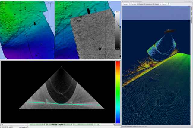
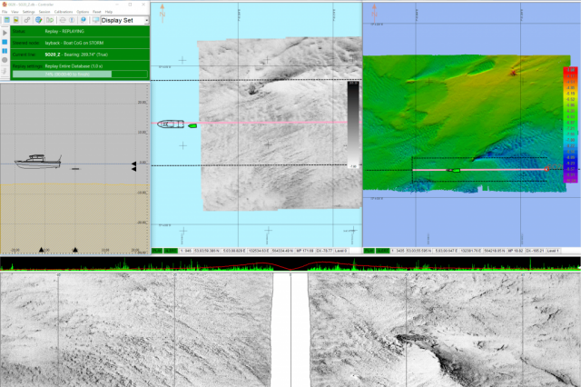
3D real time display
Y
Backscatter display
Y
Helmsman display
Y
Multibeam water column display
Y
Online eventing
Y
Real-time Pipe detection
Y
RTK GPS height correction
Y
SSS waterfall display
Y
Supported 3D display data
Y
-
Hardware requirements
-
HD (GB)
1000
Languages Supported
English
Processor (CPU)
64-bit
Documents
Brochure
#

