


Fledermaus
4D geo-spatial analysis. Not just a pretty picture.
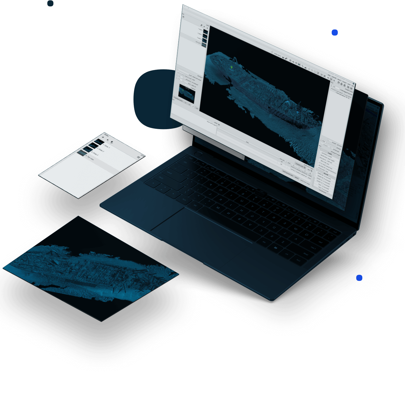
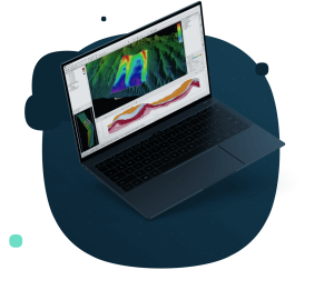
4D analysis toolbox, with movie-making tools and integrated video. The gold standard for presentation and communication. Fledermaus unlocks the potential of your data, with a wide variety of analysis tools working in 3D or 4D space. With fast and easy presentation tools, show your data better than ever before. Fledermaus supports a very wide variety of data types for direct import, where realizations and connections are made among data types in 3D and even 4D space. The extensive functionality of Fledermaus allows its use across many phases of a project from the planning, processing and QC, through to analysis and production of images, plots, and videos.

QPS
Zeist, NL
Description
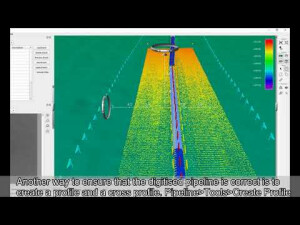
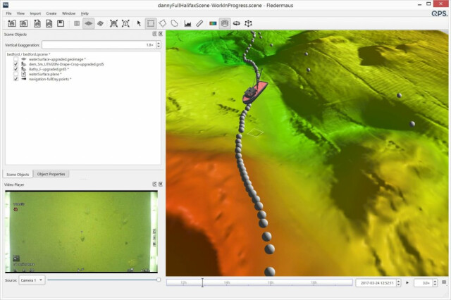
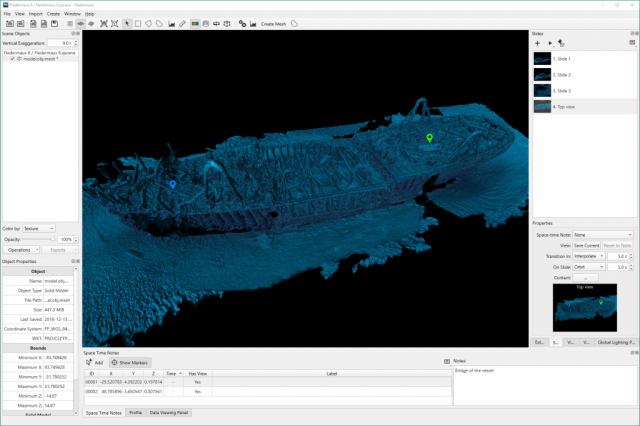
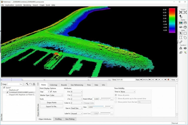
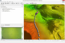
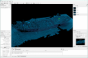
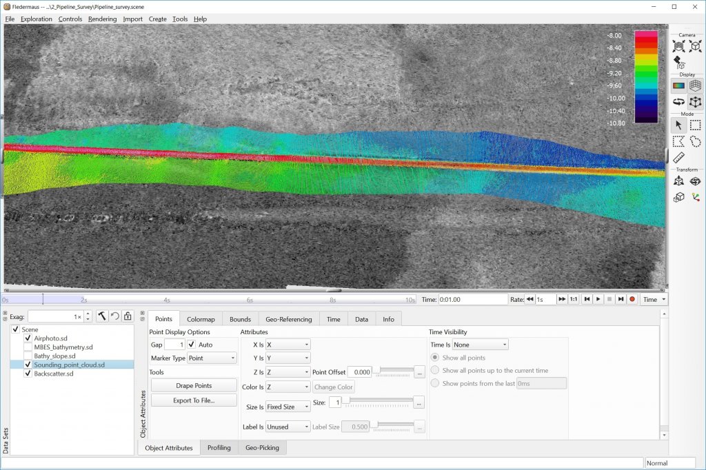
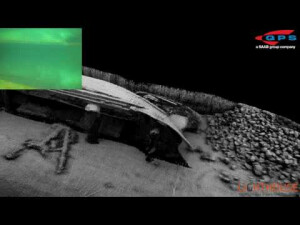
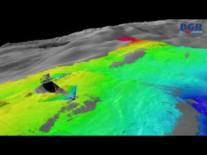
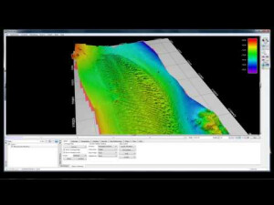
Fledermaus is an interactive 4D geo-spatial processing and analysis tool. With a wide variety of industry standard formats accepted, the intuitive 4D display and interaction allows clients to rapidly gain insight and extract more information from their underlying data. Extensive grid functionality includes interpolating, masking, cropping, and resampling. Images may be cropped and draped atop 3D surfaces. Fledermaus also allows data from remotely operated vehicles, ships, or other entities, to be visualized in realtime. Additional analysis tools allow for seafloor interpretation and characterization, object and surface change over time, object tracking, and cable and pipeline route planning. Fledermaus has integration with Esri software and enables a two-way link to geodatabases in Esri ArcGIS software. 3D mesh technology allows users to examine their data and assess structural integrity in ways that bathymetric grids are inherently limited to do. Fledermaus is the gold standard for presentation and communication, with movie-making tools and integrated video playback. Flythroughs and time/space notes are used to create presentations with slides advancing through 3D/4D space. Fledermaus also includes industry-leading solutions for water-column processing. The extensive functionality of Fledermaus allows its use across many phases of a project from the planning, processing, and QC, through to analysis and production of images, plots, and animations.
Do you have questions about this product?
- Questions about price, availability, and/or retailers
- Questions about technical specifications and usage
- Questions about suitability for your project or application
Specifications
-
Hardware/software requirements
-
RAM [GB]
8
HD [GB]
500
Use of GPU
N
Stereo Display
Y
Processor
["64-bit","32-bit"]
Stand-alone
Yes
-
Other
-
Support
online / phone / user meetings / webinars
Training
Y
Typical applications
Editing and Visualization
Distinguishing features
Windows/MAC/Linux, free viewer for FM scenes
-
Files and Registering
-
Input formats
Such as: OPTECH SHOALS, C&C, ASCII, LAS/LAZ
Output formats
Such as: OPTECH SHOALS, C&C, ASCII, LAS/LAZ
Geo-referencing
Y
Automatic Target Detection
N
Stitching multiple scans
N
-
Pre-processing and Automatic Filtering
-
Image matching facilities
N
Frequency domain decoding for data reduction
No
Removal of individual outliers
Y
Removal of vegetation
N
Removal of buildings
N
Bare ground DEM generation
N
-
Manual Measurements
-
3D Coordinates extraction
Y
Length and Height
N
Angle
N
Distance
Y
Area
Y
Volume
N
-
Interoperability
-
CAD software
No
Hydrological software
ArcGIS
Assigning colour from imagery to points
N
Image overlay on TIN
N
Integration with other data types
DXF/DWG/S57
-
General
-
Year of last update
2023
Year of initial introduction
1995
Modules
Fledermaus (4D geo-spatial analysis); FM Offshore (Route planning; offshore construction); FM GIS (integration with ESRI ArcGIS); FM Geocoder Toolbox (Multibeam backscatter processing and mosaicking); FM Midwater (Water-column processing)
Supported Systems
Such as: OPTECH SHOALS, C&C, ASCII, LAS/LAZ
Source of Point Clouds
Airborne Lidar, Indoor TLS, Outdoor TLS
-
Analysis
-
Line of sight
Y
Aspect and slope
Y
Individual tree heights
N
Simulation facilities
Yes
Time series analysis
Y
-
Automatically Generated Products
-
Regular Grid DEMs
Y
Cross sections
Y
TIN
N
Contour Lines
Y
Break lines
N
Boundary detection of solids
N
Building footprints
N
Building roofs
N
-
Solid Modelling
-
Lines
N
Planes
N
Cubes
N
Spheres
N
Cylinders
N
NURBS
N
Industrial features
No
Earth surface features
No
-
Visualisation and Editing
-
Zoom, pan and rotate
Y
Fly-throughs
Y
Adding Points
Y
Removing Points
Y
Point Reduction
Y
Documents
Brochure
#
