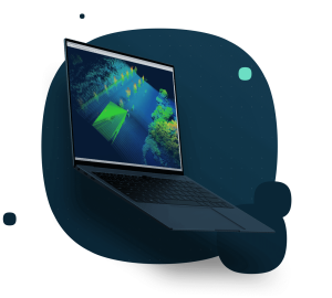


Qimera 2
Multibeam Processing, It's that easy.
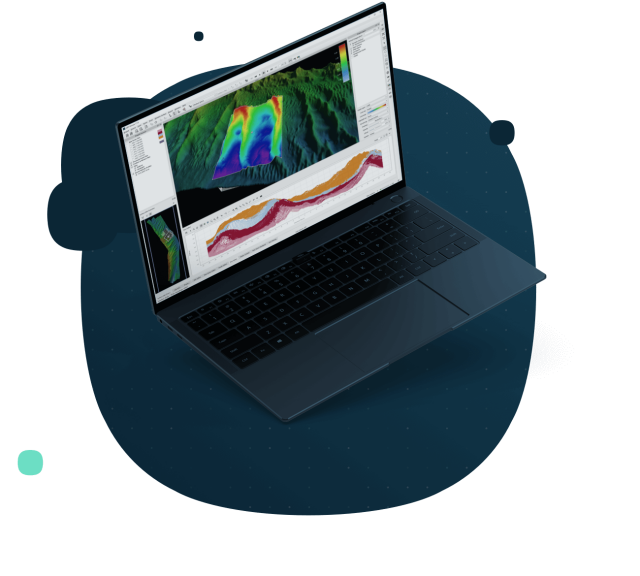
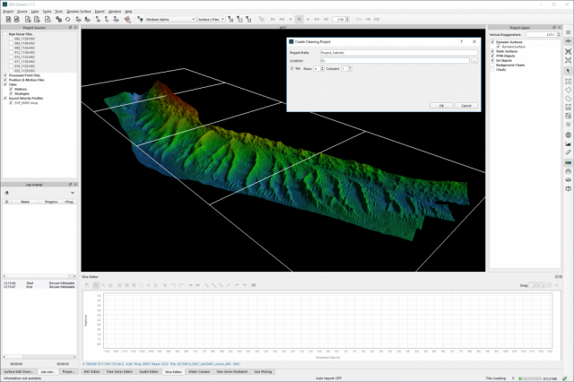
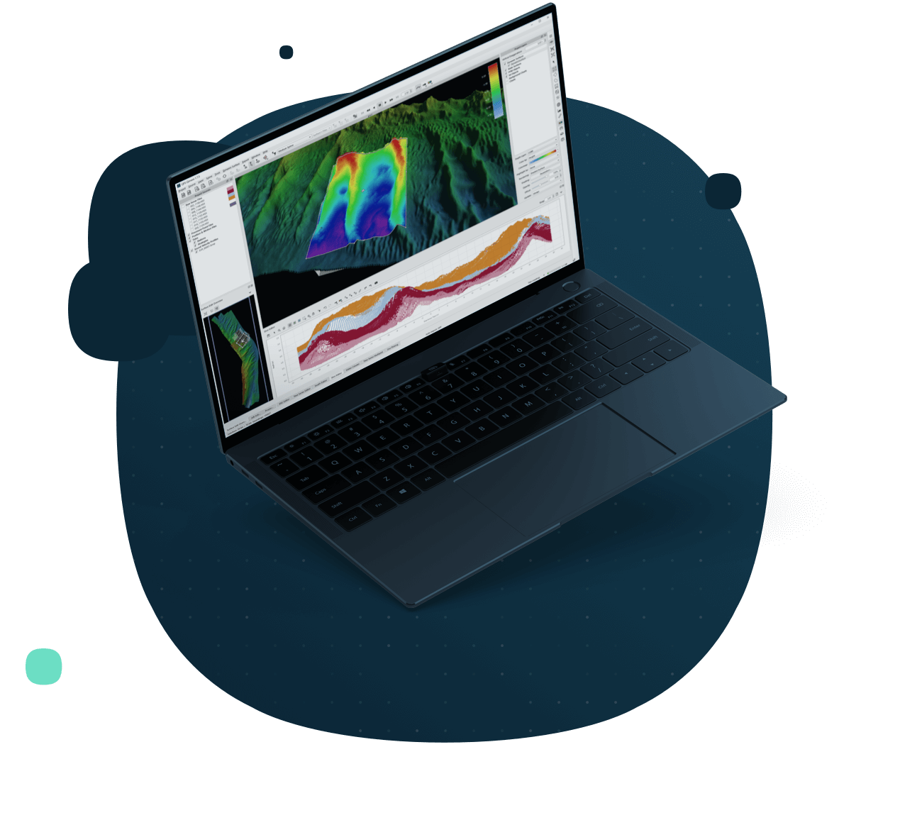
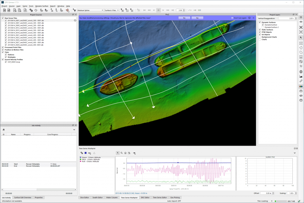
Qimera offers full sonar processing and point cloud cleaning for a wide variety of industry standard formats. Qimera is easy, and will always remain so, with rich data extraction for a streamlined, "hands off" data import and guided workflows to reduce human error and training requirements. Automation is achieved via Qimera Live, for near real-time data processing, highly customizable spline filters for rapid data cleaning, and Processing State Management to ensure the correct sequence of post -processing actions with a single-click.
QPS
Zeist, NL
Description
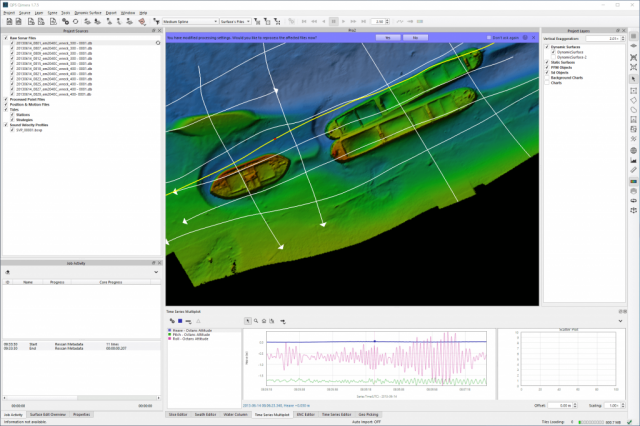
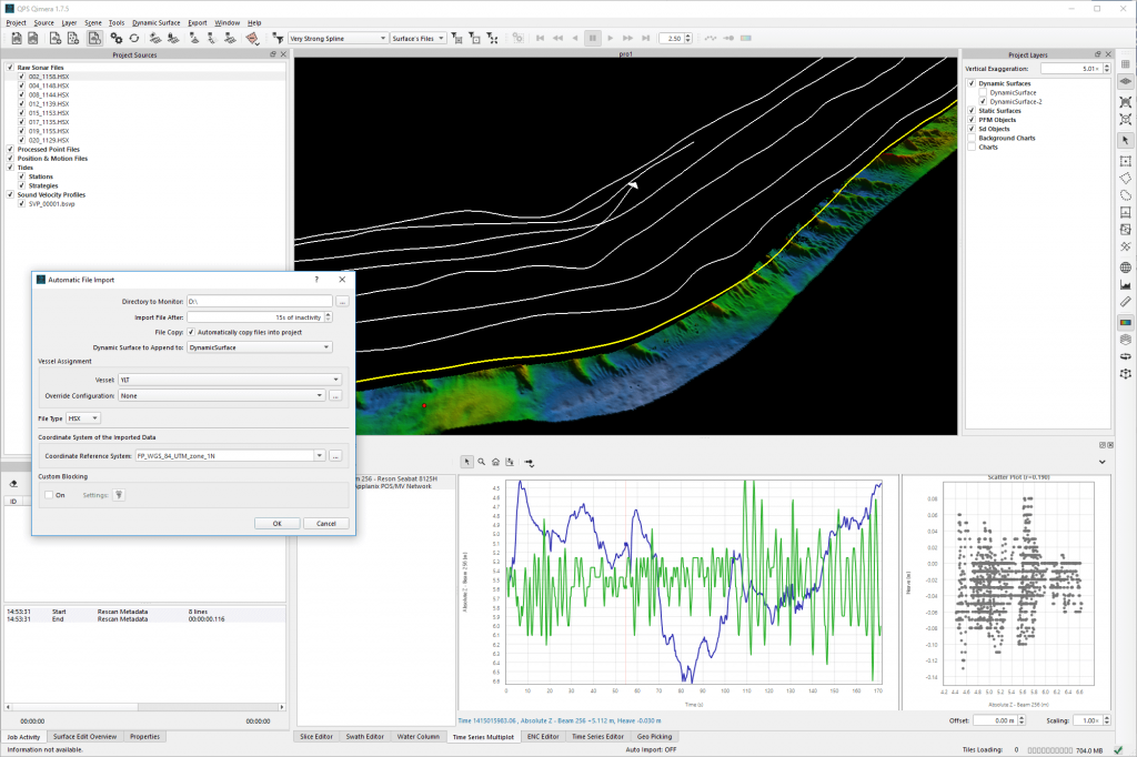
Qimera offers full sonar processing and point cloud cleaning for a wide variety of industry standard formats. Qimera is easy, and will always remain so, with rich data extraction for a streamlined, "hands off" data import and guided workflows to reduce human error and training requirements. Automation is achieved via Qimera Live, for near real-time data processing, highly customizable spline filters for rapid data cleaning, and Processing State Management to ensure the correct sequence of post -processing actions with a single-click. Advanced tools include the Patch Test tool and Wobble analysis to diagnose and fix any errors in the multibeam and motion sensor integration, and the Automated Sound Speed Correction to automatically correct refraction error. Additional analysis tools include Time Series Multiplots, Cross Check tool and Extinction Tests, which all work to ensure high multibeam data quality and system health. Great efficiency is gained with Cooperative Cleaning and Production Line Processing, which allow for multiple personnel to work on the same project simultaneously, and "Connected" S-57 feature management that ensures agreement between features and bathymetry. Qimera is fully compliant on Windows, MacOS, and Linux.
Do you have questions about this product?
- Questions about price, availability, and/or retailers
- Questions about technical specifications and usage
- Questions about suitability for your project or application
Specifications
-
Hardware/software requirements
-
Field of Use
Focus is on MBES bathymetry data processing, including water column data. Point Cloud cleaning is also possible.
HD{GB}
500
Languages Supported
English, Chinese, German, Spanish
Processor
64 bit
RAM [MB]
8000
Stereo Display
Y
Use of GPU
Y
-
General
-
Modules
Qimera supports QPS formatted and 3rd party data files. Qimera includes tools for advanced SV, Patch Test and Wobble Test. OS: Win10, MAC, Linux
Supported Systems (SB, MB, SSS, Lidar etc.)
MB systems: including but not limited to Kongsberg, R2SONIC, Teledyne-RESON, Teledyne-ODOM, Edgetech, L3-Klein, WASSP, Kongsberg-Mesotech
Year of initial introduction
2015
Year of last update
2023
-
Processing
-
Assessment of bathymetry IHO Cat S-44
Y
Gridding/Interpolation techniques
weighted
Grid attributes {Std., Mean, Max, etc.}
Avg, Min, Max, Count, 95%SD
Lay-back correction
N
Manual editing capability
Y
Mosaic creation
N
Mosaic creation algorithms
-
Mulitbeam Calibration mehods
Automatic and Manual
Multibeam water column imaging support
Y
Multibeam Backscatter Processing Functionality
QPS FMGT
Number of video channels
0
Siant range correction
N
Sound velocity correction type
Time, Distance, Distance + Time
Sound velocity correction
Single profile support, Multiple profile correction support
SSS Targeting
annotations
Support tidal reduction network
Y
Tidal reduction
RTK-tide, Tide
Type of automatic cleaning algorithm(s)
CUBE, SPLINE
Video integration
N
-
Geodetic Functionality
-
Ellipsoidal reference support (GRS80)
Y
Geographical Coordinates {Lat, Long}
Y
Ground Coordinates {E,N}
Y
Local datum support
Y
Separation model for vertical datum shift support
Y
Seven Parameter shift supported
Y
Supported coordinate systems
EPSG and more
Supported vertical reference frames
Yes
-
Product Generation
-
Automatic cross profile creation
N
Automatic top of pipe calculation
Y
Combining bathymetry / terrestrial point clouds
Y
Contouring
Y
Dynamic event numbering
N
Export/Exchange options
Many including but not limited to: QPS formatted files, ASCII, BAG, etc.
Slope analysis
N
Sounding Selection methods
Y
Volume calculation
Y
-
Visualisation and Editing
-
2D Editing
Y
2D Visualization
Y
Fly-throughs support
N
3D fly-through movies {*.mov etc}
N
Area based 3D editing
Y
Area based 3D View
Yes
3D View max number points
-
3D Integrated models
-
Sounding cleaning algorithms
CUBE, SPLINE, QINSy blocking, Manual
4D support
Y
4D fly through movies {*.mov etc.}
-
-
Files and Registering
-
Input Formates {XTF, XYZ, GSF etc}
QPS formatted files, *.ALL, *.S7K, *.GSF, HYPACK
Max. Number of Soundings
unlimited
Supported Hydrographic Systems
MBES (including water column)
Background format support {Google, Bing, OGC, CAD etc.}
Many including but not limited to: ENC and CAD, geo-referenced images GeoTiff/JPEG/PNG, etc.
Documents
Brochure
#