


Qastor 3
Precise piloting. Let us guide you.
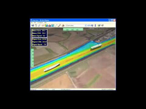
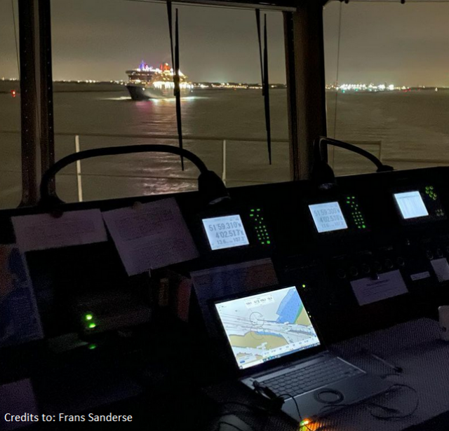
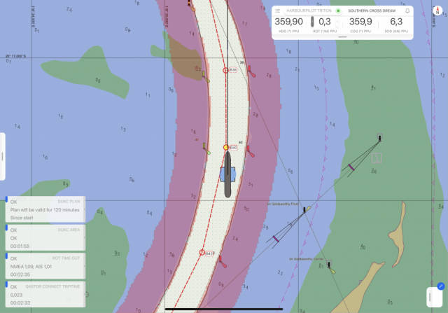
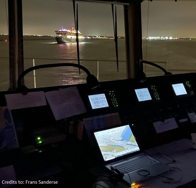
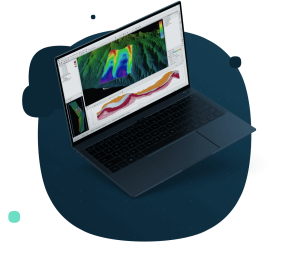
Precise piloting with under-keel clearance capability and real-time information updates. The ultimate in maritime safety. Qastor is a precise navigation, piloting and docking software application capable of receiving real-time meteorological information and chart updates via the Connect Server. A precise navigation software for piloting and docking, and with Under Keel Clearance capability and modes customized to specific, critical operations, Qastor also supports high-resolution overlays to expand navigable water, and real-time meteorological updates via the Connect Server, resulting in optimal situational awareness for pilots.
QPS
Zeist, NL
Description
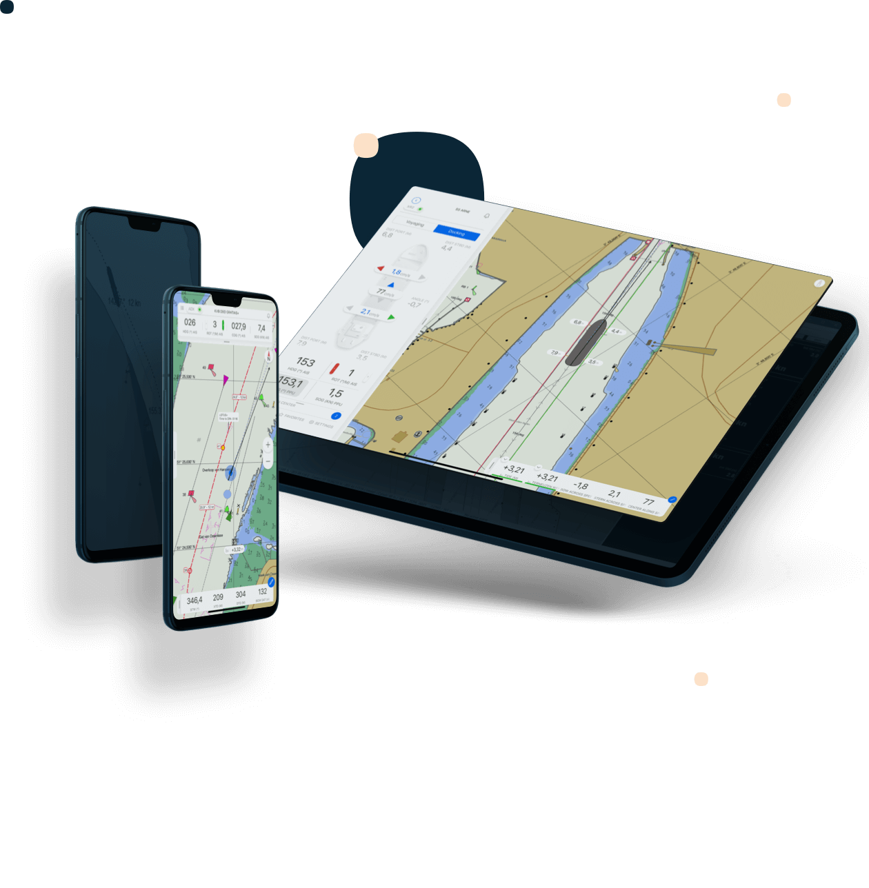
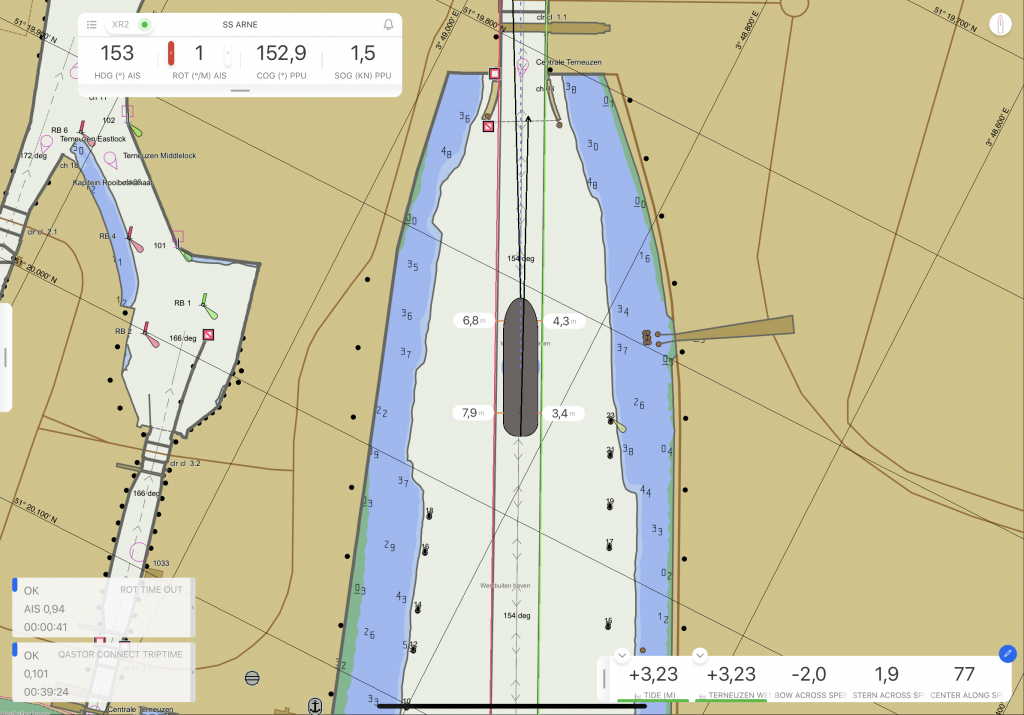
Qastor is a precise navigation software package for piloting and docking. With under keel clearance capability and real-time information updates, it is the ultimate in maritime safety. Qastor displays reliable and accurate position and orientation data, for optimal planning, situational awareness, and safety in support of any near maritime operation—piloting, docking, ship trials, oil rig positioning, inland river barges, ferry operations, oil and gas tanker approaches and docking, patrol vessels, tugboat operations, and more. There are also modes customized for tandem, side-by-side, and single point mooring.
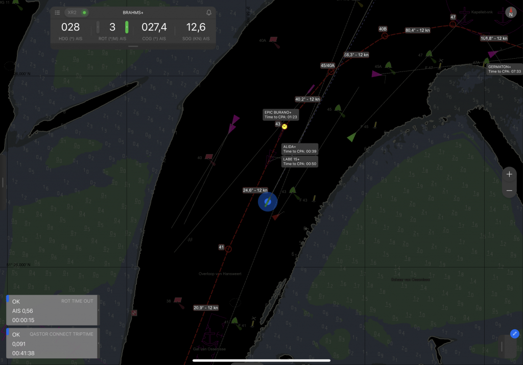
Real-time information via the Connect Server increases situational awareness with updated tides, currents, wave heights, wind and validated traffic information coming from the VTS center.
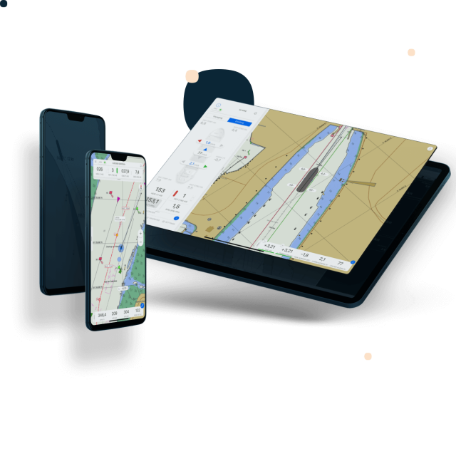
Qastor is platform independent, and can be used on desktop, tablet, or mobile, with Windows or iOS. Wired or wireless operations are supported, and data may be output via Wi-Fi to mobile devices for optimal client flexibility.
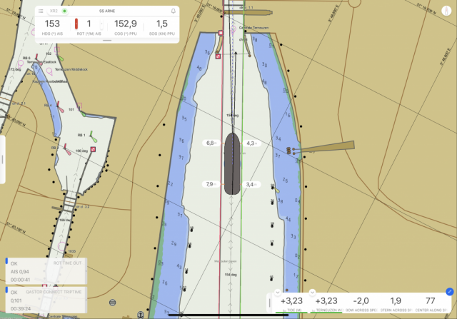
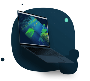
The Qastor real-time display includes vessel speed, heading, course over ground, and rate of turn. ENC formats include:
S-57, Primar, C-MAP, ARCS, DENC and bENC. Vessel path prediction is based on a user-defined period based on speed, course over ground, and heading. The closest point of approach for all VTS and AIS targets is displayed. With under keel clearance, vessel-based route planning, and high-resolution ENC support to safely expand navigable waters, master the situation better than ever with Qastor.
Do you have questions about this product?
- Questions about price, availability, and/or retailers
- Questions about technical specifications and usage
- Questions about suitability for your project or application
Specifications
-
General
-
Current version number
3.9.2
Year of current version
2023
Type
ECS, Inland Navigation
-
Features
-
Functions for on board use of SOLAS vessels
Y
Functions for leisure market
Y
Integration
AIS targets
-
Additional functions
-
Head up display
Y
Online help functions
Y
Relative motion display of AIS and radar targets
Y
User interface in multiple languages
Y
-
Support
-
24/7 Provision of chart data service
N
Documentation in multiple languages
Y
Remote wireless maintenance
N
Documents
Brochure
#
Videos

