


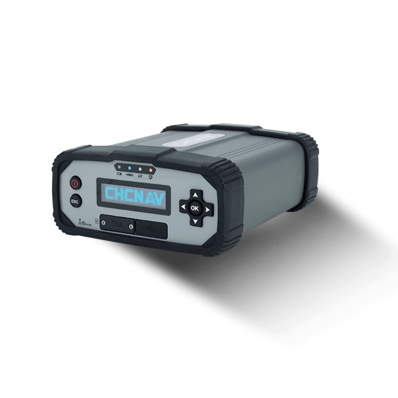


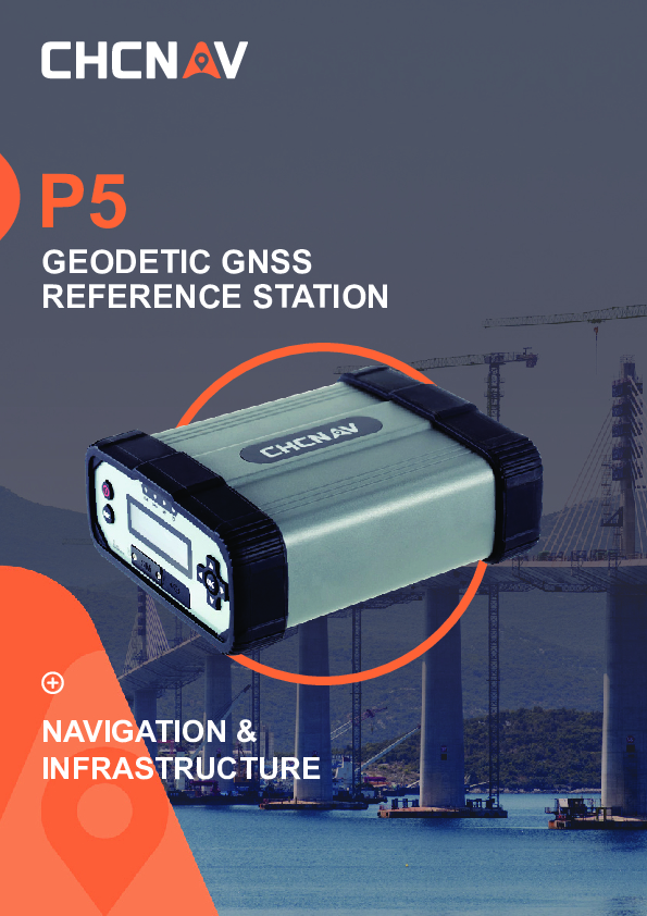
P5 GNSS
Smart GNSS Geodetic Reference Station for CORS and GNSS Networks Applications
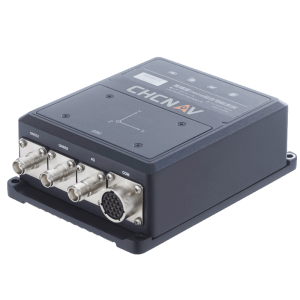
The P5 GNSS reference station ensures superior performance in all environments. Its integrated Linux OS, 624 channels for tracking multi-constellation GNSS signals, large storage and battery capacity, secure and diverse network connectivity, and smart access rights management make the P5 GNSS reference receiver extremely reliable and easy to use.

CHC Navigation | CHCNAV
Shanghai, CN
Description
-
624-CHANNEL ADVANCED GNSS TRACKING TECHNOLOGY
FULL CONSTELLATION FOR SUPERIOR GNSS RAW DATA
The 624-channel P5 GNSS simultaneously tracks signals from GPS, GLONASS, Galileo, BeiDou, and SBAS satellites with outstanding GNSS raw data quality. Furthermore, the integration of the P5 GNSS reference stations as the foundation of RTK networks guarantees optimal GNSS RTK corrections resulting in the highest quality GNSS rover positioning.
-
MULTIPLE POWER SOURCES & INDUSTRIAL DESIGN
UNINTERRUPTED OPERATION 24 H/DAY
The P5 supports DC and AC external power inputs to ensure a stable and continuous electrical supply. The electronic design results in an MTBF (mean time between failures) of over 35,000 hours. The built-in high-capacity 17,000 mAh battery provides up to 20 hours of non-stop backup operation in the event of an external power outage. Its advanced power supply ensures uninterrupted operation 24 hours a day, seven days a week, with continuous status information on its control screen and the option of remote monitoring of power supply conditions, network status, firmware version, etc. It is IP67-rated water and dust resistant to withstand challenging conditions at installation sites, reducing potential downtime due to moisture or dust ingress.
-
VERSATILE NETWORK CONNECTION MODES
ROBUST AND SECURE GNSS DATA STREAMING
The P5 supports remote connections via Intranet, Ethernet, 4G, and Wi-Fi for easy access, configuration, and data transfer. The redundant network connectivity feature allows the P5 to automatically switch between Ethernet and 4G wireless network connections, ensuring stable and reliable GNSS data streaming. The P5 also supports OpenVPN intranet penetration and multiple protocol stacks to easily create HTTP/HTTPS web access without static IP. In addition, the P5 has several security layers, such as multiple user permissions, web interface restrictions, HTTPS encryption to prevent unauthorized access, and built-in firewall, port and MAC filtering.
-
SMART DATA MANAGEMENT
LARGE DATA STORAGE AND ADVANCED WEB ACCESS
With 32GB of internal storage and up to 1TB of external storage, the P5 can simultaneously record up to 8 separate data sessions, providing DATA storage in the standard Rinex 3.02 format for up to 7 years. In addition, its embedded FTP server or FTP push to a remote site ensures data integrity and ease of use.
-
OPTIMAL SOLUTION FOR GNSS NETWORKS
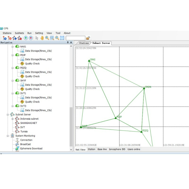
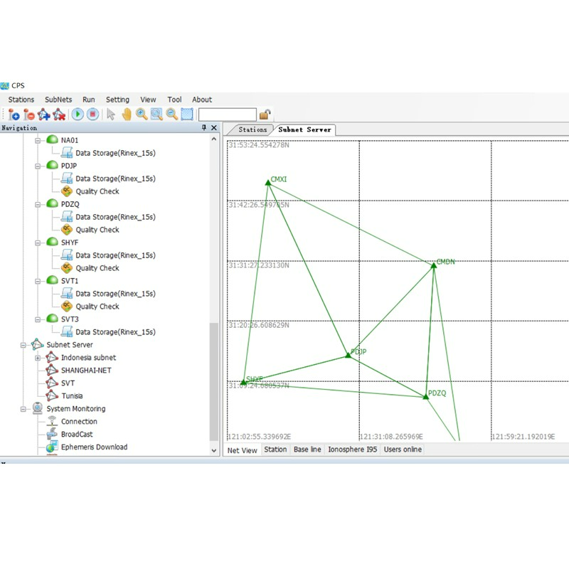
SUPPORTED BY SOFTWARE TO MANAGE GNSS RTK NETWORKS
CPS (CHCNAV Precision Service) is an advanced software solution for GNSS RTK networks. CPS is compatible with the latest QZSS and BDS III navigation systems and fulfils the requirements of regional and national CORS and GNSS RTK networks. CPS is used to establish error resolution models for the ionospheric delay, tropospheric delay, orbital error, multipath effect, etc., for the complete network. It features optimized spatial error corrections using an enhanced virtual reference station to ensure a reliable RTK fixed-rate and positioning accuracy. Its control module also monitors P5 GNSS operation, network status, and data quality in real-time.
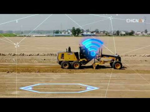
The P5 GNSS reference station ensures superior performance in all environments. Its integrated Linux OS, 624 channels for tracking multi-constellation GNSS signals, large storage and battery capacity, secure and diverse network connectivity, and smart access rights management make the P5 GNSS reference receiver extremely reliable and easy to use. The P5 GNSS reference station is shock resistant and suits any environment, and it features voltage stabilization, lightning protection, real-time self-diagnosis, and status monitoring to ensure uninterrupted operation. The P5 is an advanced GNSS reference station to provide positioning services in various demanding industries, such as GNSS ground augmentation, deformation monitoring, atmospheric research, seismic research, precision agriculture, machine control, and vehicle and ship navigation.
Do you have questions about this product?
- Questions about price, availability, and/or retailers
- Questions about technical specifications and usage
- Questions about suitability for your project or application
Specifications
-
General
-
Type
Land
Year of initial introduction
2020
Height [m]
0.069
Depth [m]
0.2
Width [m]
0.15
Total Weight [kg]
2.15
-
Performance
-
No. channels
624
Tracked satellite signals
GPS (L1, L2, L5), GLONASS (L1, L2), Galileo (E1, E5A, E5B), BeiDou (B1, B2, B3, B1c, B2a), QZSS (L1, L5).
SBAS differential signals
L1 - will be provided through future firmware upgrade.
RTK Network Compatibility
Horizontal: 8 mm + 1 ppm RMS Vertical: 15 mm + 1 ppm RMS Initialization time: < 8 s Initialization reliability: > 99.9%
-
Environment
-
Operating temperature: min. [°C]
-40
Operating temperature: max. [°C]
65
Humidity resistance
100%
Water sand and dust proof
IP67 waterproof and dustproof, protected from temporary immersion to depth of 1 m
Shock and vibration proof
IEC68-2-27
-
Communication: general
-
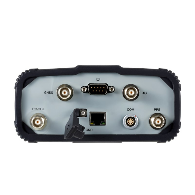
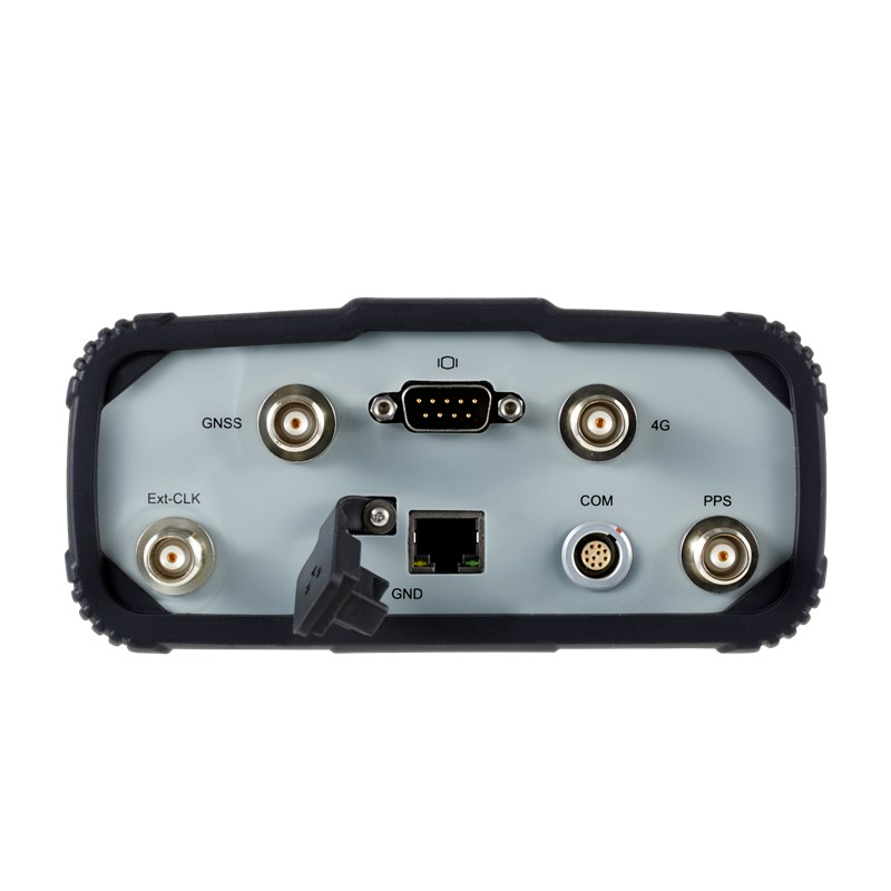
Communication ports
1 x 10-pin LEMO port (external power, RS-232) /// 1 x USB 2.0 port (data download, firmware update) /// 1 x LAN port /// HTTP / HTTPs, TCP/IP, UDP, FTP, NTRIP Caster, NTRIP Server, NTRIP Client – Simultaneously transmits multiple data stream – Support proxy server and route table /// 1 x DB9 port /// 1 x GNSS antenna port /// 1 x SIM card slot
Bluetooth
Y
-
Communication: links
-
GSM; UMTS phone modems
Internal 4 G modem
-
Horizontal uncertainty
-
phase: static post processing (constant part) [m]
Horizontal: 2.5 mm + 0.5 ppm RMS /// Vertical: 5 mm + 0.5 ppm RMS
-
Power
-
Typical consumption [W]
5
Internal power supply
17 000 mAh, 7.4 V
External power supply
9 V DC to 36 V DC
Operating time with internal power supply [hr]
20
Certifications
FCC Part 15 (class B Device), FCC Part 22, 24, 90; CE Mark; Method 514.7, IGS
-
Recording
-
Data capacity [MB]
1000000
-
More information
-
Distinguishable features
Smart GNSS geodetic reference station for CORS and GNSS networks applications
Documents
Brochure
p5-ds-en.pdf
800.1 KB


