

Using Highly Accurate Inertial Navigation Systems to Improve Our World’s Mapping Systems
Horus View and Explore, based in the Netherlands, specializes in integrating video, sensor fusion technology and their proprietary mapping software to help companies collect and process geospatial data. Their customers collect this data using cars, unmanned aerial vehicles (UAVs), boats and trains to form GIS data, digital maps or geo-referenced images and video with time-stamped information.
Horus View and Explore got its start in mobile mapping in 2006 when the founder was looking for a simple, but cost-effective method to improve the accuracy of geospatial data used by organizations responsible for maintaining public areas like roads, bridges and critical infrastructure.
One of the most significant issues Horus set out to fix was in emergency services. When crews responded to an incident, they were relying on geographical data that was outdated, which made it difficult to find the right location.
Similarly, local governments needed a solution to help them proactively survey street signs, road conditions and more.
Shortly after, Horus introduced their first system that utilized a 360-degree camera, sensors, software and other equipment to measure geographical information. The system measures the distance from the road to the vehicle and uses the new navigation data to improve its customers’ mapping systems.
“It’s very important for governments to frequently measure the condition of their assets. Having the ability to compare past data with today’s information allows you to see degradation over time.” Dirk Aalbers, Sales Manager Geospatial, Horus.
Today, Horus provides do-it-yourself recording systems and develops hardware-independent software platforms to capture and stream data. Horus’ solutions are based on commercial off-the-shelf (COTS) components. This means there’s a solution for every application and for every budget.
Decision
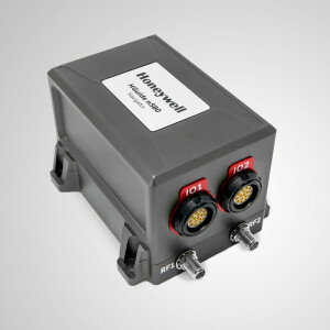
To improve the location accuracy of its mobile mapping systems in GNSS-denied areas like bridges, mountains, highways, parking garages and dense forests., Horus chose Honeywell’s HGuide n580 inertial navigation system.
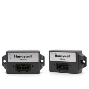
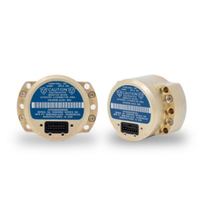
The HGuide n580 inertial navigation system is made up of Honeywell’s high-performing and rugged HG4930 inertial measurement unit (IMU), a GNSS receiver and proprietary fusion software. These components work together to provide time-stamped position, velocity, angular rate, linear acceleration, roll, pitch and heading information acceleration and orientation.
“If you’re collecting data in cities and are using images to measure your surroundings, it’s important to have highly accurate location data. We no longer use unreliable GPS systems that fail inside cities because of high buildings and trees,” said Aalbers.
The HGuide n580 inertial navigation system transmits high-accuracy navigation data as well as status information once it has powered up and continues to do so, even when exposed to the harshest environments.
Since 2006, Horus has worked with several customers to demonstrate how easy and cost-effective it can be to implement their systems to capture street-level imagery data. Imagery data can be interpreted very quickly by humans, leading to a broad audience that can work with this kind of data.
By implementing the HGuide n580 inertial navigation system across their systems, Horus has been able to give customers a turn-key solution that is always going to work when and where they need it.
“A difficult aspect of capturing location data in an urban area is getting absolute position. If you want to do mobile mapping in an urban area, it’s necessary that you have a good tool to find absolute position and the HGuide n580 inertial navigation system always provides precise, absolute position,” said Robert Medendorp, project engineer, Horus View and Explore.
When Horus sought out to improve their location accuracy, they were looking for a navigation partner that could provide a solution that was scalable and would meet the needs of their future roadmaps. With Horus’ mobile mapping software, it’s now possible to extract features manually as GIS data or automatically with artificial intelligence software.
Benefits
Horus’ mapping software and Honeywell’s HGuide n580 inertial navigation system continuously work together to provide highly reliable navigation data without any additional aiding sources. In conjunction with a simple tool like a video player, the software inputs information on top of the imagery. This means it creates an accessible way to enter data and verify the current data of the assets, stored in databases is still correct.
In addition, the HGuide n580 inertial navigation system continually corrects the location of the images captured through Horus’ camera while the customer is driving. As a result, this ensures the customer doesn’t have to go back and drive in that area to recapture the photos because the system captured incorrect location data.
If customers are only using a GNSS device without a good inertial measurement unit that signal can be disturbed by high buildings or trees and especially in urban areas, you need to correct that location while driving through the city.
According to Horus, they’ve been able to achieve location accuracy around 10 or 20 centimetres while driving through a city with high buildings since moving to the HGuide n580 inertial navigation system. “Connecting it to several of our sensors and the rest of the system was simple. You can link it to our city mapper, hook up the antennas, connect it to your computer, start up the software and you’re ready to go,” said Medendorp.
Honeywell’s technology, coupled with Horus’ software, helps to maintain the public space that is used and monitored by government officials, law enforcement and defence organizations.
“A reliable system requires reliable hardware and Honeywell supplies robust and reliable hardware. The HGuide n580 inertial navigation system helps us enormously,” said Medendorp.
Horus is helping organizations worldwide to innovate very quickly with Honeywell’s HGuide n580 inertial navigation system – bringing the outside world inside, one piece at a time.
Click here for the original Honeywell article.


![Do-Giant-Tortoises-Make-Good-Neighbors-1[1].jpg](https://cdn.geo-matching.com/vRMO2Edp.jpg?w=320&s=a6108b2726133ff723670b57bc54c812)


