![improving-lidar-data-quality-and-results-using-point-cloud-smoothing-1.png](https://cdn.geo-matching.com/6pykBxRj.png?w=480&s=1610716fc06a3fd007ba45282483352b)
![gvi-web1.jpg](https://cdn.geo-matching.com/dogeB7nZ.jpg)
Showing 1-9 of 9 results
![improving-lidar-data-quality-and-results-using-point-cloud-smoothing-1.png](https://cdn.geo-matching.com/6pykBxRj.png?w=480&s=1610716fc06a3fd007ba45282483352b)
![producing-and-processing-canopy-height-models-in-steep-terrain-1.png](https://cdn.geo-matching.com/9pN8g7RZ.png?w=480&s=c335cf6ac39831fffb151fc8a55cb56d)
Producing and Processing Canopy Height Models in Steep Terrain
![how-to-process-missing-lidar-point-cloud-data-under-the-forest-canopy-header.png](https://cdn.geo-matching.com/Pnj7d9pa.png?w=480&s=fbd2bb80782d8b6e370bc233d67be7ac)
How to Process Missing Lidar Point Cloud Data Under the Forest Canopy
![1629966299171730.jpg](https://cdn.geo-matching.com/PR03wVoX.jpg?w=480&s=d036952b49836fea27cb97990e5730fe)
Intelligent Solar Energy Inspection Project Using Lidar and Point Cloud Data
![3d-point-cloud-data-and-the-production-of-digital-terrain-models-figure-1.png](https://cdn.geo-matching.com/yod23rne.png?w=480&s=14d1d7a37b8d2d282d8c847e1e5dcc3c)
3D Point Cloud Data and the Production of Digital Terrain Models
![21-0.png](https://cdn.geo-matching.com/voa1L6oK.png?w=480&s=2aa2ec79c595a684eb4a1c4c8ed40cf5)
How to Manipulate and Generate Meaningful Geospatial Products From Point Cloud Data
![14-0.png](https://cdn.geo-matching.com/1pP8q2pm.png?w=480&s=a38e135669b74a2f027b617e051765ef)
Intelligent and Automated Solutions for Collecting and Managing Forestry Information
![img5ffc0a9c811ba7.png](https://cdn.geo-matching.com/wRW8dknL.png?w=480&s=851afcfc1fe1af6f91a1bfe852998d97)
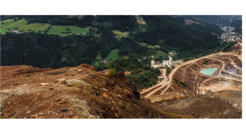
Advanced Laser Scanning Solutions for Specific Mining Applications
![img5ffc005ce19945.png](https://cdn.geo-matching.com/enY82KRG.png?w=480&s=eeff40e1c4d29c223171a4ebbc33682e)