Valve Exercising
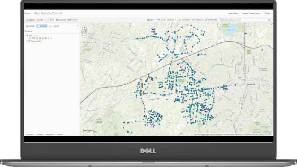
Two Rivers Utilities added hundreds of valves to its GIS as part of a new valve-exercising program, intended to reduce service interruptions and modernize valve-tracing on the Esri ArcGIS platform
City of Gastonia Public Utility Department Looks to the Future of GIS with Arrow 100 for Valve Exercising
BY EOS POSITIONING SYSTEMS / WEDNESDAY, 24 APRIL 2019 / PUBLISHED IN LATEST NEWS, NEWS, SUCCESS STORIES

Founded back in the late 1800s, the modern-day Two Rivers Utilities was born of a 2011 merger between the City of Gastonia and the Town of Cramerton. Photo courtesy of City of Gastonia and TRU
Two Rivers Utilities added hundreds of valves to its GIS as part of a new valve-exercising program, intended to reduce service interruptions and modernize valve-tracing on the Esri ArcGIS platform
About the Organization: Two Rivers Utilities
Thirty minutes west of Charlotte, North Carolina, Two Rivers Utilities (TRU) offers water and sewer services to a large part of Gaston County. Founded in the late 1800s, the modern-day TRU was born of a 2011 merger between the City of Gastonia and the Town of Cramerton. Today, TRU is part of the City of Gastonia’s Public Utility Department and serves more than 100,000 industrial and residential customers.
“We have the largest system in the area, and we even provide contracted services to neighboring municipalities,” TRU GIS Analyst Brian Hart said.
With more than 600 miles of water mains, TRU’s water system contained at least 12,000 valves. But today, two years into a valve-isolation and exercising project, that figure has jumped to 13,000. It is due to a new valve-exercising program that combines high-accuracy location data with valve exercising.
![]()

About the Challenge: TRU’s First Valve-Exercising Program
“Most of the locations were OK. But they weren’t pinpoint accurate.”
— Brian Hart, GIS Analyst, Two Rivers Utilities
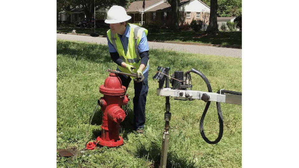
For 15 years, the TRU staff had known that starting a valve-exercising program would be beneficial. (Valve exercising is the task of opening and closing a valve to check if it’s functioning properly.) But it was only in the last five years that the utility hired the right team to bring the project to life. Brian Potocki was hired as the Division Manager of Utilities Maintenance, and Brian Hart as the GIS Analyst.
“We brought in the right staff, with our two Brians [Hart and Potocki], and one made the case for a valve exerciser and trailer, while the other one was able to get the technical side of things running,” said Ron Cook, the Assistant Division Manager of Systems Maintenance.
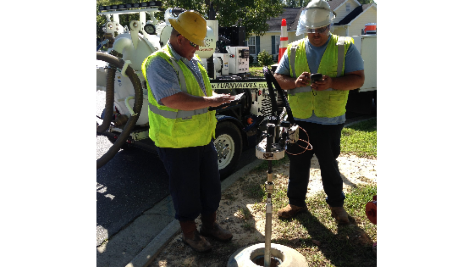
With Hart on board, the City of Gastonia purchased its first valve-exercising trailer, made by EH Wachs. The trailer came with a built-in handheld controller, which uses proprietary software to guide the exercising workflow.
“It does the whole process,” Hart said.
The controller is also capable of connecting via Bluetooth® to an external GPS receiver, which would allow TRU to update the location of its valves.
“Most of the locations were OK,” Hart said. “But they weren’t pinpoint accurate.”
The manufacturer recommended a specific brand of GPS receiver, but Hart wanted something that was more modern and easier to use. So Hart made the case for a new GPS receiver, and in 2017 he got his wish.
“We made him wait a year before he was allowed to change anything,” Cook joked.

Valve exercising is the task of opening and closing a valve to check if it’s functioning properly.
“We brought in the right staff, with our two Brians [Hart and Potocki], and one made the case for a valve exerciser and trailer, while the other one was able to get the technical side of things running.”
— Ron Cook, Assistant Division Manager of Systems Maintenance, Two Rivers Utilities
About the Solution: Arrow 100 for Valve Exercising
“We picked the Arrow 100 because it was easy to use and affordable.”
— Brian Hart, GIS Analyst, Two Rivers Utilities
Hart had read about the Arrow 100 GNSS receiver in an Esri Water Newsletter article featuring Le-Ax Water District in Ohio. He called Le-Ax and asked for recommendations.
“Le-Ax spoke highly of the Arrow 100 GNSS,” Hart said. “So we purchased our first Arrow 100 device.”
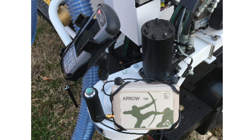
Hart worked with Eos Positioning Systems to make sure the Arrow 100 paired properly via Bluetooth® to the trailer’s handheld controller. Once paired, the Arrow 100 provided with an average of 40-cm location accuracy out of the box, using the free WAAS differential correction service.
“We picked the Arrow 100 because it was easy to use and affordable,” Hart said.
Its antenna was also small enough that Hart could have a welder mount it onto a trailer arm. The exact location of the valves could thus be recorded with the trailer arm extending over them.

TRU picked the Arrow 100 GNSS receiver because of its ease of use, accuracy and affordability. Its antenna was also small enough that a welder could permanently mount it to the valve-exercising trailer arm, to capture the precise location of each valve.
To read the rest of the article, click here ...
GNSS
Esri
RTK
Collector for ArcGIS
water
municipality
Valve Exercising
Wastewater
Arrow 100
Asset Management
Tracing
Utility
network management
utility network
trailer
Do you have questions about this case study?
Get in touch with Eos Positioning Systems, and they would be happy to answer any questions you have about pricing, suitability, availability, specs, etc.

Related products


![Do-Giant-Tortoises-Make-Good-Neighbors-1[1].jpg](https://cdn.geo-matching.com/vRMO2Edp.jpg?w=320&s=a6108b2726133ff723670b57bc54c812)


