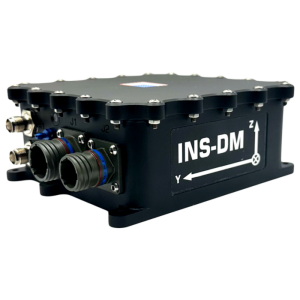
The Critical Role of INS in Disaster Management
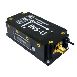
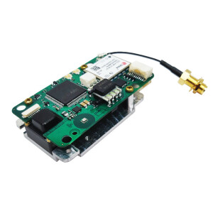
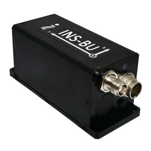
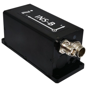
Rapid and effective emergency response is paramount in disaster management to minimize loss of life and mitigate damage. Inertial Labs’s Inertial Navigation Systems (INS) emerge as a pivotal technology offering robust positioning, navigation, and orientation capabilities, particularly in environments where conventional GPS signals may be unreliable or unavailable. This report delves into the significance of our INS in disaster management, highlighting its functionalities, applications, and the insights gleaned from scientific research.
Applications in Disaster management
Search and Rescue Operations
In disaster-stricken areas, where conventional infrastructure may be compromised, Inertial Labs’s INS-equipped drones or Unmanned Aerial Vehicles (UAVs) can undertake swift and targeted search and rescue missions. Research by Smith et al. (2020) underscores the utility of UAVs in disaster response, citing their ability to navigate through cluttered or GPS-deprived environments, thereby expediting the location and retrieval of survivors.
Damage Assessment and Mapping
Post-disaster, precise mapping of affected regions is essential for prioritizing response efforts and resource allocation. Our RESEPI team developed an INS integrated with LiDAR or imaging systems to facilitate the creation of high-fidelity maps for assessing damage and planning evacuation routes. Kumar et al. (2019) corroborate this, highlighting the role of INS-enabled drones in generating detailed 3D maps following the 2015 Nepal earthquake.
Infrastructure Inspection
Critical infrastructure such as bridges and power lines necessitate thorough inspection after disasters. Inertial Labs’s CheetahNAV can enable vehicles to navigate treacherous terrains and provide visual and sensor data for structural assessments. The Federal Emergency Management Agency (FEMA) emphasizes the use of Unmanned Aircraft Systems (UAS) equipped with INS for infrastructure assessment in their guidelines (FEMA, 2018).
Logistics and Resource Management
Inertial Labs (IMUs) can be crucial in logistics and resource management by providing precise motion-sensing capabilities. Integrated within vehicles or cargo containers, IMUs accurately monitor movements, vibrations, and orientation changes during transit. This real-time data is invaluable for optimizing logistics operations, ensuring the integrity of goods, and enhancing overall supply chain efficiency. By tracking the position and status of assets, IMUs enable better inventory management, route planning, and timely delivery of goods, ultimately contributing to cost savings and improved customer satisfaction.
Aerial and Ground Surveys
Unmanned Aerial Vehicles (UAVs) and ground-based robotic systems equipped with our high-precision INS are increasingly used for rapid aerial and ground surveys in disaster-affected areas. These platforms can capture detailed imagery and 3D terrain models, assisting emergency responders in assessing the extent of damage and identifying inaccessible regions.
Environmental Monitoring and Pollution Control
In the aftermath of certain disasters such as oil spills, chemical leaks, or nuclear incidents, INS-equipped drones and robotic systems are deployed to monitor environmental pollution levels and assess the extent of contamination. By precisely navigating through hazardous zones and collecting real-time sensor data, Inertial Labs INS contributes to the effective containment and cleanup of pollutants, minimizing environmental damage and protecting public health.
Public Safety and Evacuation Route Planning
During evacuation procedures in densely populated areas or regions prone to wildfires or flooding, INS plays a crucial role in guiding evacuees along safe routes to designated shelters or assembly points. By continuously updating evacuation maps and dynamically adjusting routes based on real-time conditions, INS enhances public safety and ensures timely evacuation of at-risk populations, reducing the likelihood of casualties and facilitating orderly evacuations.
Wildlife Monitoring and Conservation
In the wake of natural disasters, ecosystems and wildlife habitats can suffer significant disruption. Integrated Navigation Systems aid conservationists and wildlife agencies in monitoring the movement and distribution of animal populations affected by disasters. By deploying GPS-tagged wildlife and aerial drones equipped with INS, researchers can track displaced animals, assess habitat damage, and devise conservation strategies to mitigate the ecological impact of disasters on vulnerable species.
Challenge and Future Applications
Inertial Labs technology holds immense promise for disaster management. It improves other technology regarding cost, scalability, and interoperability with existing systems. Our engineers tirelessly work on system integration and advanced navigation in the GNSS-denied environment.
Inertial Labs technologies represent a cornerstone in the arsenal of technologies employed for effective disaster management. By furnishing accurate positioning, navigation, and orientation data in adverse conditions, INS facilitates swift and targeted emergency response actions, ultimately saving lives and mitigating the impact of disasters.
References
Smith, J. et al. (2020). “Role of UAVs in disaster response: A state-of-the-art review.” International Journal of Disaster Risk Reduction, 45, 101457.
Kumar, A. et al. (2019). “Inertial Navigation System (INS) Integration in Unmanned Aerial Vehicle (UAV) for Disaster Management.” Procedia Computer Science, 165, 290-298.
Federal Emergency Management Agency. (2018). “Using Unmanned Aircraft Systems (UAS) for Disaster Response and Recovery Operations: Guidelines for State and Local Governments.” Washington, D.C.: FEMA.
Do you have questions about this article?
Get in touch with Inertial Labs, Inc., and they would be happy to answer any questions you have about pricing, suitability, availability, specs, etc.


