


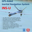

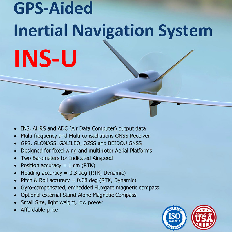
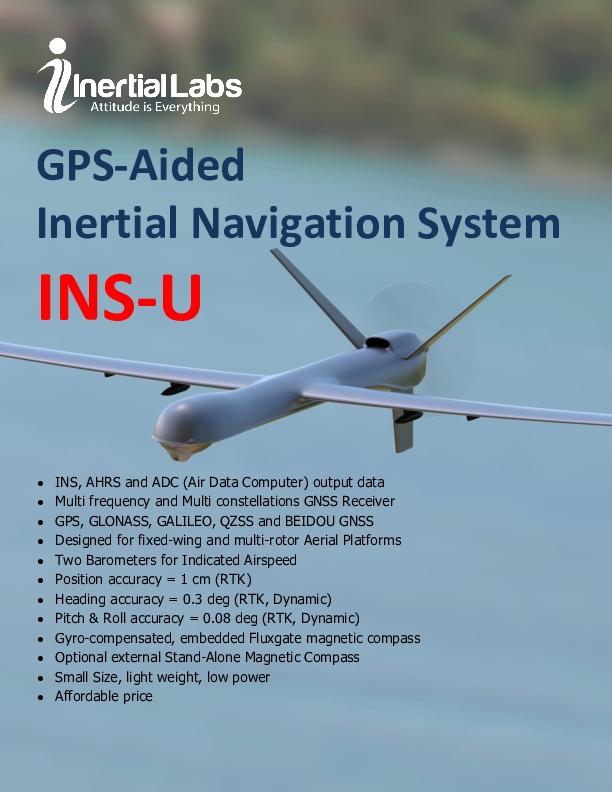
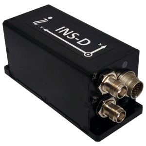
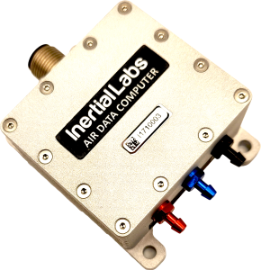
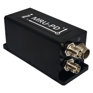
INS-U – GPS-Aided INS with Air Data Computer
GPS-Aided Single Antenna Inertial Navigation System
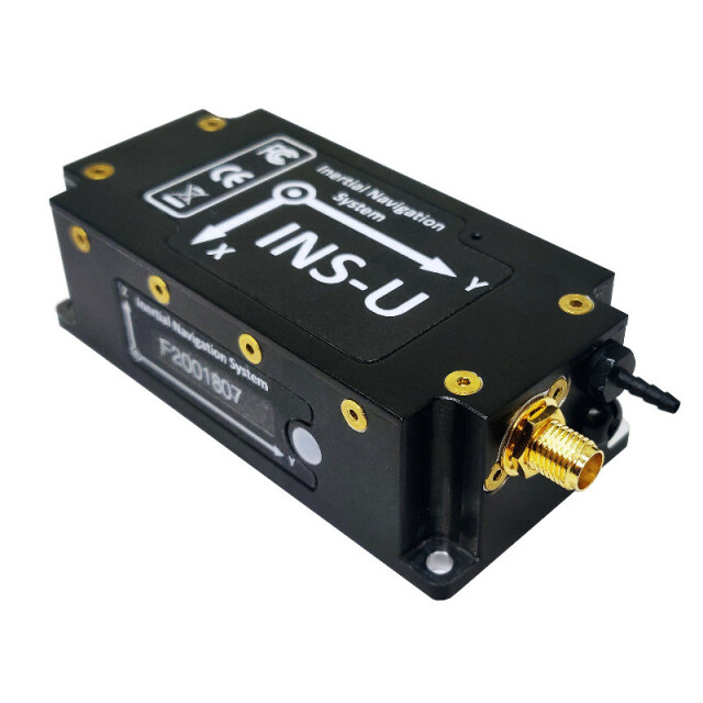
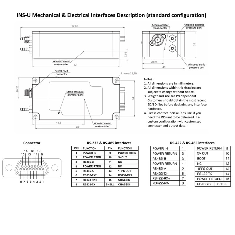
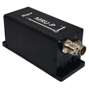
The Inertial Labs GPS-Aided Inertial Navigation System (INS-U) is an IP67 rated version of the new generation, fully-integrated, combined Inertial Navigation System (INS) + Attitude & Heading Reference System (AHRS) + Air Data Computer (ADC) high-performance strapdown system, that determines position, velocity and absolute orientation (Heading, Pitch and Roll) for any device on which it is mounted.

Inertial Labs, Inc.
Paeonian Springs, US
Description
Horizontal and Vertical Position, Velocity and Orientation are determined with high accuracy for both motionless and dynamic applications.
The Inertial Labs INS-U utilizes advanced single antenna multi constellation (GPS, GLONASS, GALILEO, QZSS and BEIDOU GNSS) receiver; two Honeywell TruStability® Board Mount Pressure Sensors; a miniature gyro-compensated Fluxgate compass; 3-axes each of calibrated in full operational temperature range Advanced MEMS Accelerometers and Gyroscopes to provide accurate Position, Velocity, Heading, Pitch and Roll of the device under measure.
INS-U contains Inertial Labs new on-board sensor fusion filter, state-of-the-art navigation and guidance algorithms and calibration software.
KEY FEATURES, BENEFITS & FUNCTIONALITY
-
Commercially exportable GPS-Aided Inertial Navigation System
-
3-in-1 strapdown system: INS + AHRS + ADC (Air Data Computer)
-
Embeddedin-flightcalibration
-
Designed for UAV application algorithm
-
UBlox ZED-F9P F9 High Precision GNSS Module
-
Small size, lightweight & low power: 82 x 40.0 x 26.0 mm, <200-grams, <1 watt
-
GPS, GLONASS, GALILEO, BEIDOU, QZSS, RTK supported signals
-
Total and Static Pressure Sensors for calculating Indicated Airspeed
-
Embedded Gyro-compensated Mini-Fluxgate magnetometers (compass)
-
GNSS measurements and IMU raw data for post-processing
-
Advanced, extendable, embedded Kalman Filter-based sensor fusion algorithms
-
State-of-the-art algorithms for different dynamic motions of Helicopters, and UAV
-
Full temperature calibration of all sensing elements
-
Environmentally sealed (IP67)
-
Aiding data: Wind sensor, Air Speed Sensor, Doppler shift from locator (for long-term GPS denied), External position and External Heading
Do you have questions about this product?
- Questions about price, availability, and/or retailers
- Questions about technical specifications and usage
- Questions about suitability for your project or application
Specifications
-
Other specifications
-
Export restrictions
ITAR Free
Graphical user interface
Y
Typical application
Fixed-wing, VTOL UAV
Distinguishable features
Low cost, Air Data Computer (ADC)
-
Environmental
-
Non-operating shock tolerance [g]
3000
Operating shock tolerance [g]
1500
Min. operating temperature [°C]
-40
Max. operating temperature [°C]
85
Max. rotation speed [deg/s]
950
-
Software
-
Name
GUI Software
Filtering
Y
Adaptable filter strength
Kalman
Adaptable input signals
Y
Integrity monitoring of position input
Y
Integrity monitoring of log input
Y
Max. number of position input signals
10
Max. number of log input signals
10
Maximum latency of log input [ms]
3
Maximum latency of position input [ms]
3
Uncertainty indicators given in output
Yes
Uncertainty of time stamp for output [ms]
0.02
-
GNSS aided uncertainty
-
Heading [deg]
0.3
Pitch [deg]
0.05
Roll [deg]
0.05
-
General
-
Type of application
Air
Year of initial development
2020
Height [mm]
26
Width [mm]
40
Length [mm]
82
Weight [kg]
0.2
Min. Voltage (DC)
5
Max. Voltage (DC)
32
Power consumption [W]
1
Splashproof casting
Y
Water resistant casting
Y
Mean time between failures [hr]
100000
Type of accelerometer
MEMS
Type of gyro
MEMS
Removable from base plate
N
Moving parts
N
-
GNSS Positioning Sensor
-
Number of integrated GNSS receivers and antenna ports
1
No. channels p receiver
184
Tracked satellite signals
All Constellations
SBAS differential signals
Yes
RTK Network Compatibility
Yes
Update rate [ Hz ]
200
Cold start [ seconds ]
50
Hot start [ seconds ]
30
-
Data formats
-
NMEA formats
NMEA 0183
RTCM
Y
Other
Binary, ASCII
-
Inertial Measurement Unit
-
Accelerometer bias [µ-g]
2
gyro bias [deg/hr]
2
Calibration procedure
In-flight
-
GNSS positional accuracy
-
Horizontal Position Accuracy [ RMS in cm ]
150
Horizontal Position Accuracy (RTK) [ RMS in cm ]
1
Documents
Brochure
INS-U_Datasheet_rev-2.12_Oct_2023.pdf
998.12 KB
Videos

![YRBKMWXn[1].png](https://cdn.geo-matching.com/En53gY1o.png?w=300&h=300&crop=1&s=024b01a5456af84a24979824702460d7)


