

Silt Measurement Data Examples in Yancheng by GeoScope 100
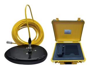
Products:GeoScope 100 Surface
Date:January, 2024
Location:Binhai, Yancheng, China
Water Depth:Less than 20m
System Connections
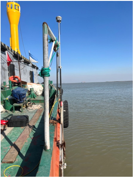
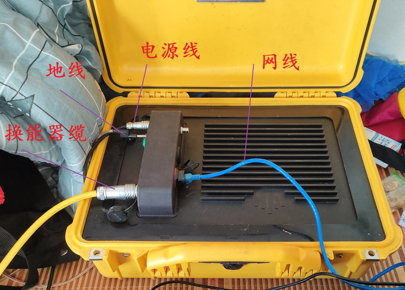
Equipment connection is relatively simple, firstly, complete the mounting bracket, and secondly, complete the cable connection, including: transducer cable, power cable, ground cable, network cable, GPS/attitude meter connection cable (connected to the acquisition computer).
Fix Mounting Branket
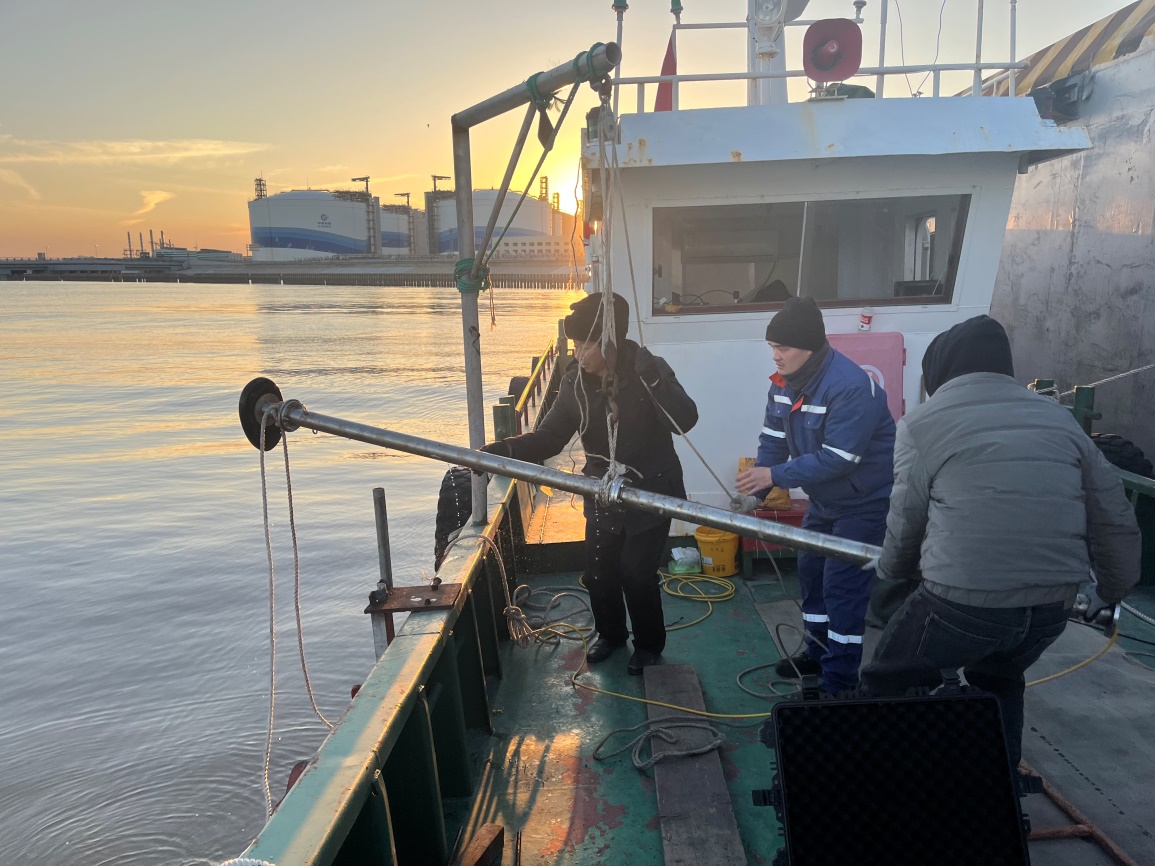
Connect the cables
Operation Process
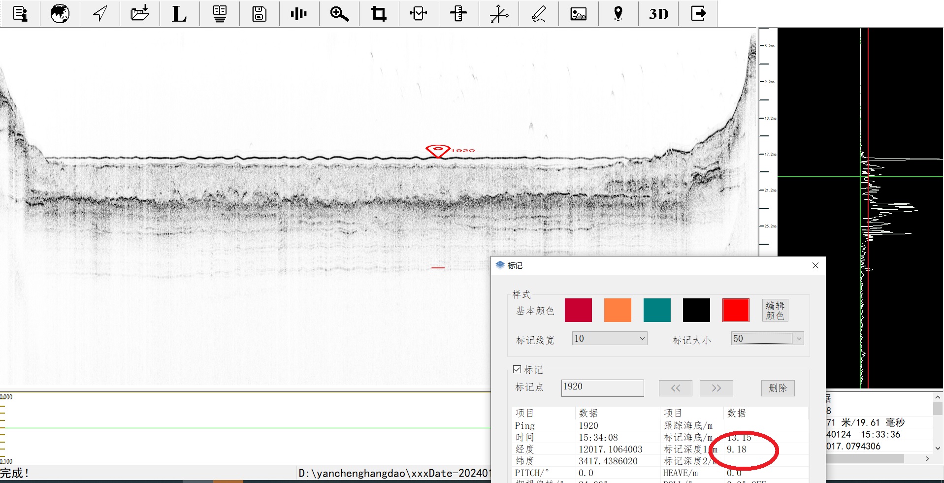
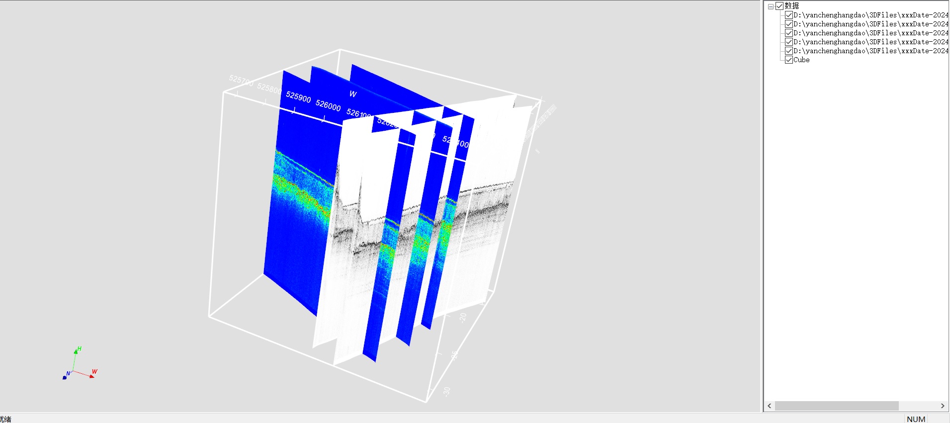
In this case, the transducer was mounted by the side, with a draft of 1.38 m. The GPS antenna was directly above the measuring pole, and no IMU compensation was configured. The siltation in the channel was measured at 4 knots along the direction of the survey line and the inspection line (different colours were used to differentiate the 3D view).
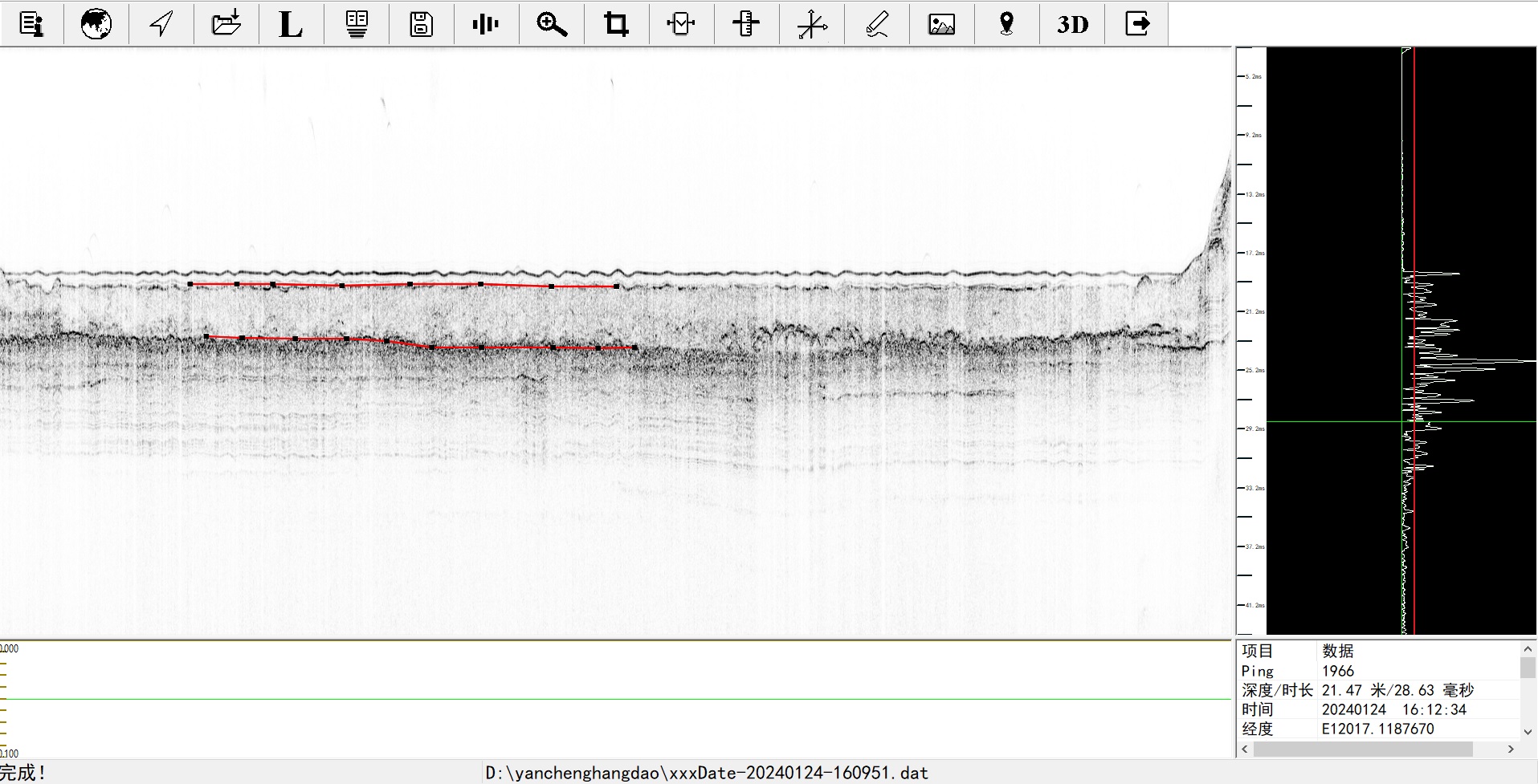
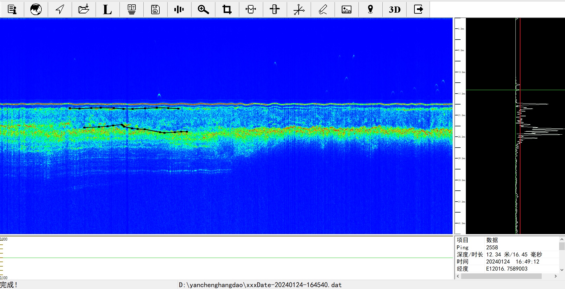
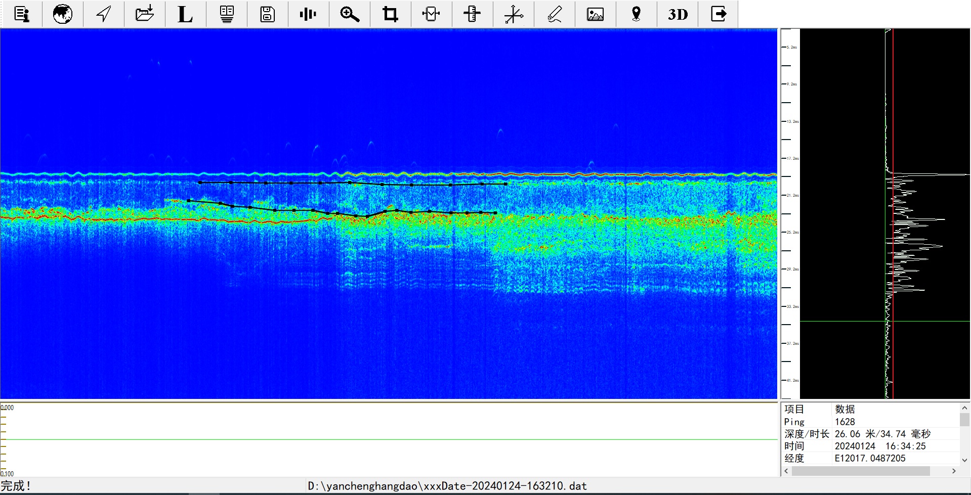
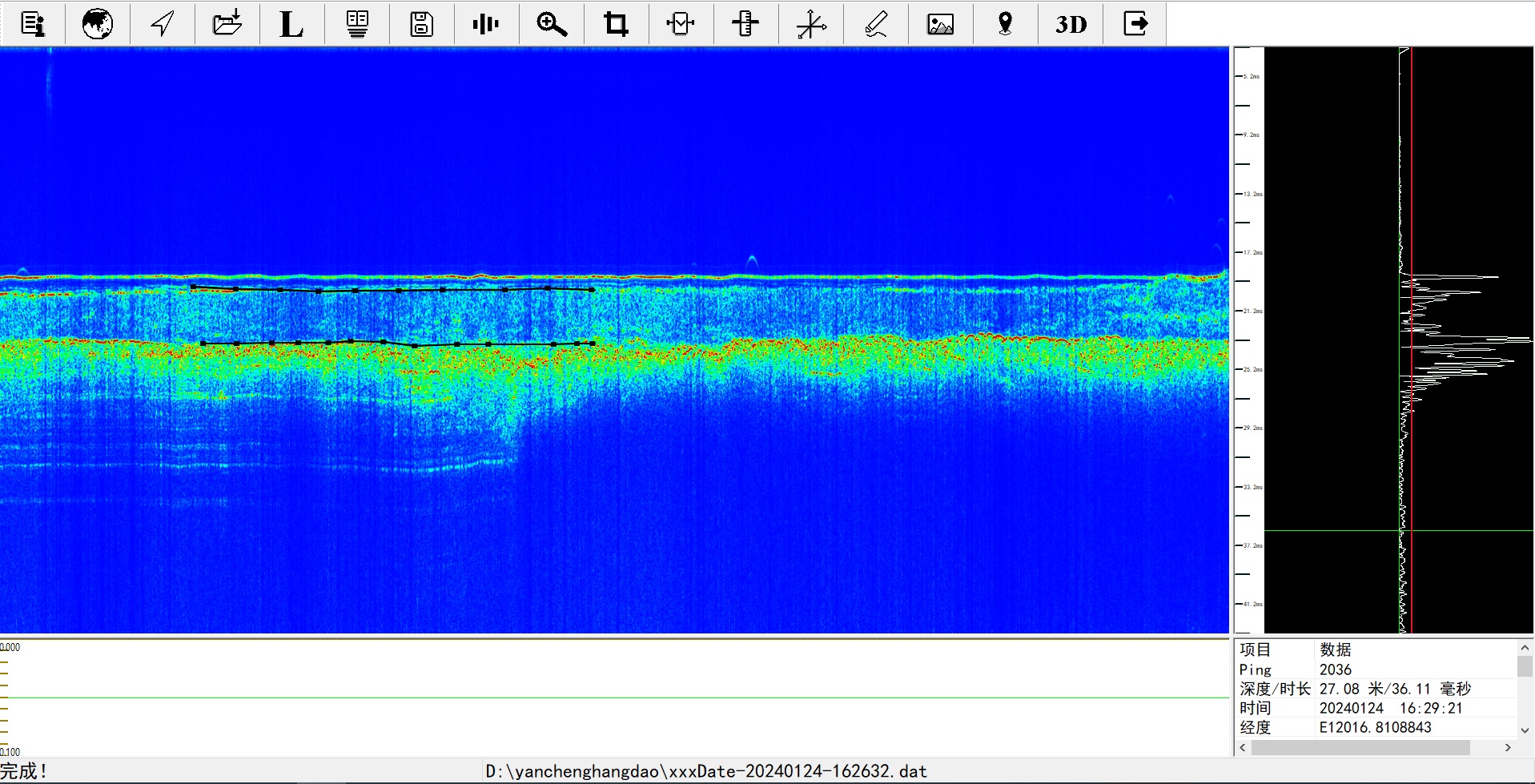
The 10kHz CW wave was selected to sweep near the channel, and the penetration depth was around 9 metres, and two more obvious layered were obtained. The first layer varies in thickness from 0.5-0.8 m, which may be suspended sand or floating mud due to the frequent siltation back to the channel and frequent need for dredging; the second layer is about 3 m thick, which may be an old silt layer due to the long period of time not cleaned up, and due to the thickness of this layer, whether it is silt or not needs to be further determined by geological sampling; below the second layer, there is a harder substrate.
Summary
The seafloor topography is wrinkled due to the fact that the IMU was not used to compensate for attitude this time. The stratigraphy of the survey line is consistent in the 3D view after correction for tide level and sound speed. The second stratum could not be accurately determined because the channel was very heavily silted back, cleaned frequently, and not effectively monitored and sampled. The collected data were processed to inform the user of the measurement information of the first and second layers (floating mud and silt), so that it was convenient to make an assessment of the amount of silt and the dredging of the channel.
Comparing with the dual-frequency single-beam used by the customer, this measurement uses dual-frequency sounder to measure the bathymetry value at the same time, in which the high-frequency 200kHz can accurately obtain the bathymetry information, which can accurately show the seabed topography; the low-frequency 24kHz, the bathymetry data is compared with the high-frequency bathymetry value, the low-frequency bathymetry data is fluctuating below the seabed by 0-1 metre, and if the low-frequency data is understood to be the stratum below the seabed, the layer is fluctuating are large and discontinuous. Compared with the dual-frequency bathymetry, the shallow stratigraphic profiler has a significant advantage when doing profile measurements such as channel dredging.
Do you have questions about this case study?
Get in touch with Ocean Physics Technology, and they would be happy to answer any questions you have about pricing, suitability, availability, specs, etc.
Related products


![Do-Giant-Tortoises-Make-Good-Neighbors-1[1].jpg](https://cdn.geo-matching.com/vRMO2Edp.jpg?w=320&s=a6108b2726133ff723670b57bc54c812)


