


Making "Impossible" GNSS Shots Possible
An English surveying firm saw a substantial boost in productivity on their first project using the new Trimble R12i GNSS system—and on many jobs since. The project—a difficult topographic survey for widening a narrow airport bypass road—presented challenges for both traditional total station surveys and GNSS. High hedges and dense vegetation could have been costly and time-consuming problems had it not been for the Trimble R12i. Not only was the survey completed in a fraction of the estimated time, but it was completed with just one system.
Benchmark Surveys is a small firm in Southwest England that has grown a broad portfolio of services. “There are only seven of us, but we offer topography, utilities, GPR, measured building surveys, UAS and more,” says Benchmarks’ James Richards, Land, Utility, and Measured Building Surveyor. “We each have specialties, but we often change roles to help out and to learn new skills.”
A QUEST FOR NEW TECH
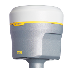
After acquiring the Trimble R12i GNSS System from UK distributor KOREC, Benchmark wanted to test the R12i’s capabilities on a project that would have been a challenge for any combination of surveying equipment. “There is a narrow road between an industrial park and Exeter Airport,” said Richards. “For a widening project, we needed to survey 10 meters on either side of the road.” The route is lined with high hedges, thick tangled foliage and large trees. “The R12i was able to fix and gather points in places not accessible by other GNSS kits we’ve used,” said Richards. “With the tilt compensation, we could reach under the edge of hedges and shrubs, up against buildings and walls, and safely out into the road.”
TWO TECHNOLOGIES
The R12i provides a double tech boost. The first is Trimble ProPoint™ GNSS Technology, which can process multiple constellations and signals in a deft mix-and-match, providing roughly a 30% gain over previous models in difficult sky-view environments. The second new feature is no-calibration tilt compensation. The R12i uses a combination of inertial sensors and the GNSS to compute orientation and tilt. Prior to tilt compensation, GNSS surveying required plumbing of the rod for every observation. Now the R12i is ready to go and stays calibrated during normal pole movement over the course of the survey.
“The R12i enabled me to go behind the hedges of the road, measuring all the edges of the buildings and obtaining levels on all the concrete bases,” said Richards. “I managed to get many more points than if I had measured the traditional way.” Richards had estimated seven days for the survey but completed it in two, thanks to the R12i.
CONFIDENCE AND ADAPTATION
Proving the performance of their new system was important for Benchmark. “We’d surveyed a landfill site years ago with total stations. We had lots of points such as manholes we could check with the R12i,” says Richards. “Surprisingly, the new points matched previous positions with more than acceptable tolerances.” Benchmark was surprised the GNSS positions matched so well with the conventional points because many of the points were covered by dense foliage and trees. Benchmark performed additional tests since this was their first experience with the tilt compensation features. “It took a bit of getting used to,” said Richards. “The tilt changes the way we work, but once we were comfortable with it, we immediately used it on most other jobs.”
Benchmark uses the R12i with corrections from Trimble’s UK VRS Now network and in base-rover mode using their R10 as a base. Within the first six months of owning an R12i, Benchmark has revised workflows, instruments used, estimating, and business practices in general. Benchmark is regularly finding new uses for the system in places they would have never considered with older GNSS gear.
“I gathered many more points than if I had surveyed with traditional instruments.” — James Richards, Land, Utility, and Measured Building Surveyor, Benchmark Surveys
Do you have questions about this case study?
Get in touch with Trimble, Inc., and they would be happy to answer any questions you have about pricing, suitability, availability, specs, etc.

Related products


![Do-Giant-Tortoises-Make-Good-Neighbors-1[1].jpg](https://cdn.geo-matching.com/vRMO2Edp.jpg?w=320&s=a6108b2726133ff723670b57bc54c812)


