Improving Hurricane Preparedness in Colombia with Wave and Current Data
Adaptation and mitigation measures for hurricanes affecting Colombia have been hampered by the lack of an in-situ meteorological and oceanographic observational network. To help plan for future events, researchers are now employing modeling tools with in-situ wave and current measurements collected by Nortek’s AWAC acoustic wave and current profilers.
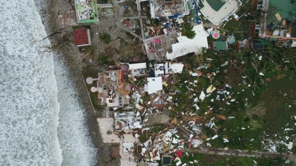
Undoubtedly, 2020 will go down in the history books as a tumultuous year. It was certainly a year of disruption and unprecedented events, including the most active Atlantic hurricane season on record. Thirty tropical storms were severe enough to be named; 14 of those storms developed into hurricanes. In November 2020, two of those hurricanes – Eta and Iota – battered Colombia’s Archipelago of San Andrés, Providencia and Santa Catalina within two weeks of each other. Alongside the loss of homes, the Colombian government estimates that 98 percent of the infrastructure, including roads, water, sanitation and medical centers, was damaged on the island of Providencia.
Using wave and current data to predict which locations are most vulnerable to hurricanes
To help authorities better plan and prepare for such events, researchers at the Universidad Nacional de Colombia have developed a technical agreement with the environmental institution CORALINA to use wave and current data collected from acoustic wave and current profilers to improve Colombia’s hurricane adaptation and mitigation measures.
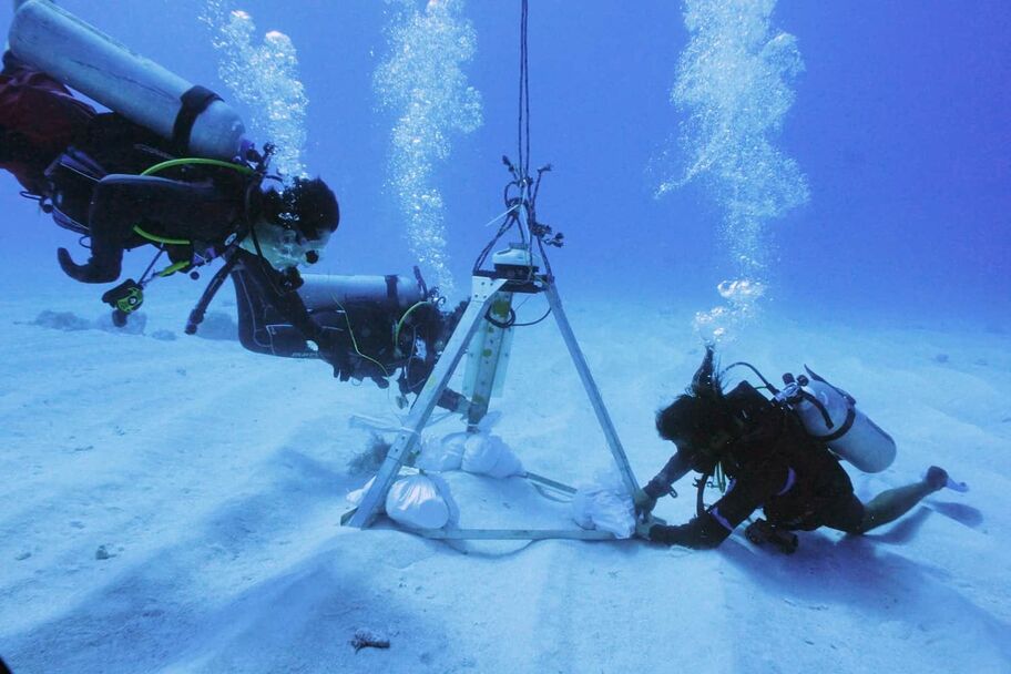
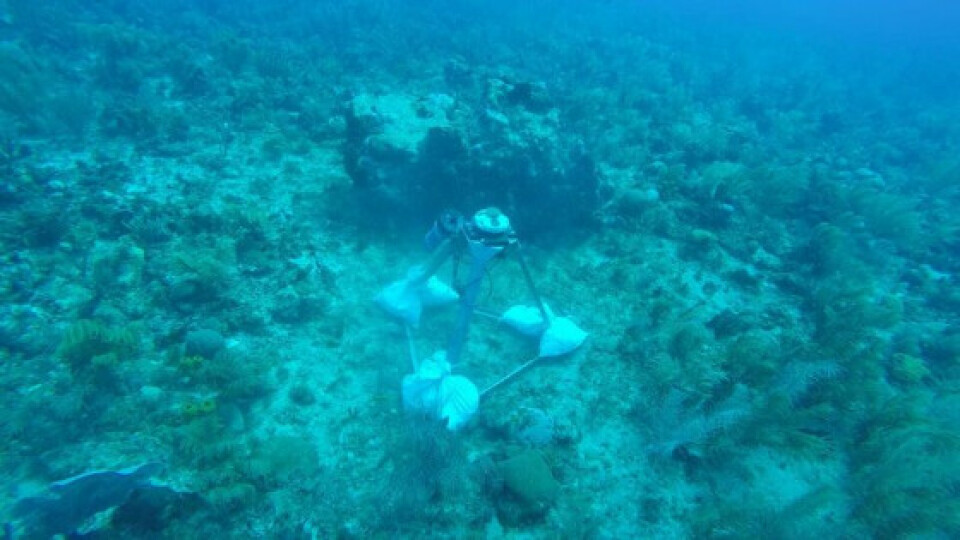
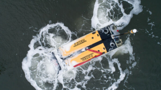
Image 1: The researchers have deployed their AWACs for numerous studies over the past ten years. Photo: Irene Lema/CEMarin.
Researchers are employing modeling tools and in-situ (at-sea) measurements collected by Nortek’s AWAC acoustic wave and current profilers to predict where the Colombian archipelago’s three main islands – San Andrés, Providencia and Santa Catalina – are most vulnerable to hurricanes.
The work is being carried out by researchers at the Universidad Nacional de Colombia (at its Medellín and Caribe campuses) in alliance with other academic institutions, including the Colombian–German Center CEMarin (with participation from six universities) and the Universidad de Medellín.
Real-world wave and current data for model calibration and validation
The danger hurricanes pose arises from strong winds, intense rainfall, storm surges and powerful waves. To predict the impact these combined factors have on the islands, the researchers employed a series of open-source numerical models: Weather Research and Forecasting (WRF) for atmospheric processes, WAVEWATCH III and SWAN for oceanographic processes and XBeach for coastal processes.
“We used these models to create reconstructions of the hurricanes that occurred in the past and also to predict scenarios that have not yet occurred – synthetic scenarios of hurricanes,” explains Dr Andrés Fernando Osorio Arias, professor at the Universidad Nacional de Colombia and Executive Director of CEMarin (the Center of Excellence in Marine Sciences).

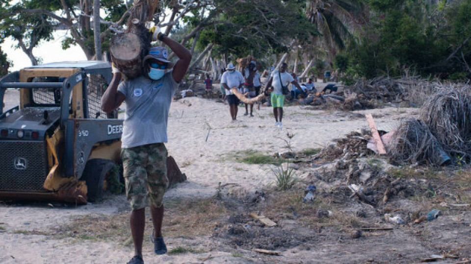
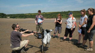
Image 2: Clearing up debris after the damage caused by a hurricane affecting Colombia’s coastal communities. Photo: Irene Lema/CEMarin.
Validating and calibrating atmospheric, oceanographic and coastal numerical models to improve accuracy
Numerical models are an abstraction of reality. By combining real-world observations with mathematics and statistics, Nortek can simulate real-world conditions. Although numerical models used for research are generally robust, they require validation and calibration to improve their accuracy.
“It’s about reducing uncertainty in our predictions,” says Universidad Nacional de Colombia’s Dr Juan David Osorio-Cano.
Validation and calibration are particularly important when looking at local scales, such as in an archipelago, where biophysical features can alter hydrodynamics.
“One of our goals is to develop parameterizations that reproduce, for example, the thickness and roughness of coral systems or seagrasses into the numerical model,” says Osorio Arias.
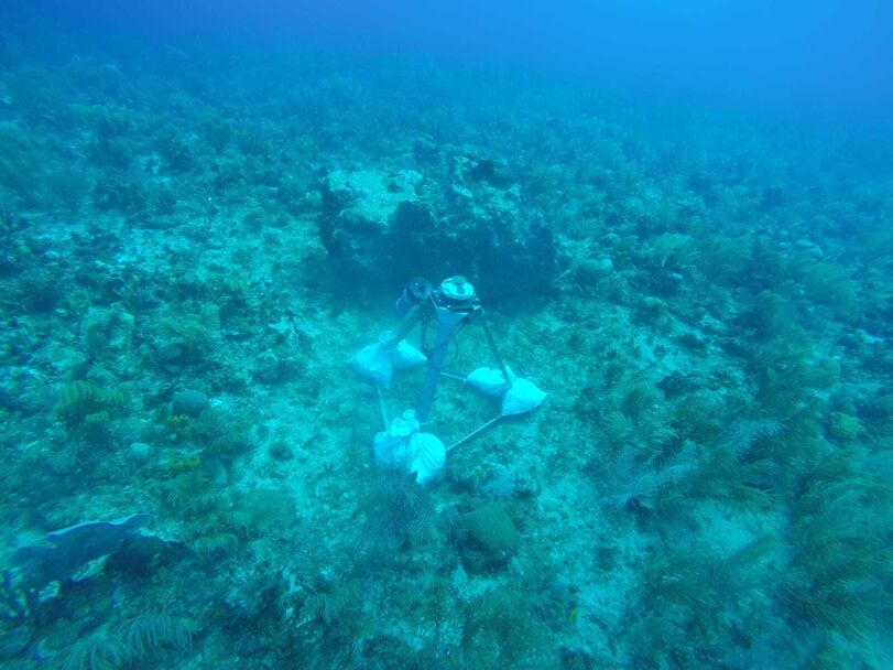
Image 3: Biophysical features such as coral reefs can alter hydrodynamic processes, so collecting data from these features is important for accurate modeling. Photo: CEMarin.
For validation and calibration, real-world data from the area you are interested in is vital. For this study, it meant deploying the AWACs in the waters around the islands of San Andrés and Providencia.
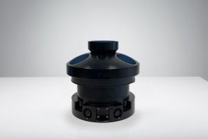
The team has two AWACs in their arsenal: an AWAC 600 kHz acoustic Doppler current profiler (ADCP) and an AWAC 1 MHz ADCP. Both instruments collect current profile and directional wave data but differ in their maximum depth range.
With a depth range of 35 m, the 1 MHz is optimal for shallower waters, but to achieve a depth range of up to 50 m, the 600 kHz is most suitable.
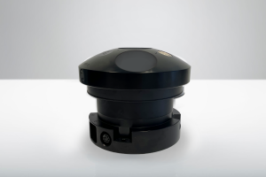
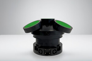
“The AWACs have three slanted beams for measuring orbital wave velocity and a central beam – the acoustic surface tracking beam – which measures wave height,” says Cristobal Molina, Nortek’s Senior Sales Engineer for Latin America.
“The waves we see on the surface combine many waves with different directions, wave periods and wave heights. The AWAC measures wave parameters for a long time, allowing us to discriminate between the different waves,” he explains.
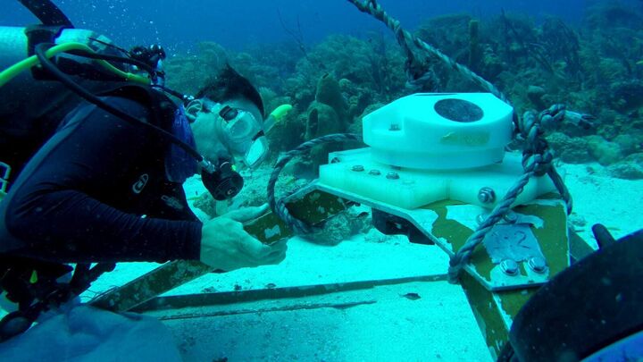
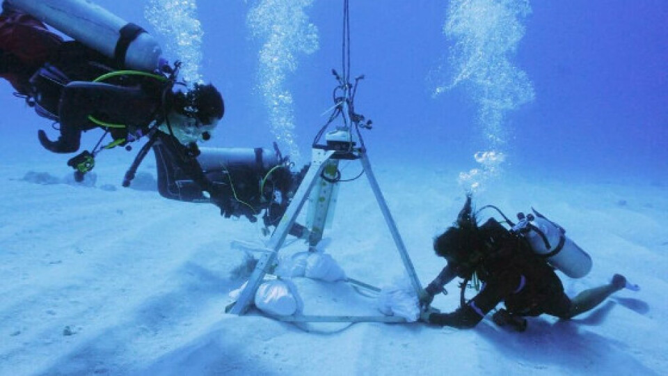
Image 4: The AWACs are typically placed on fixed frames in an upwards-looking configuration. Photo: CEMarin.
Robust instrumentation for long-term ocean research
The AWACs, which form the backbone of the team’s in-situ instrument collection, was purchased over ten years ago. Since then, the researchers have used the AWACs in a variety of studies, including assessing flood risks at Playa Palmeras (Isla Gorgona, Colombian Pacific), one of the most important sea turtle nesting sites in South and Central America, and quantifying how a fringing reef at Tesoro Island (Rosario Islands, Colombian Caribbean) dampens waves.
“With only these two instruments, we’re doing magic,” says Osorio-Cano.
Despite being put through their paces over the years, the instruments and their readings remain robust.
“The instrument's longevity combines good user practices and good manufacturing. If the user takes care of the instrument, it can last for many years,” Molina explains, noting that the life expectancy of an AWAC is at least 15 years.
The researchers found AWAC maintenance straightforward.
“The sensors are very robust. We clean them very well and check the cables, connections and batteries. They are low maintenance,” says Osorio-Cano.
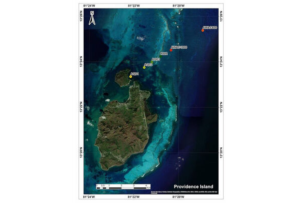
Image 5: The deployment off Providencia Island. The AWAC 600 kHz (AWAC600 – red) was placed offshore and the AWAC 1 MHz (AWAC1000 – green) closer to the shore. Pressure sensors were also deployed to provide additional data. Image: CEMarin.
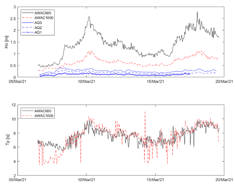
Image 6: The AWAC 600 kHz (AWAC600) and AWAC 1 MHz (AWAC1000) measured significant wave height (upper panel) and wave period (lower panel) at Providencia Island. Additional pressure sensors (AQ1-3) provided only wave height data. Image: CEMarin.
Deploying ADCPs mounted on subsurface buoys and fixed frames
AWACs are well suited to be mounted on subsurface buoys and fixed frames – the option chosen by the research team for this study. The researchers ran two separate deployments, one around San Andrés and one around Providencia. In both deployments, the team placed the AWAC 1 MHz in shallower waters and the 600 kHz further offshore.
Set to burst mode, the instruments collected wave data for 17 minutes every hour. In addition, the AWAC 1 MHz took five-minute averaged current profile measurements every 30 minutes at 0.5 m cell size.
Risk predictions depend on accuracy of water column velocities in hurricane scenarios
The oceanographic data provided by the instruments was critical for the work. Not only is it essential to know that the velocities experienced throughout the water column in the real world generally match the numerical model, but it’s also crucial for ensuring that the hurricane reconstructions and synthetic scenarios replicate conditions accurately.
“For example, sediment transport is controlled by these different velocities and the morphology of the coast. Our risk predictions depend on how accurately the velocities are represented in our hurricane scenarios,” Osorio Arias explains.
Alongside the two AWACs, the team also deployed a series of pressure sensors that provide important information that the team could use to understand how the waves and currents evolved as they moved from the offshore into the coast.
Osorio Arias explains that by combining the data from the AWACs and the pressure sensors, his team captured different processes, including shoreline refraction, transfer of energy, wave direction and how the currents change the magnitude of waves.
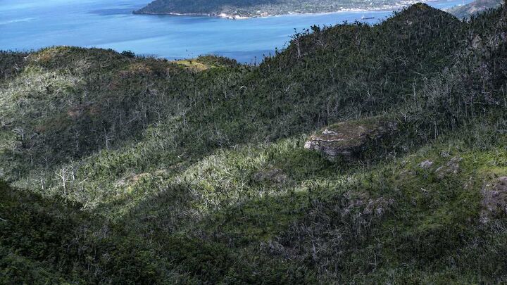
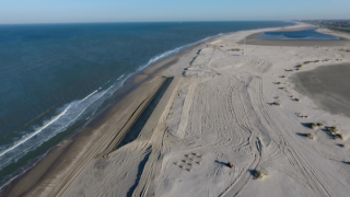
Image 7: In 2020, a hurricane caused severe damage to the natural environment on the Colombian island of Providencia. Photo: Irene Lema/CEMarin.
Mapping the impact of hurricanes with the help of ADCPs
The data collected during the two-week deployment in Providencia and one-week deployment in San Andrés confirmed that the oceanographic numerical models replicate the archipelago conditions well. With this information, the researchers could confidently simulate historic hurricanes – including Eta and Iota – and create synthetic hurricane scenarios with different tracks and strengths. Together, these reconstructions and synthetic scenarios allowed the researchers to predict which locations would be most vulnerable across a range of hurricane intensities and tracks.
The study suggests particularly vulnerable areas include the northern coastal area of San Andrés Island, which simulations suggested would be at particular risk from coastal flooding. In Providencia, the geomorphological configuration and bathymetry resulting from the proximity of Santa Catalina increase the magnitude of the waves in the area.
“This kind of information answers important questions for people: Are we at risk? Should we wait? Should we move to the other side of the hill? Where should we spend money to adapt to hurricanes?” explains Osorio-Cano.
The researchers have passed on their work to La Corporación para el Desarrollo Sostenible del Archipiélago de San Andrés, Providencia y Santa Catalina (CORALINA), who funded the study, and are currently preparing their findings for peer-review publication. In addition, they hope to use the data collected by the AWACs for future laboratory studies.
Developing new equations, parameters and understanding of physical processes to improve models
“It’s important to collect information from the field and try to reproduce conditions on a laboratory scale because, in the laboratory, you have more control of the different parameters,” says Osorio Arias. “With field and laboratory data, you can develop new equations, new parameters and new physical understanding of physical processes, to improve the models,” he explains.
There was considerable damage on infrastructure due to the hurricanes that battered Colombia’s Archipelago of San Andrés, Providencia and Santa Catalina in 2020. Photo: Irene Lema/CEMarin.
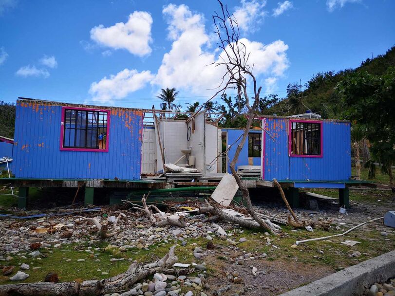
A home in a Colombian coastal community ravaged by a hurricane. Researchers in Colombia have been using wave and current data measured by Nortek’s ocean sensors to improve hurricane prediction. Photo: Juan David Osorio Cano/CEMarin.
Do you have questions about this case study?
Get in touch with Nortek, and they would be happy to answer any questions you have about pricing, suitability, availability, specs, etc.


![Do-Giant-Tortoises-Make-Good-Neighbors-1[1].jpg](https://cdn.geo-matching.com/vRMO2Edp.jpg?w=320&s=a6108b2726133ff723670b57bc54c812)


