Implementing Lidar in Pipeline Surveys Expands Project Scope Capabilities for MSI
Measurement Sciences Inc. (MSI) leverages lidar technology in the oil and gas industry by expanding their project scopes and increasing the number of completed surveys within the short fair-weather window between snowmelt to snowfall.
Challenge
Measurement Sciences Inc. is a Calgary based professional engineering and land surveying company founded in 2005. MSI ‘s team of engineers, land surveyors, and technicians use the latest technology to provide solutions to a broad base of clients. Clients include oil and gas pipeline companies, land developers, power generation, engineering, construction firms, local municipalities and provincial governments.
In Canada, MSI is faced with a wide array of challenges, including a very small window of fair-weather surveying, from May to October, to many river-crossing and pipeline surveys. The narrow weather window combined with a high project site count demands a solution capable of efficiently mapping large vegetated areas to meet deadlines. Boots on the ground topographic surveys weren’t cutting it.
Solution
MSI, Inc. leverages Lidar technology in the oil and gas industry by expanding their project scopes and increasing the number of completed surveys within the short fair-weather window between snowmelt to snowfall.
They implement lidar in pipeline surveys to be able to show a grander scope of the river crossing and banks. Lidar enables their team to produce a much more detailed pipeline profile than traditional methods (i.e. taking gridded shots every 5 meters with GNSS), and offers expanded client deliverable offerings.
Application
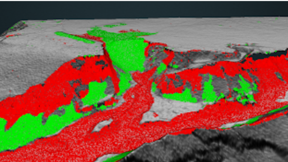
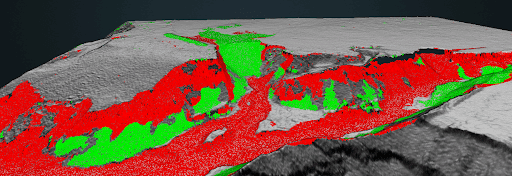
MSI realized the potential for high-resolution change detection analysis with the increase in data density. Previously, they did surface-to-surface change detection from gridded topographic surveys. Now, they leverage the high-density Lidar to perform point-to-point surface differencing and have found the high quality resolution and accuracy of these Lidar point clouds make it possible to detect small amounts of change. This enhanced representation of site change is paramount for pipeline monitoring.
The team at MSI uses Phoenix Lidar systems to detect small topographical changes on the order of 5 cms - an impressive feat taking the densely vegetated site characteristics into consideration.
Results
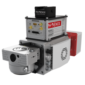
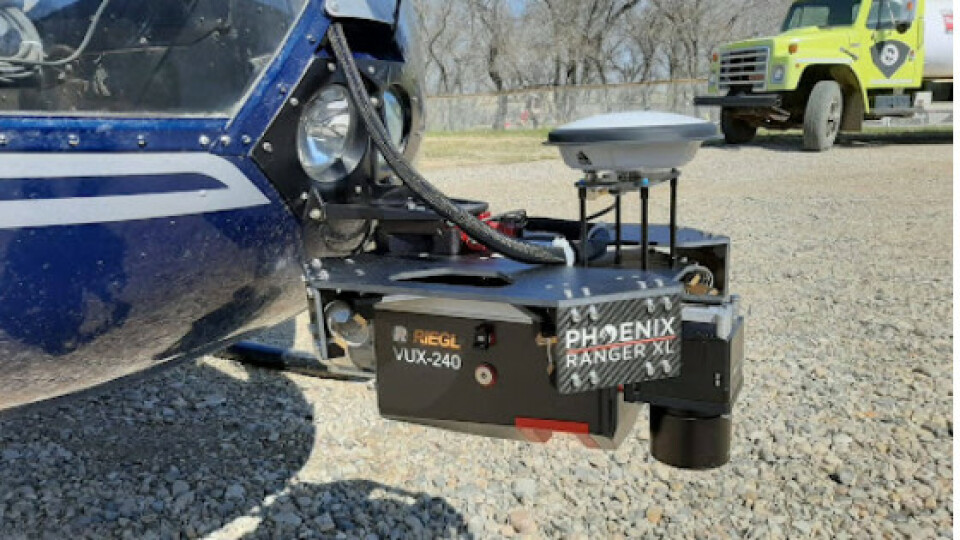
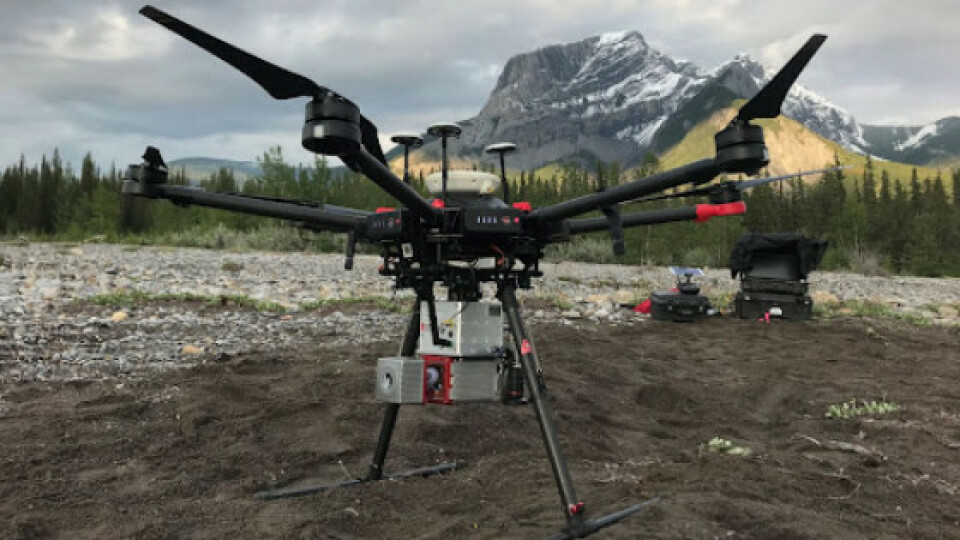
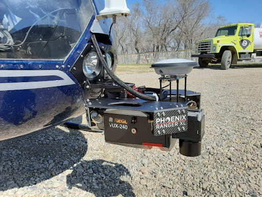
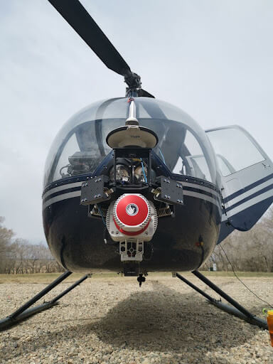
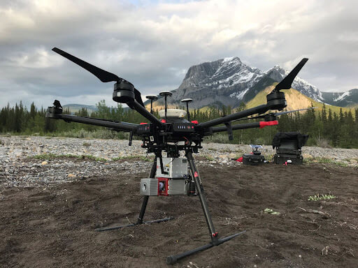
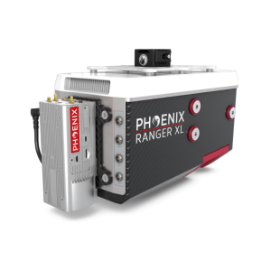
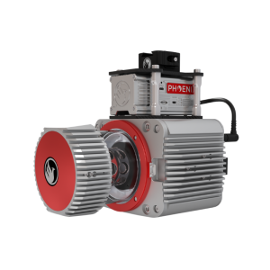
MSI, Inc. owns and operates three Phoenix Lidar systems: the MiniRANGER-1, RANGER-LR, and RANGER-XL. Their best collection windows are early spring and late fall, so they try to group as many sites as possible to map consecutively during two sizeable RANGER-XL helicopter campaigns each year. They deploy the UAS-based miniRANGER to supplement sites between those two collection windows. This keeps the cost of helicopter operations down and still enables MSI to collect sites on demand, if needed, rather than waiting for the two seasonal windows. The decision process for which Phoenix system to deploy varies site by site - depending on time of year, project scope, and strictness of deliverable timelines.
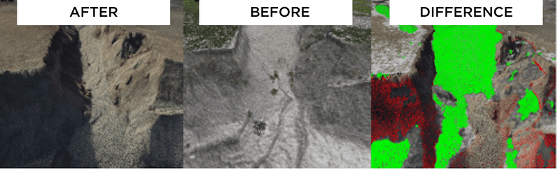
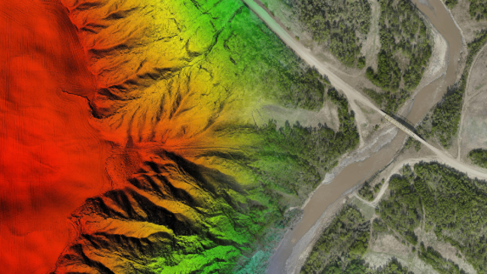
A washout in northern British Columbia. Left - A pipeline left hanging was removed with middle image depicting repair. Right - Detailed change analysis from initial damage to completed repair delivered to client.
Do you have questions about this case study?
Get in touch with Phoenix LiDAR Systems, and they would be happy to answer any questions you have about pricing, suitability, availability, specs, etc.


![Do-Giant-Tortoises-Make-Good-Neighbors-1[1].jpg](https://cdn.geo-matching.com/vRMO2Edp.jpg?w=320&s=a6108b2726133ff723670b57bc54c812)


