

Identifying Archaeological Structures Using UAS Lidar Systems
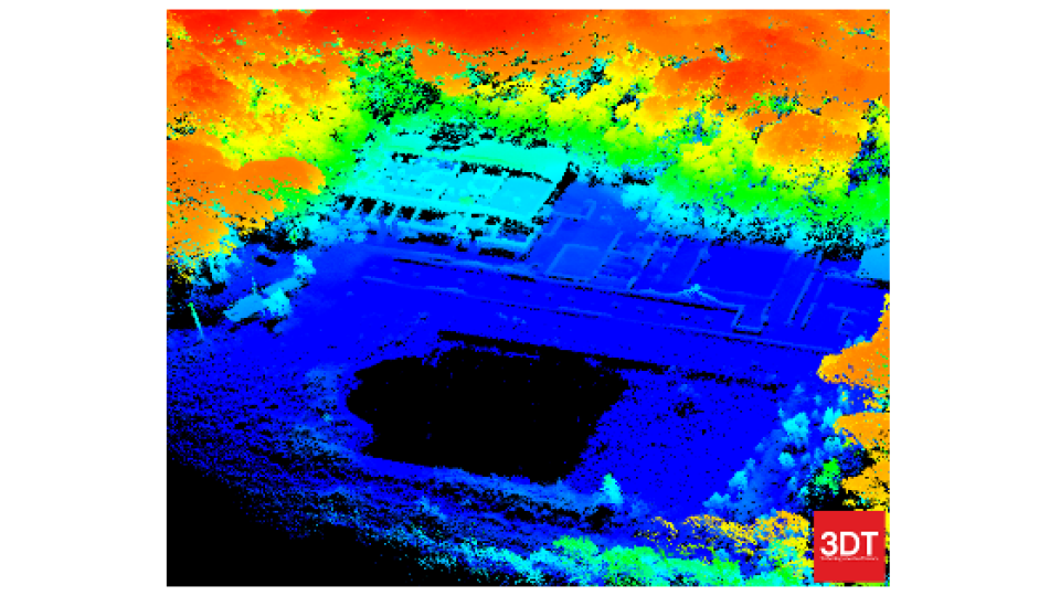
Photonics active sensors based on Lidar (Light Detection And Ranging) have been widely used to identify traces of buried archaeological structures. The multi-echo technology allows the detection of depressions and elevations of the ground level, which may indicate a possible region of interest for more detailed field surveys, even in the presence of dense vegetation. Nowadays, a Lidar payload can be installed in an unmanned aerial vehicle (UAV) and easily deployed in the field in a matter of minutes, with a lower cost of data acquisition and unprecedented ground resolution.
The project
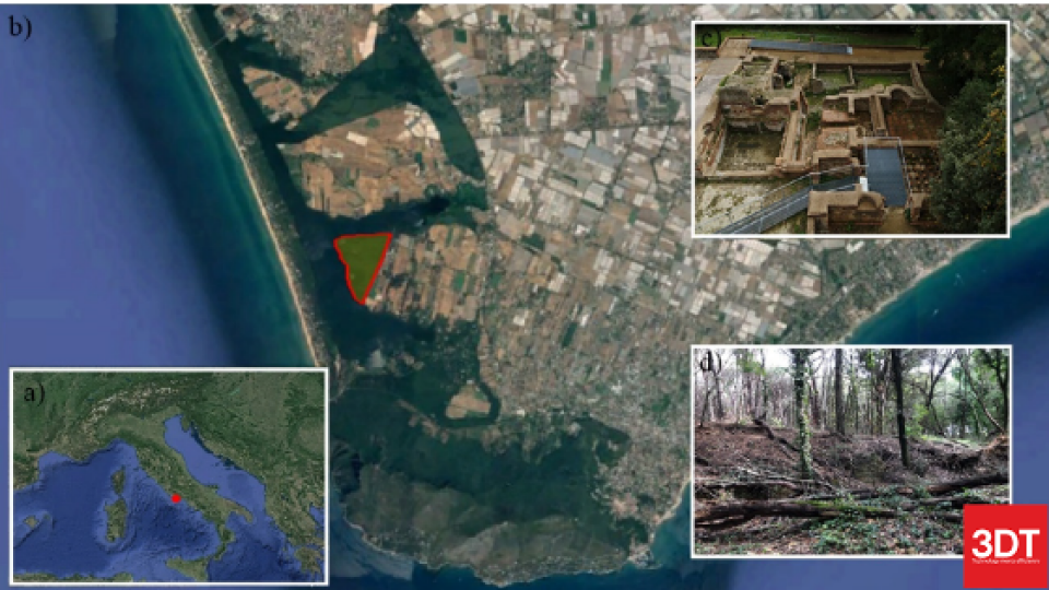
The University of Salerno performed an investigation of the remains of the Imperial Domitian Villa in Sabaudia, Italy.
The site extends for about 50 hectares and is largely still to be excavated, A dense forest of maritime pines covers the area and vegetation impedes traditional land surveying operations.
Purpose
The Lidar survey of the area was performed to identify the traces of the original terracing system and to detect anomalies in the ground levels suggesting the presence of buried buildings.
Results
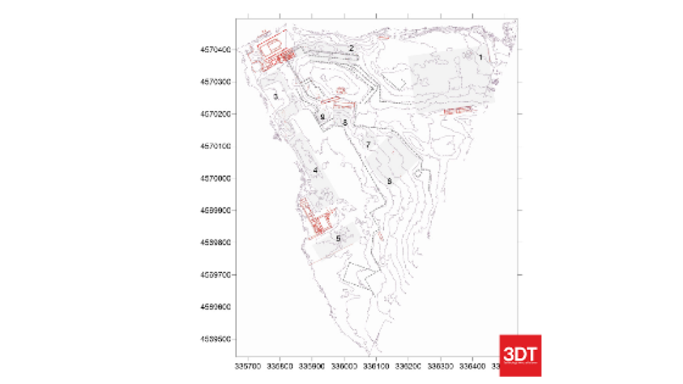
The Digital Terrain Model (DTM) generated from the Lidar point clouds allowed us to pinpoint at least nine regions of interest.
The presence of interesting artefacts in each of the regions was later confirmed by direct investigations in the field.
The Scanfly advantages
The combined effect of the multi-channel and the dual return technology of the Scanfly ULTRA allowed penetrating effectively the vegetation layers to detect and measure features on the ground level. Scanfly ULTRA can be installed in a UAV and deployed in the field in a matter of minutes and is capable of generating a usable 3D model of the area of interest immediately after the survey is complete.
Do you have questions about this case study?
Get in touch with 3D TARGET, and they would be happy to answer any questions you have about pricing, suitability, availability, specs, etc.


![Do-Giant-Tortoises-Make-Good-Neighbors-1[1].jpg](https://cdn.geo-matching.com/vRMO2Edp.jpg?w=320&s=a6108b2726133ff723670b57bc54c812)


