How to Use Drones Effectively for Conservation
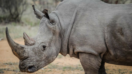
Protecting our wildlife is a hotly discussed topic. And it’s no surprise when you read the alarming stats. In just a decade, more than 7,245 African rhinos have been lost to poaching. There are many technologies being developed to combat wildlife crime to predict, locate, track and catch suspected poachers. But protecting against poaching is not the only use of drones when it comes to conservation. Drones can and are playing a significant role in predictive analysis of species in threat of becoming endangered. UAVs are revolutionizing the field by proving they can produce high quality data, along with the ease in which data is collected in comparison to traditional methods.
UAVs are revolutionizing the field by proving they can produce high quality data, along with the ease in which data is collected in comparison to traditional methods.
We look at a few application uses in conservation that have proved to be the most effective.
But first, we help to answer frequently asked questions when determining the right UAV.
-
How do I select a UAV?
When selecting the right system for you, always ensure you have outlined the data required to support your study. This will help determine which type of equipment is required. And thus, will help narrow down your selection for the system which will be compatible for your mission. You will also need to ensure you have a skilled drone operator, someone who has received sufficient training.
-
Which drone is best for me?
Selecting the right drone will largely depend on your technical requirements (based off your data needs), location and budget. Requirements will range from the payload capacity, endurance to control/video range. Location will largely depend on the local climate (which may affect drone performance), manufactures training and support. And lastly but certainly in most cases the most crucial factor will be budget. There are a wide range of drones available on the market, when looking at price consider all the factors like quality grade of materials used, compatibility with other equipment and training/support that is offered by the manufacturer.
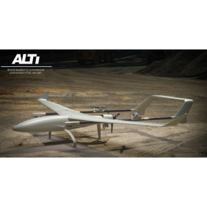
ALTI offer a highly capable, reliable and affordable civil use commercial VTOL (vertical take-off and land) aircraft. Contact our drone experts to learn more.
Here are a few effective application uses for conservation:
UAV/drones for Monitoring
Much of our wildlife is threatened by a rapidly changing landscape. The use of imagery from UAVs is helping to understand the type of environment that certain animals need to survive.
Up until a few years ago it was difficult to quantify whether UAV surveys were more effective than traditional monitoring methods.
However, a recent study conducted compared counts for colonies of seabirds and penguins, and the results were that UAV-derived counts had significantly lower variance within colonies than ground counts for all species. The drones also did not disrupt the birds and proved that the down-facing perspective of a drone reduces the likelihood of missing birds. The full report can be read here.
Another example is WWF use of drones to monitor illicit trade in Africa and Brazil to monitor deforestation and illegal mining operations.
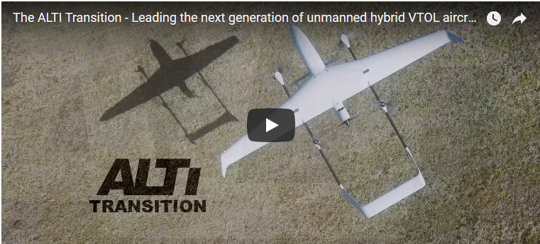
The Transition with a payload capacity of 1.5 kg and endurance of up to 12 hours is suitable for many conservation monitoring assignments.
UAV/drones for Surveying
UAVs offer quick and cost-effective aerial imagery along with sensor and monitoring capabilities. Due to the nature of a drone it also requires minimal staff and overcomes many site-access issues.
A great is example is the Indonesian Tax offices usage of UAVs to survey palm-oil plantations and truck owners who misrepresent the actual size of plantations.
Another impressive surveying and implementation is a UK-based company who seeks to plant one billion trees per year in South Africa. The drones conduct a 3D survey of the area, based off this evaluation they are loaded with the correct germination seed pods which are then distributed from a height of two meters. The result is that a farmer who usually plants 3000 seeds per day is now planting 36,000 seed pods daily, using a drone. And often in an area where a farmer is not able to reach easily.
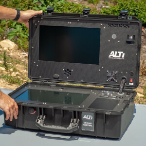
The ALTI Ground Control Station is an advanced, modular, multi-link unmanned aircraft command and control system. It features dual screen design, direct control link (C2), a backup data telemetry link, main digital data link (flight planning and telemetry) as well as HD video support, all integrated seamlessly into a weatherproof travel case. Suited to managing surveying assignments of this scale.
UAV/drones for Poaching
It is arguably the most heated debate as to whether drones are making an impact on reducing poaching, or not.
What many can agree on is they are certainly helping to support park rangers especially in Africa and Asia with vast areas to cover.
The real value lies in UAVs equipped with infrared and thermal cameras which is essential to detect, target and track poaches at night, who generally tend to be most active at this time of the day. This data is then stored and analysed to assist with future missions in understanding patterns.
The Transition, a fixed-wing drone, with an open payload can carry a variety of sensors plus offering the option to interchange between a wide variety of sensors.
To learn more about the ALTI Transition or Reach please contact our drone experts, click here.
Watch the video
Do you have questions about this case study?
Get in touch with ALTI Unmanned Aircraft Systems, and they would be happy to answer any questions you have about pricing, suitability, availability, specs, etc.


![Do-Giant-Tortoises-Make-Good-Neighbors-1[1].jpg](https://cdn.geo-matching.com/vRMO2Edp.jpg?w=320&s=a6108b2726133ff723670b57bc54c812)


