
How Lidar Helps Assessing the Interferences in the Track for Oversize Loads Transportation
Creating a digital copy of a road environment enables a variety of new ways to visualize assets, perform analysis and, in general, drive decisions concerning the infrastructure. Mobile mapping systems based on LiDAR allow for collecting a huge amount of data in reduced time and, with their flexibility, they represent an established method to create digital twins or road infrastructures and urban areas very effectively cost-wise.Additionally, mobile mapping systems address the concern about the work safety of the operators, which can now measure relevant information directly from the digital twin at the office, instead of constituting an interference to the traffic.
The project
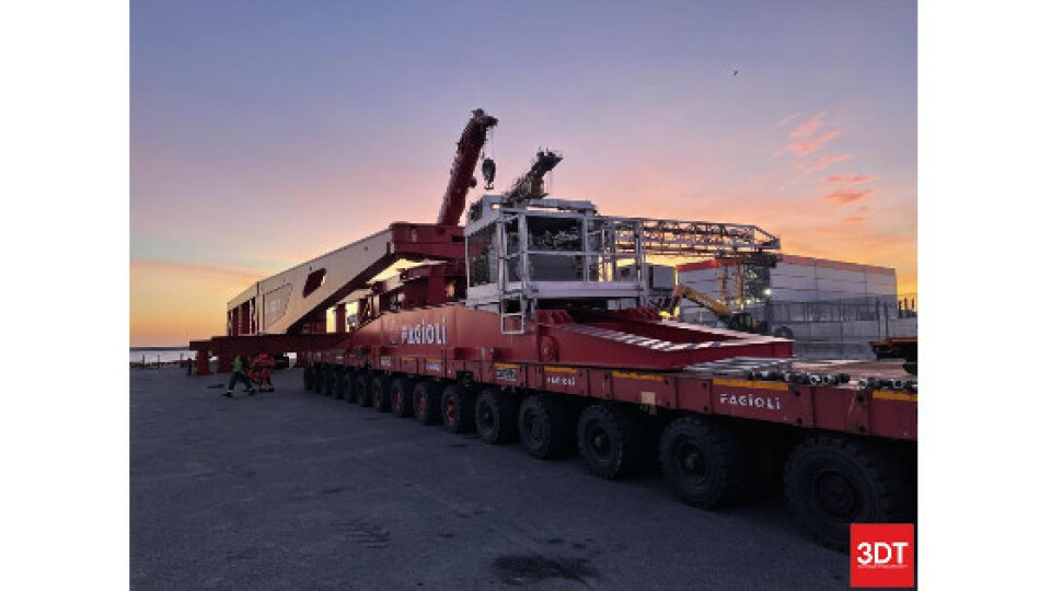
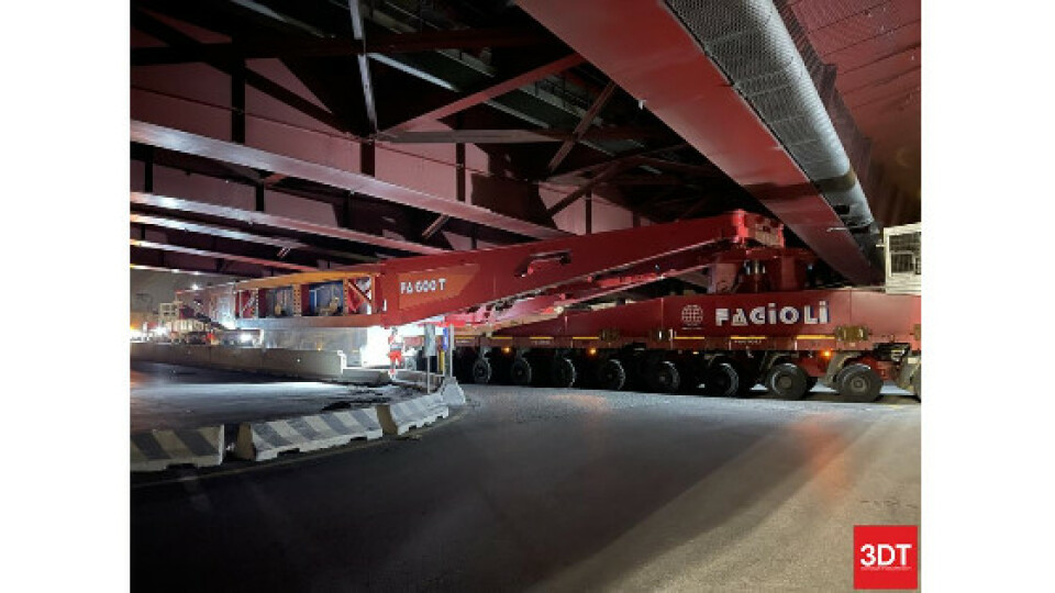
Fagioli SpA handled the transport of a 300 tons generator stator type TRYL 63 on behalf of Ansaldo Energia, with Bangladesh as the final destination.
The first part of the journey was one of the most challenging, as the route 2.3 km long between the Ansaldo Energia warehouse and the freight port located at the Dente di Cornigliano, featured two underpasses with very low clearances, that prevented the possibility to use traditional trailers.
The route also included a pass under the Polcevera Viaduct, rebuilt after the collapse of the old Morandi Bridge on August 14, 2018. In that occasion, a part of the bridge landed on the warehouses of Ansaldo Energia.
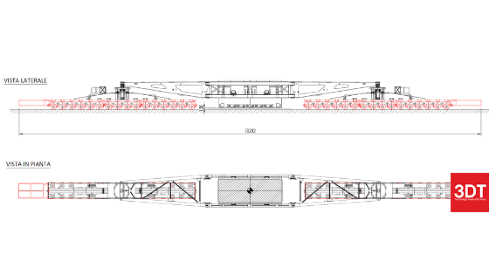
To perform the task, Fagioli organized the load in a dedicated trailer, carried by two self-propelled modular transporters (SPMTs). The overall length of the convoy was 70 m.
The particular configuration was selected to keep the maximum height below the threshold necessary to successfully avoid the collision with the interferences in the site while keeping the possibility of steering along the track.
Workflow
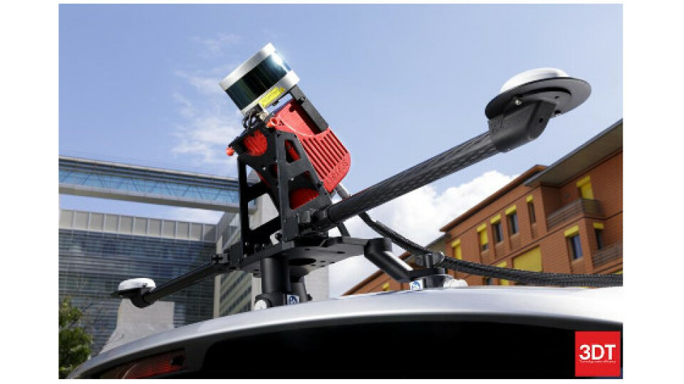
Scanfly XT was quickly installed on the vehicle designated from the survey via the dedicated car mount adapter. System was configured in the field, and the navigation system completed the initialization in less than a minute in good, open sky conditions. After a warm-up of a few minutes, the operator activated the recording of the LiDAR data and traveled the designated route in the north-south direction, with just a single pass in normal traffic conditions. The whole operation required less than 15 minutes.
Later at the office, the trajectory of the survey was estimated with an RMS accuracy in the range of 3 cm using the RINEX corrections from the nearby base station of a CORS network.
Finally, the point cloud was generated in SmartProcessing Lidar, 3DT proprietary direct geo-referencing software,
Results
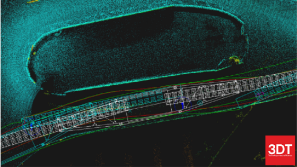
The route was previously inspected by Fagioli with traditional methods in the field, as it constitutes the obligatory passage to reach the freight port of Geneva from the Ansaldo Energia’s site. In particular, the analysis was focused on two underpasses
The clearance measurements from the point cloud were compared to the values previously taken in the field by the operators.
The average difference between the digital twin of the route and the field measurement was 2.5 cm, with the maximum value being below the 5 cm threshold required for the application, in compliance with the specifications of the Scanfly XT.
It was possible to use the point cloud from the survey as the base for simulations of the convoy traveling in the most demanding parts of the track
The Scanfly advantages
Fagioli validated the use of Scanfly XT for the preparation of the transport of oversize loads.
Since traditional surveys on the critical points method were typically performed manually, Scanfly XT enables to increase the efficiency of the operations without creating interferences to regular traffic. Since most part of the critical points is on public roads open to heavy traffic, surveying with Scanfly XT reduces the risks for the operators in the field.
Finally, creating the digital twin allows taking any additional measurements at any time directly from the point cloud stored at the office, reducing the need of going back in the field.
Do you have questions about this case study?
Get in touch with 3D TARGET, and they would be happy to answer any questions you have about pricing, suitability, availability, specs, etc.


![Do-Giant-Tortoises-Make-Good-Neighbors-1[1].jpg](https://cdn.geo-matching.com/vRMO2Edp.jpg?w=320&s=a6108b2726133ff723670b57bc54c812)


