How High-Resolution UAS Cameras Help in Power Line Corridor Mapping
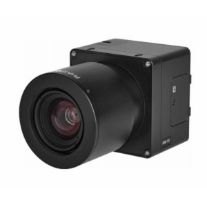
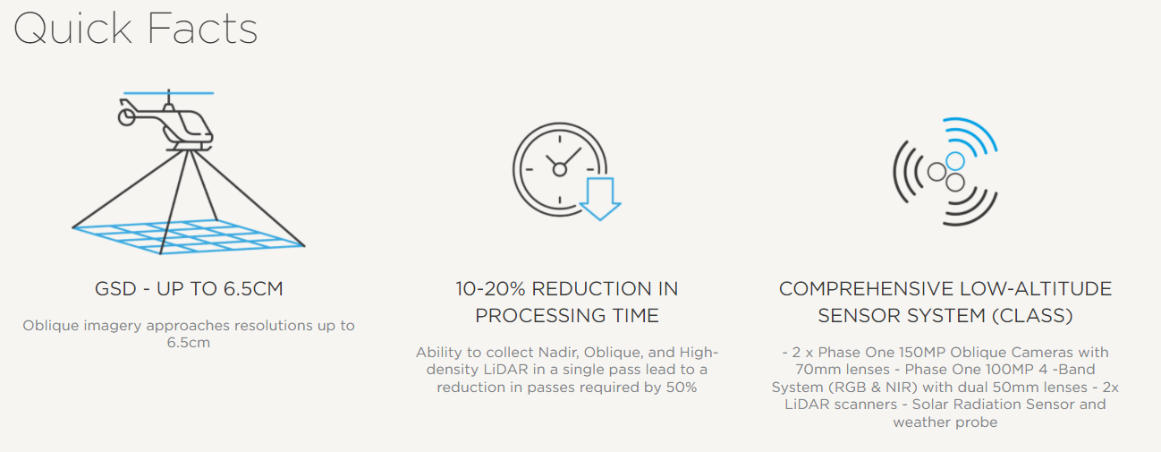
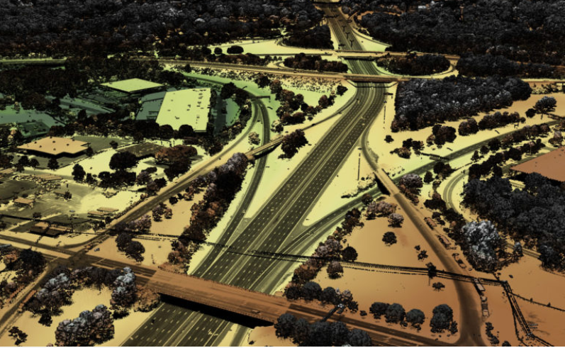
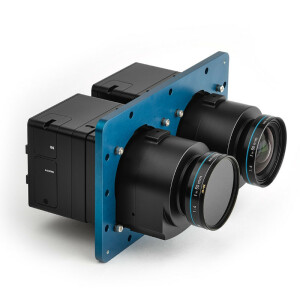
Medium to large scale oil, gas and electric utility companies require constant high-resolution imagery and data of their physical assets to inspect any health and maintenance concerns. NV5 Geospatial is able to provide high quality data in 50% less time by integrating four Phase One cameras into their CLASS helicopter-based platform and collect the required nadir and nadir 4-band, oblique, and high-density LiDAR data in a single pass.
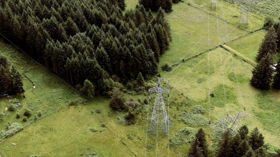
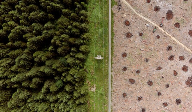
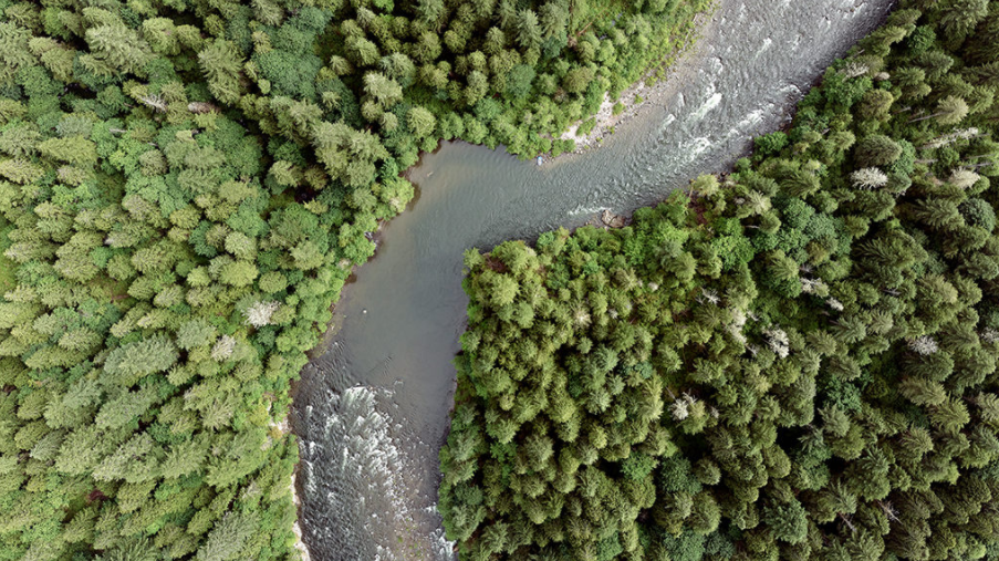
High-Resolution Imagery Detailing Health and Encroachment Concerns.
Providing such data to utility companies across North America is one of many projects undertaken by NV5 Geospatial, one of North America’s largest geospatial services firms. In order to meet inspection-grade detail and accuracy requirements for their data, NV5 Geospatial integrated Phase One medium format cameras into their Comprehensive Low-Altitude Sensor Solution (CLASS); a platform that collects nadir, 4-band, oblique, and high-density Lidar data in a single pass.
Previously, NV5 Geospatial focused more heavily on high-accuracy Lidar products than on RGB and NIR imagery. However, with the availability and growing knowledge of high-resolution oblique imagery, their clients have become more aware of the usefulness of imagery for high-value asset inspection. Oblique images offer greater visibility as compared to nadir imagery or point clouds and can often be much more useful for inspection.
''The sharpness of the un-stabilized imagery has enabled our team to provide automated asset inventory and asset health on transmission line structures. Previous solutions prior to Phase One did not have the reliability, accuracy, sharpness, and support to offer such a product to our customers.'' - Ryan Lynch, Flight Operations Manager - NV5 Geospatial
Integration
The ability to seamlessly integrate Phase One components with other instrumentation allows NV5 Geospatial to provide end solutions to their clients that exceed requirements and expectations. The CLASS 1.0 and 2.0 platforms ensure that all data and imagery collected provide the necessary high level of detailed information without any concern for reliability, accuracy, or sharpness.
Instead of having to perform separate passes with a high-altitude fixed-wing level for Nadir imagery and another low pass for Oblique imagery, NV5 Geospatial is now able to collect Nadir, Oblique, and high-density Lidar data in a single pass for corridor survey projects with their CLASS system. Mounted to a helicopter-based platform this reduced the number of passes required by 50%, while still achieving asset inspection grade detail in the imagery for their clients.
NV5 Geospatial
NV5 Geospatial is North America’s largest geospatial services firm, providing insights to organizations that need geospatial intelligence to mitigate risk, plan for growth, better manage resources and advance scientific understanding. NV5 Geospatial goes beyond data acquisition and measurement, transforming high-quality, accurate data into usable information tailored to meet our client's needs. Major government agencies, the military, and corporate organizations of all sizes, including utilities, oil and gas producers, and engineering and construction firms, depend on NV5 Geospatial to revolutionize the way they use and value geospatial data through end-to-end solutions that push the boundaries of data and analytics.
Do you have questions about this case study?
Get in touch with Phase One A/S, and they would be happy to answer any questions you have about pricing, suitability, availability, specs, etc.


![Do-Giant-Tortoises-Make-Good-Neighbors-1[1].jpg](https://cdn.geo-matching.com/vRMO2Edp.jpg?w=320&s=a6108b2726133ff723670b57bc54c812)


