GNSS Helps Document and Excavate Cultural Sites in Coastal South Carolina
Just off the southern coast of South Carolina, Edisto Island was named for an Indigenous sub-tribe of the Cusabo peoples. The Edisto people used the island for settlements and fishing. With a population estimated at 1,000 in the year 1600, the Edisto people eventually disappeared by the 1800s, due to European settlement and disease.
Today Edisto Island is home to important artifacts, including unique pottery such as Thoms Creek pottery sherds (a “sherd” is a piece of pottery, not to be confused with a “shard” which is a piece of glass) and mysterious shell rings, which are structures built of oyster shells and other shells. Shell rings still hold many archaeological mysteries about the earliest inhabitants of the southeastern United States, but these un-excavated artifacts are at risk of being lost to the ocean, due to rapid coastal erosion.
“In the past 70 years, Edisto Island has seen about ¾ of a mile of shoreline loss,” said Meg Gaillard, a Heritage Trust Archaeologist for the South Carolina Department of Natural Resources (SCDNR), citing this ArcGIS StoryMap which visually documents the South Carolina coastline’s erosion from the earliest known records.
The SCDNR’s Heritage Trust Program was founded in 1974 with a mission to “preserve and protect natural resources, for current and future generations.” Today the Heritage Trust Program archaeologists assist with cultural resource management across the state. The SCDNR is responsible for over 1.1 million acres, and over 200,000 of those acres are coastal.
Due to fast-paced erosion, there is an obvious question about carrying out such a mission along the coast.
“Our legal obligation is to protect these resources for current and future generations,” Gaillard said. “But the question we are facing today is, ‘What happens when we can’t?''
The Challenge: A Race Against Time to Excavate Coastal Artifacts
Eos Positioning Systems interviewed Gaillard while she was conducting research at a site adjacent to Pockoy Island in December 2021. The Pockoy Island Shell Ring Complex consists — or rather, used to consist — of a set of two shell-ring structures. These rings were discovered in late 2016 during a LiDAR scan of the coast taken after Hurricane Matthew. The two shell rings date back to 4,300 years ago, making them contemporary with Stonehenge and Egypt’s first Great Pyramid.

Ring 2 of the Fig Island Shell Ring Complex, owned and managed by the SCDNR, is as wide as a football field and dates to the Late Archaic period, the same time period as the Pockoy Island Shell Ring Complex. Most shell rings, like the rings of the Pockoy Island Shell Ring Complex, can’t be seen from the air, except with the use of LiDAR, due to thick vegetation. Photo by Jamie Koelker, Koelker & Associates, LLC.
Since 2017, SCDNR archeologists have been racing to excavate the Pockoy Island Shell Ring Complex.
“We’ve been doing these excavations while knowing full well that we would lose this site within our careers,” Gaillard said.
In fact, in 2017, Dr. David Anderson of the University of Tennessee-Knoxville and his colleagues, published a paper detailing a predictive model that estimates at least 13,000 known archaeological sites in the southeastern United States alone will be lost to erosion in the next 100 years.
“That’s significant, because the Pockoy Island site became known to us just recently,” Gaillard said. “It’s hard to imagine how many cultural sites we might lose that have yet to be discovered.”
According to Dr. Anderson, this is a threat not unique to the southeastern United States, but rather a challenge for humanity globally. Archaeological investigation is one of the only ways to ensure the preservation of records for future generations.
“The SCDNR research team’s efforts to rescue information from vanishing coastal sites is exactly the kind of proactive action needed if our descendants are to have any appreciation for how life used to be in coastal areas,” Dr. Anderson said. “While many will rise to the challenge, this is an important example showing us all how to proceed.”
Today, Gaillard and her SCDNR archaeology colleagues have become passionate advocates for monitoring and mapping shoreline erosion with extremely precise measurements. By having reliable shoreline maps over time, it is possible to prioritize known excavation sites that may be lost in the near future.
“If we can excavate these sites today, before they are lost, then research on the excavated artifacts will be possible in a museum or a curatorial facility at a later date,” Gaillard said. “It’s an opportunity for future researchers to be able to say something about these cultures that came before us.”
The Solution: Measuring Shoreline Loss with Extreme Accuracy to Prioritize Excavation Sites
To prioritize excavation sites in the future, Gaillard and her colleagues wanted a highly accurate, irrefutable method of measuring shoreline loss.
“Being able to have really accurate measurements is critical,” Gaillard explains. “We want to be able to say, at a conference for instance, that we are not just guessing at the measurement of shoreline loss. We are certain this site is gone, or is highly likely to completely erode away in coming years. Quantifiable data lends credibility to anything we say.”
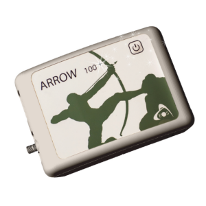
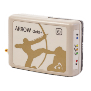
In 2018, Gaillard and her SCDNR archaeology colleagues learned that SCDNR’s GIS Manager Tanner Arrington was using a Global Navigation Satellite System (GNSS) receiver to enhance the accuracy of his mobile mapping work. She borrowed Arrington’s device, an Arrow Gold® GNSS receiver made by Canadian company Eos Positioning Systems, and tested it for shoreline mapping.
“Just knowing that this technology was out there, we had to have it,” Gaillard said.
In September of that year, the Heritage Trust Program purchased their first of two Arrow Gold® GNSS receivers for shoreline mapping.
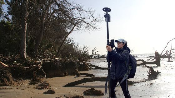
At Pockoy Island, Gaillard uses Esri’s ArcGIS Field Maps (formerly ArcGIS Collector) on both iPhone and iPad to collect data points as she walks along the beach and climbs across fallen trees marking the space where land and sea meet. The Arrow Gold® sends centimeter-level accurate horizontal and vertical positions to Field Maps via Bluetooth®, along with useful GNSS metadata.
Back in the office, Dr. Karen Smith, SCDNR archeologist and lead on the Pockoy Island Shell Ring Complex excavations, digitizes a line from Gaillard’s points. The resultant shoreline can be compared to earlier measurements. Over time, the team can see where erosion is most rapid. And because the measurements are extremely accurate, Smith and the team, including Eastern Tennessee State Assistant Professor of Anthropology Dr. Lindsey Cochran, can predict which land might be underwater by the next planned excavation season. Dr. Cochran and Gaillard have been using this modeling since 2020 (they did not use the modeling on Pockoy Island itself, which had already undergone multiple seasons of field work prior to the collaboration’s beginning).
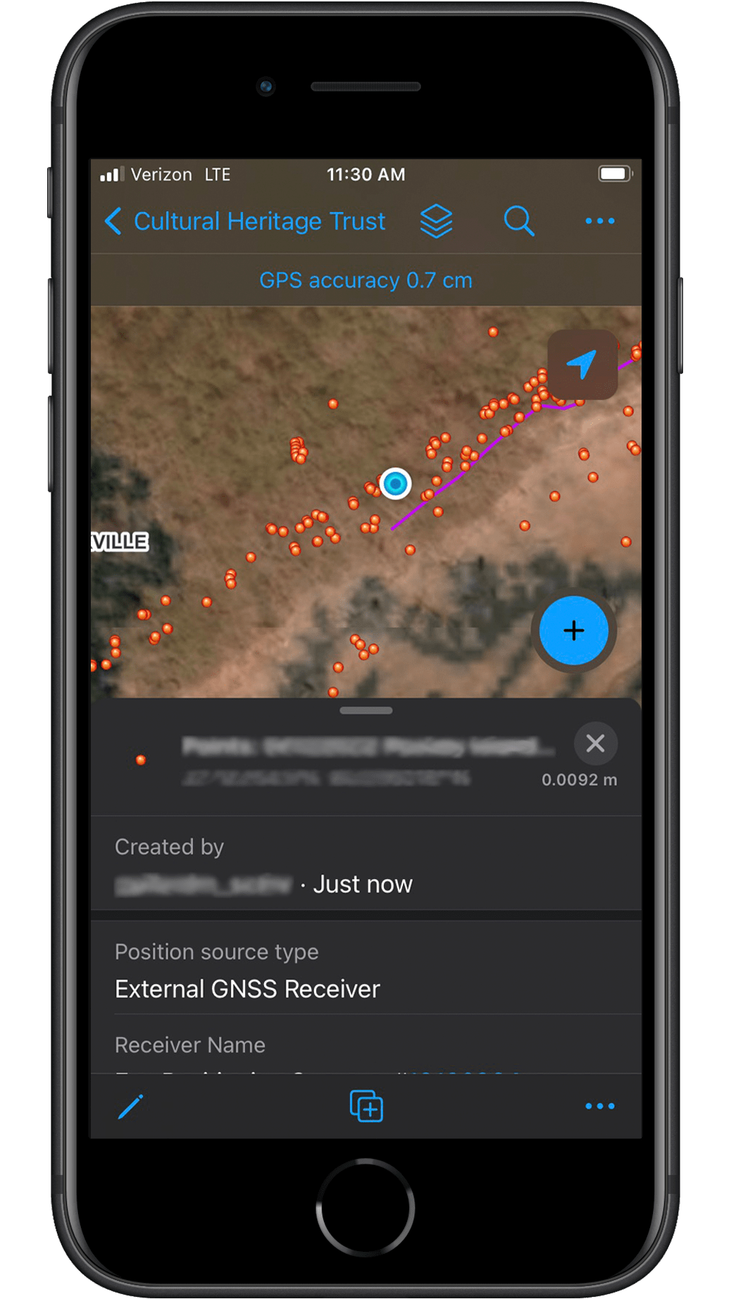
SCDNR uses ArcGIS Field Maps paired with an Eos Arrow Gold® GNSS receiver to collect shoreline locations.
“While predictive modeling of the impact of shoreline change is never perfect, the output maps give us a great place to start identifying areas that are most susceptible to damaging changes from the ongoing and intensifying climate emergency,” Dr. Cochran said. “Every model needs to be ‘groundtruthed,’ which is the act of archaeologically verifying digital predictions to see if what I see on a computer screen matches what SCDNR archaeologists see in the dirt.”
Based on the models Dr. Cochran creates, the team builds an excavation plan to prioritize the next season’s sites.
SCDNR archaeologist Meg Gaillard measures the shoreline of Pockoy Island using an Arrow Gold® in September 2021. Photo by Kiersten Weber, SCDNR.
“Without these boots-on-the-ground measurements and predictive models, we would be flying mostly blind,” Gaillard said. “With them, we can see the shifts in what is being lost and what is somewhat stable. And we can try to put excavation units in ahead of the loss, knowing for a fact that the parts of the site we excavate this season will be under the Atlantic Ocean come next season.”
The Results: Shell Ring 1 is Gone, But Its Artifacts Survive
The Pockoy Island Shell Ring Complex is a literal race against time. “Ring 1 is completely gone,” Gaillard said. “Never to return.”
The data show that Pockoy Island’s erosion rate has been increasing since 2016. According to calculations by SCDNR Coastal Geologist Katherine Luciano, Pockoy Island will be completely eroded by 2037.
“That’s very rapid,” Gaillard said. “We have a finite amount of time to work. This is why technology like the Arrow Gold® is so important to us. Without it, we’re just guessing which places to prioritize for excavation.”
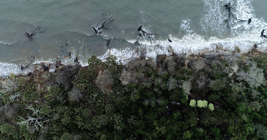
A row of green tents can be seen in the maritime forest on Pockoy Island covering the May 2018 archaeological excavation of the Pockoy Island Shell Ring Complex. All of the land within this image is now under water due to coastal erosion. Photo by Jamie Koelker, Koelker & Associates, LLC. A poster showcasing this image can be downloaded for free here.
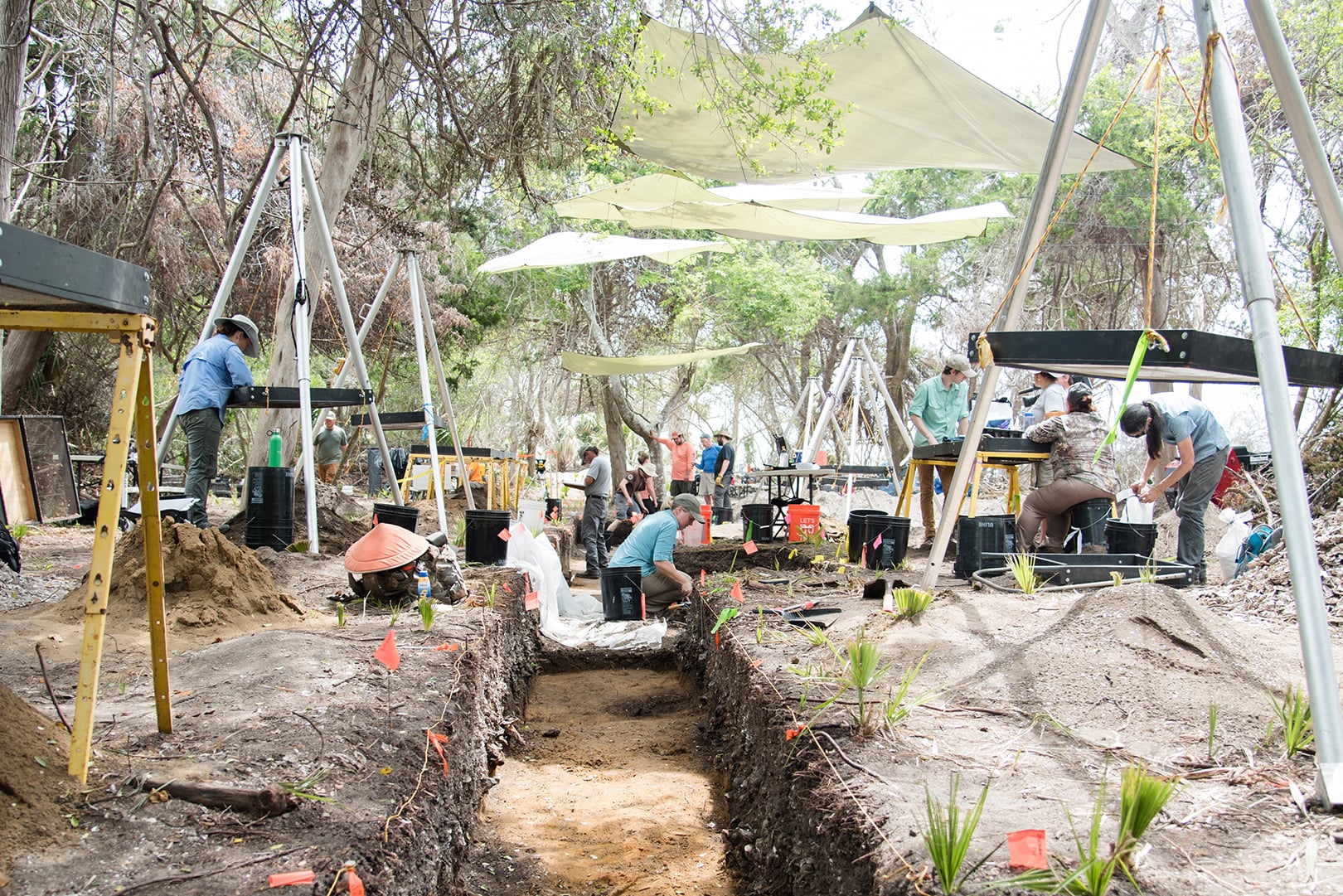
SCDNR archaeologists excavate a trench across the Pockoy Island Shell Ring Complex, Ring 1 in May 2018. Photo by Taylor Main, SCDNR.
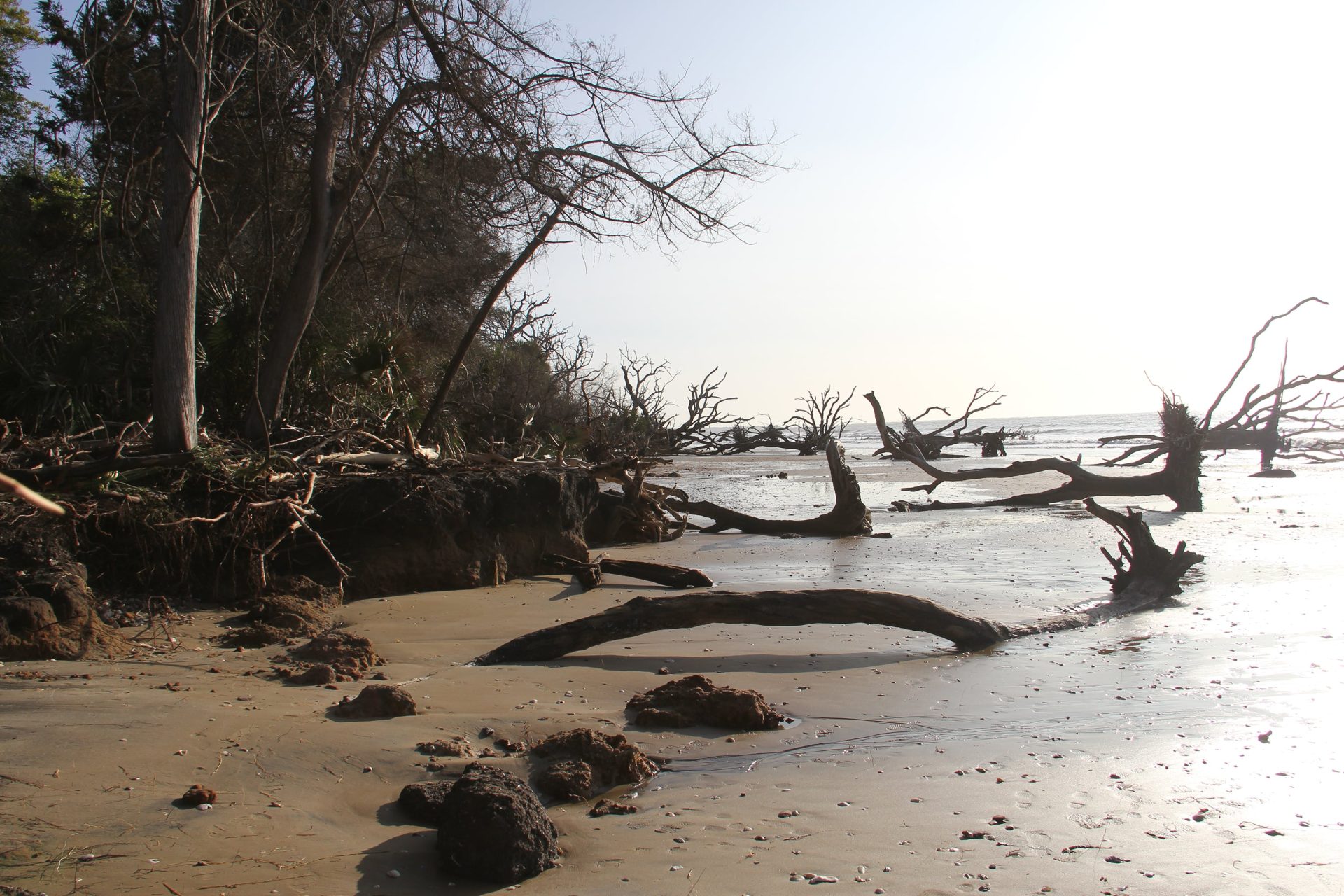
This photo was taken on September 23, 2020, at approximately the same location as the photo in May 2018 that showcased the trench excavation. The comparison of the two images is one way to showcase what coastal erosion can do to archaeological sites, and the reason why careful, but rapid mitigation of this and other cultural sites is critical. Photo by Meg Gaillard, SCDNR.
Looking Ahead: Erosion is a Global Concern
Gaillard and her team collaborate with organizations facing similar challenges worldwide. In May 2019, archaeologists Tom Dawson and Joanna Hambly from the Scottish Coastal Archaeology and the Problem of Erosion (SCAPE) and Scotland’s University of St. Andrews visited the Pockoy Island site. They have been monitoring the shoreline of Scotland for many years.
“This is not just a southeastern United States problem,” Gaillard said. “It’s a global effort to stay ahead of erosion.”
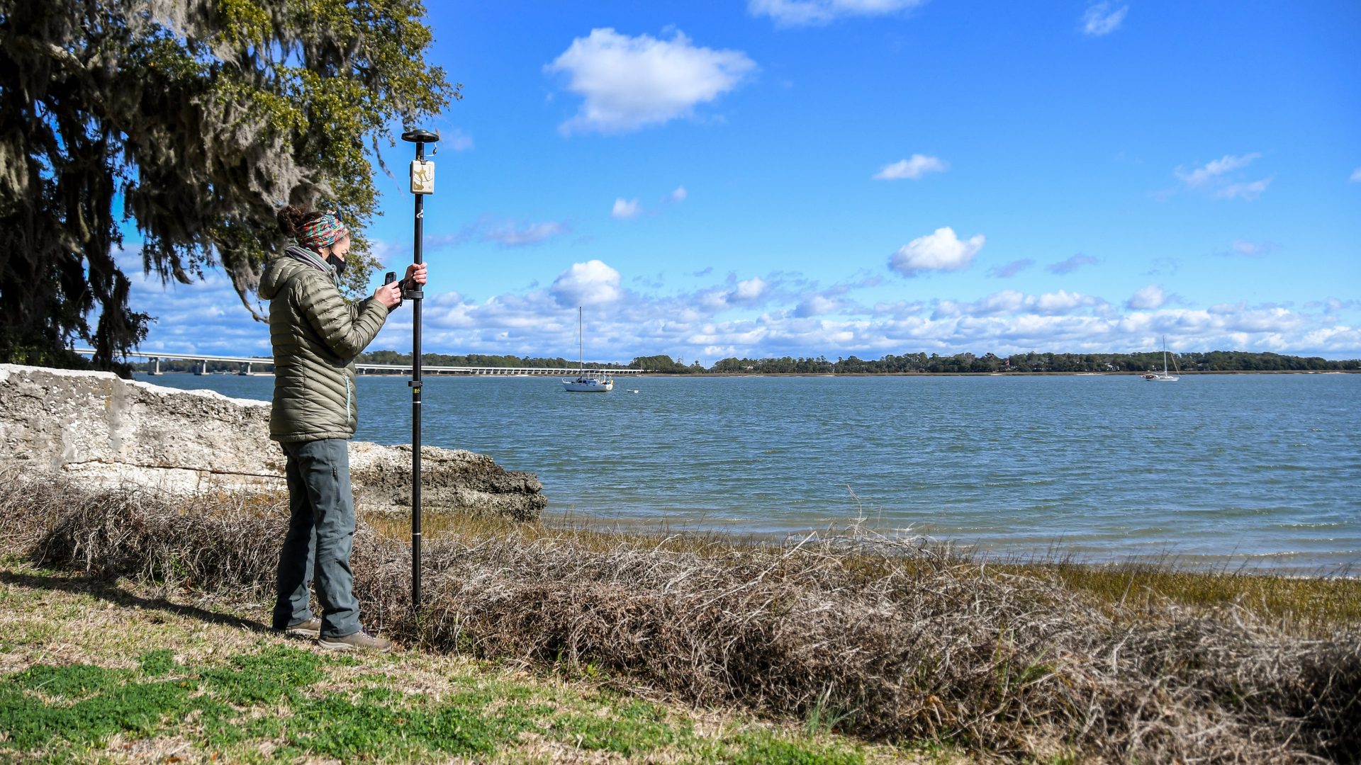
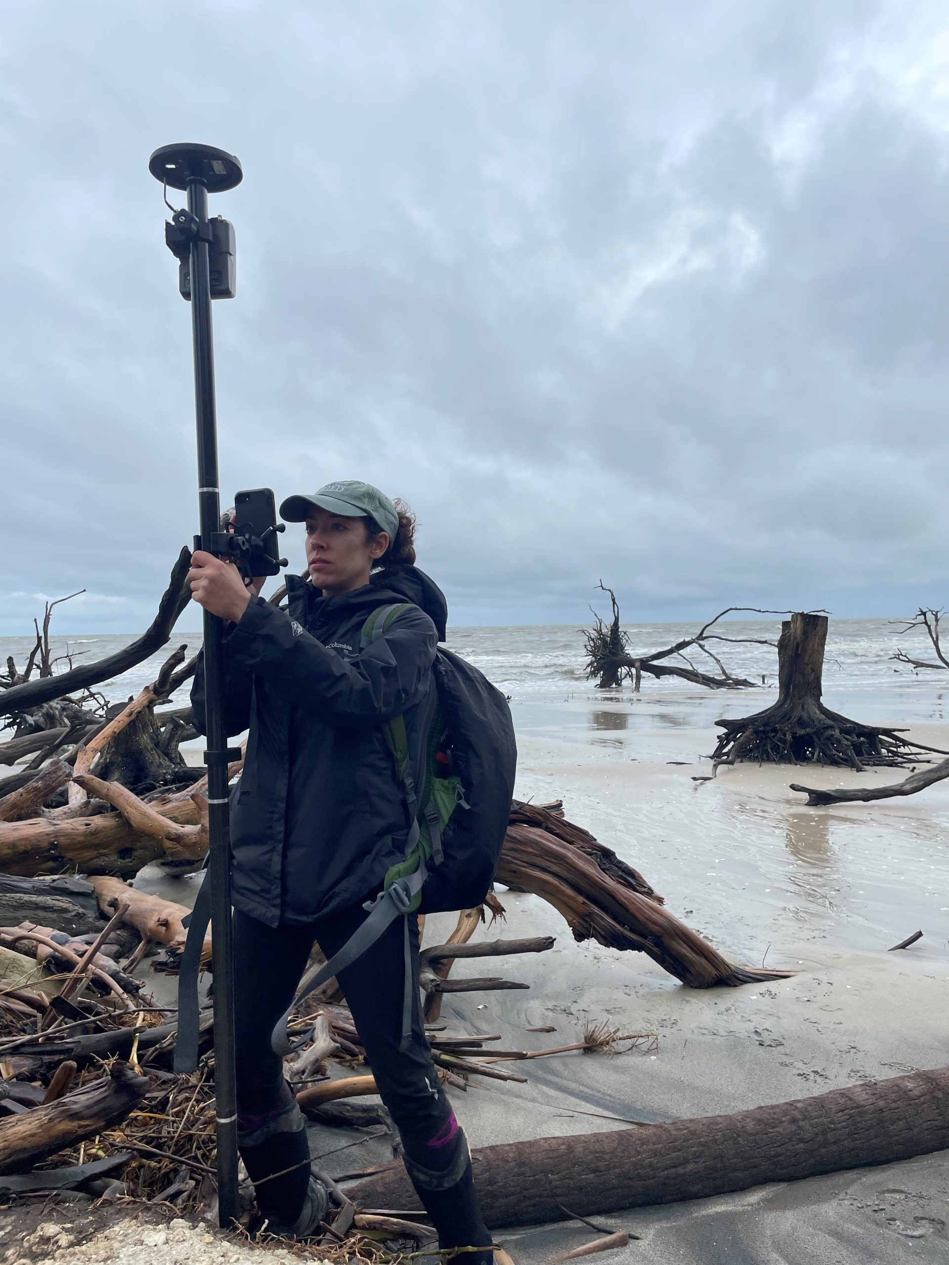
SCDNR archaeologist Meg Gaillard measures the shoreline of Fort Frederick Heritage Preserve using an Arrow Gold® in January 2021. Fort Frederick is where the Emancipation Proclamation was read for the first time in southern states. The site, buffered by the Beaufort River, is an example of slow erosion. Photo courtesy of SCDNR.
The SCDNR has also developed partnerships with the Florida Public Archaeology Network (FPAN), who run Florida’s Heritage Monitoring Scouts (HMS) program, which was modeled after shoreline monitoring working already underway in Scotland. According to Gaillard, FPAN is leading when it comes to incorporating community stakeholders in their work. FPAN meets regularly with a representative of the northeastern Florida Gullah/Geechee Nation, Glenda Simmons-Jenkins, to coordinate both parties’ priorities.
“I think it’s important we, as professionals and academics, align our priorities to the communities we serve,” said FPAN Regional Director Sarah Miller.
Through Simmons-Jenkins, the Gullah/Geechee Nation has shared concerns with FPAN about the disturbance of sacred burial sites, environmental impacts from climate change, and restorative justice. According to Miller, this discourse provides a clear priority for FPAN, which can help ensure Gullah/Geechee burial sites are accurately mapped, which in turn fills data gaps for planners and reviewers who in the future might make important decisions that impact these local communities.
“It can’t be said enough in our work, you can’t manage what you don’t know is there,” Miller said. “Confirming the location of sites is the number-one thing we can do to help manage heritage at risk along our coastlines.”
''We barely ever use paper anymore. We’ve gone completely digital. We’re using our iPads, iPhones, Arrows, and the Esri platform. I don’t know how we would do our job on heritage at-risk sites like Pockoy without being able to use this technology.'' - Meg Gaillard, Heritage Trust Archaeologist
Gaillard calls her colleagues from Scotland and Florida an inspiration. She hopes to emulate the standard FPAN has set for proactively incorporating community feedback into their work.
“Florida is leading on this, and we hope to be right on their bootheels, because time is of the essence,” Gaillard said. “We’re in early conversations with Tribal representatives who are interested in the Pockoy Island site. We want to know if they want us to excavate sites on their ancestral land, or if we should let them go. These are questions we don’t have answers to yet, but measurements will be critical.”
Gaillard says there are many reasons why a site would not be excavated, including limited storage capacity for artifacts. Everything excavated from an archaeological site is, by law, required to be curated in perpetuity.
“We are not going to be able to excavate and curate the artifacts from all of the at-risk cultural sites we are currently aware of to the extent we have at Pockoy Island,” Gaillard said. “But by using the Arrow Gold® and other technologies, we can at least measure the loss. We can also discuss with colleagues and the public the rate of loss, as well as the decisions we make as cultural resource managers as to which sites we do choose to excavate, like Pockoy, and why we choose not to excavate others.”
Gaillard says the technology has made the Heritage Trust Program’s mission more possible.
“I can’t tell you how much we’ve been using our Arrows and iPhones,” she said. “We barely ever use paper anymore. We’ve gone completely digital. We’re using our iPads, iPhones, Arrows, and the Esri platform. I don’t know how we would do our job on heritage at-risk sites like Pockoy without being able to use this technology.”
Do you have questions about this case study?
Get in touch with Eos Positioning Systems, and they would be happy to answer any questions you have about pricing, suitability, availability, specs, etc.


![Do-Giant-Tortoises-Make-Good-Neighbors-1[1].jpg](https://cdn.geo-matching.com/vRMO2Edp.jpg?w=320&s=a6108b2726133ff723670b57bc54c812)


