Fusing Aerial and Mobile Lidar Data Using Phoenix's Vehicle Adaptable RANGER-LR Mapping Solution
Using our RANGER-LR LiDAR mapping system, geomatics service provider, Caltech Group successfully created a facility as-built of a site consisting of a large range of pipes, buildings, and assorted equipment.
Challenge
Companies looking to perform large scale, high resolution mapping projects with budget restrictions and time constraints struggle using traditional surveying methods. Caltech’s team of surveyors, engineers, CAD experts, technologists, and GIS specialists has spent the last 30+ years becoming Western Canada’s go-to company for geomatics services. Caltech provides services to many oil & gas and utility clients. These clients demand some of the highest standards pertaining to data quality. Caltech was contacted to generate a facility as-built of a site consisting of a myriad of pipes, buildings, and equipment. Using the mapping tools on hand, it would have been very difficult to complete the project, at least not to the level of accuracy that would be useful to the client. The only tool that could have been used was a terrestrial laser scanner, but due to the size of the facility – it was just not feasible.

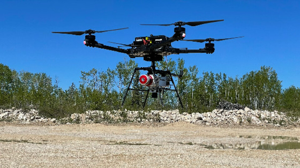
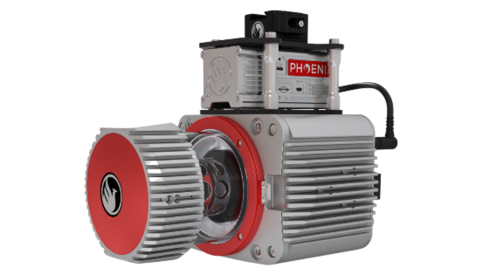
Phoenix LiDAR Systems RANGER-LR Mounted on an Aerial Scan (Freefly Alta X) UAS
Solution
Caltech Group invested in a RANGER-LR mapping solution from Phoenix LiDAR Systems, allowing them to rapidly scan as-built facilities with high accuracy in a single day – the main motivator for acquiring a dual-purpose UAS and terrestrial mapping system. The derived data deliverables acted as a ‘digital twin’ of their clients’ facilities, empowering the end-users to digitally visit their facilities and make informed decisions. The value-added ability to easily disseminate 3D geospatial data in a user-friendly format facilitated collaboration with people across all skill levels - both internally within their organizations and externally with subcontractors.

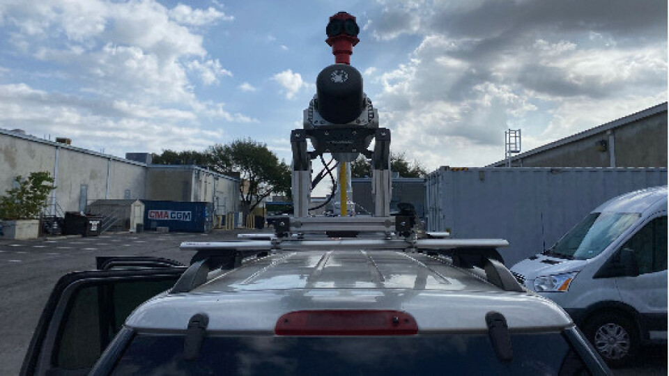
Phoenix LiDAR Systems RANGER-LR Mounted on a mobile scan (truck)
Acquisition
• Survey Area: 160-acre site
• Platform: Mobile Scan (truck) + Aerial Scan (Freefly Alta X)
• Site Features: Complex Pipe network, buildings, and equipment
• Time: 8 hours on site
Step 1: Caltech accomplished the complex facility as-built mapping project by first mounting the RANGER-LR payload with a 360-degree Ladybug camera to a truck and traversing through the site
collecting 360-degree high-density lidar and spherical imagery.
Step 2: After the drive, they removed the payload from the truck, mounted the Sony A7R2 camera to it, and affixed the payload to an Alta X UAV, all without leaving the job site. This configuration enabled them to quickly collect aerial high-density lidar and imagery over the facility.
Step 3: The final step was to merge both the mobile and aerial point clouds into a single cohesive dataset to be shared with the end-user.
RESULTS
Deploying the vehicle adaptable RANGER-LR mapping solution allowed Caltech to successfully complete the data collection and turn around the deliverable facility as-built within a very short timeline. All project deliverables met or exceeded ASPRS accuracy specifications. The combination of rapid data collection, processing time, and data quality resulted in additional customer quotations for larger projects, subsequently awarded to the Caltech team.
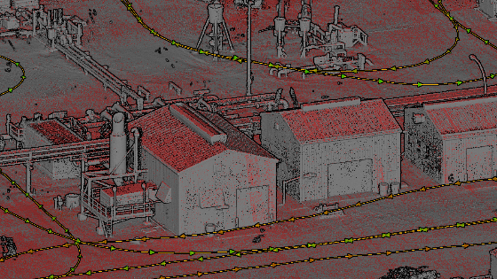
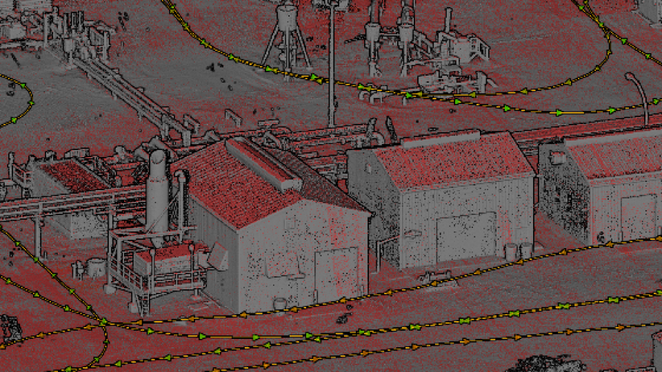
Survey Deliverables
Do you have questions about this case study?
Get in touch with Phoenix LiDAR Systems, and they would be happy to answer any questions you have about pricing, suitability, availability, specs, etc.
Related products


![Do-Giant-Tortoises-Make-Good-Neighbors-1[1].jpg](https://cdn.geo-matching.com/vRMO2Edp.jpg?w=320&s=a6108b2726133ff723670b57bc54c812)


