Cultural Heritage 3D Modeling With the I93 Visual Imu-Rtk GNSS
The trend toward smart cities and digital twins is gaining traction around the world. When cities need to make planning, designing, or management decisions, they turn to 3D modeling to create realistic renderings of existing buildings, infrastructure facilities, cultural heritage sites, and green spaces. Moving to East Asia, China is also investing significantly in digital twins, from planning to disaster response, to determine where to develop new projects and how to manage existing challenges effectively.
Recently many cases of historical and cultural heritage preservation have been carried out by GIS professionals using the latest 3D digital modeling technologies. For smarter, faster, better informed urban planning, and as a complement to aerial surveys, the i93 IMU-RTK GNSS receiver, which integrates visual positioning and video photogrammetry technologies, was used in this case study and proved its effectiveness in saving considerable funds, time and efforts in collecting highly accurate data to create a 3D model of a cultural heritage site in China.
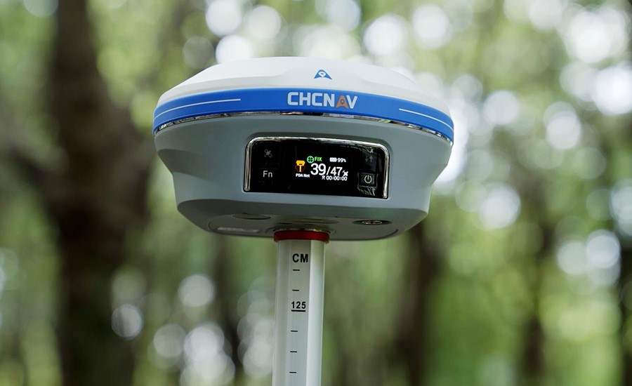
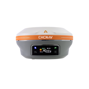
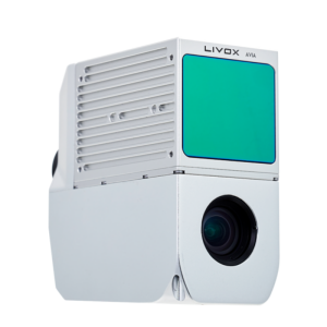
Figure 1. The i93 is an extremely versatile receiver that integrates the latest GNSS, Auto-IMU, RTK, and premium dual-camera technologies.
Dynamic Panoramic Video Capture and Automatic Image-Matching Technologies Enable 3D Modeling and Enhanced Surveying Capabilities
By combining GNSS, IMU, and cameras in a single device, the i93 brings significant innovation to a wide range of surveying and mapping applications. It enables more accurate, efficient, and diverse surveying, mapping, and modeling scenarios, reducing the time and cost to complete projects. In addition, visual positioning technology overcomes the limitations of standard GNSS surveying systems and ultimately improves the profitability of surveying firms and other organizations.
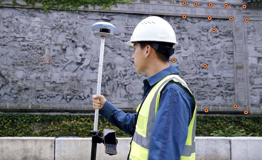
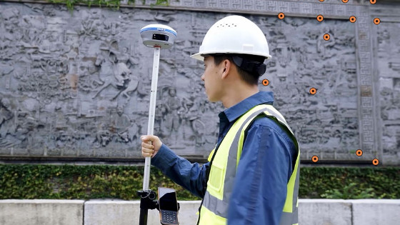
Figure 2. The preparation to a project with the i93 Visual IMU-RTK GNSS smart antenna and HCE600 controller from CHCNAV.
Overcoming Difficulties of Gnss Surveying With the 3D Navigation and Stakeout
The i93 integrates star-level cameras to provide an immersive 3D visual navigation and stakeout experience. In addition to its advanced features, the i93 can operate continuously in any RTK mode and is equipped with built-in Wi-Fi, Bluetooth, and NFC technologies for seamless connectivity to handheld controllers and tablets in the field. The integrated 4G and UHF modem supports all GNSS measurement modes for maximum flexibility. Intelligent power management ensures up to 34 hours of GNSS RTK network rover operation without the need for backup batteries. The rugged magnesium alloy housing is shock, dust, and water resistant to ensure uninterrupted performance in all conditions.
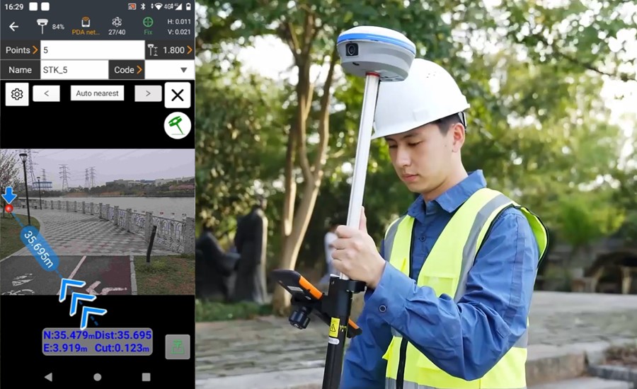
Figure 3. The i93’s visual stakeout feature is in use on the field controller.
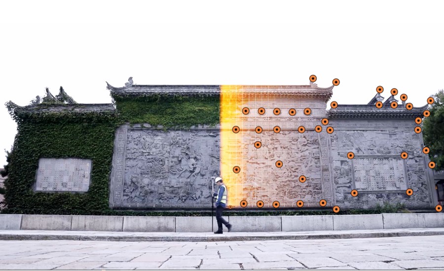
Figure 4. The single cultural heritage object modeling process with the i93 Visual IMU-RTK GNSS.
Benefit From Superior Gnss Signal Tracking and High-Quality Data
Many surveying, mapping, and modeling projects take place in challenging environments that require reliable and accurate RTK positioning. The i93 Visual GNSS RTK is powered by a powerful new SoC chip and iStar CHCNAV technology with 1408 channels that can track satellites across all frequency bands to meet this requirement. In challenging environments, the i93 can achieve a 15% improvement in GNSS RTK performance, ensuring robust centimeter accuracy positioning. The i93 also features a built-in hybrid engine and unique narrowband interference rejection technology, improving GNSS data quality and signal track by more than 20%.

Figure 5. The 3D model of the Chinese cultural heritage (front view), data obtained with the i93.
Advantages of Georeferenced Video Photogrammetry for 3D Reality Modeling
The i93 GNSS is a cutting-edge surveying tool integrating two premium global shutter cameras with video photogrammetry technology. It delivers survey-grade 3D coordinates from real-world video capture in seconds, making it easy to survey previously hard-to-reach, signal-obstructed, and hazardous points in the field, such as under overpasses, under eaves, and near power poles. With its dynamic panoramic video capture and automatic image matching, the i93 improves productivity by up to 60%. In addition, automatic high-speed continuous shooting and adjacent image generation with up to 85% overlapping ensure high processing success.
The 3D modelling was done exclusively with i93 data, resulting in a complete and detailed model with accurate calligraphy, letters, facial expressions, and surface textures.
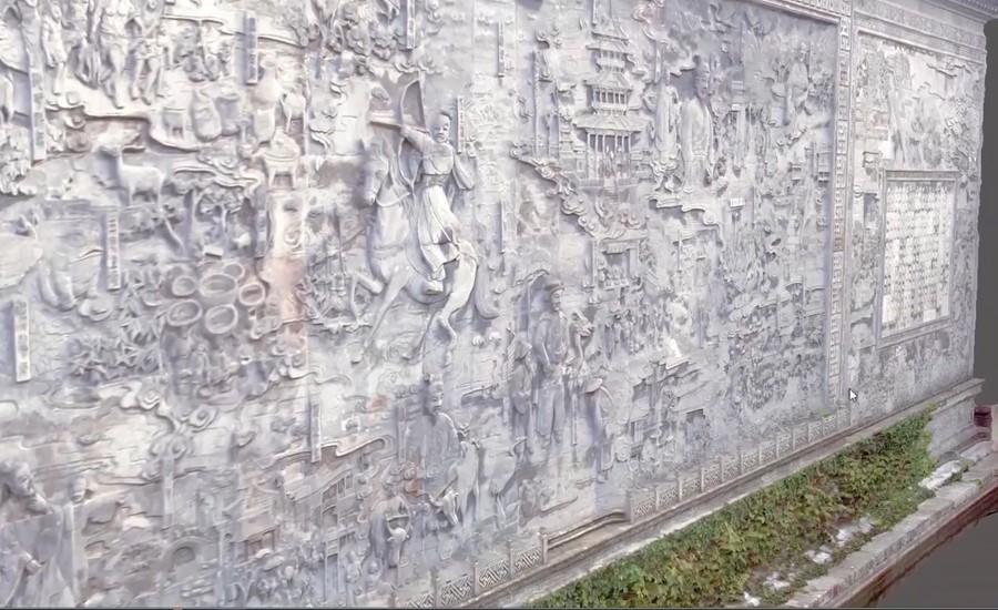
Figure 6. The 3D model of the Chinese cultural heritage (side view), data obtained with the i93.
Improved ROI for Reality Capture Projects
The i93 receiver can also be used to complement aerial surveys generated from oblique imagery. Aerial imagery can be subject to distortions, gaps, and blur due to the angle of the camera mounted on the drone. This is especially true in occluded areas. The i93 Visual IMU-RTK GNSS overcomes this problem by continuously capturing dynamic video with POS information. The i93 and UAV data are then combined to create a joint model, and processing is completed automatically within a few hours. The captured data can also be exported to popular modeling software such as ContextCapture and Smart3D, resulting in more accurate 3D models.
The project was successfully implemented and demonstrated that the i93 is the ideal solution for professionals looking to carry out high-precision 3D surveying and modeling tasks faster, more accurately, and more cost-effectively than ever before.
The innovative surveying and mapping solutions from CHC Navigation provide businesses and governmental organizations globally with the opportunities to do surveys and produce the most comprehensive 3D models that should effectively identify the geometry and properties of all the main structures that can be typically found in the city, like roads, bridges, buildings, cultural heritage objects, and others, which can be used for urban planning goals to facilitate the development. As a result, it can remarkably improve a project's time, cost, and quality performance.
About CHCNAV
CHC Navigation (CHCNAV) creates innovative GNSS navigation and positioning solutions to make customers' work more efficient. CHCNAV products and solutions cover multiple industries such as geospatial, construction, agriculture, and marine. With a presence across the globe, distributors in more than 120 countries, and more than 1,700 employees, today, CHC Navigation is recognized as one of the fastest-growing companies in geomatics technologies.
Do you have questions about this case study?
Get in touch with CHC Navigation | CHCNAV, and they would be happy to answer any questions you have about pricing, suitability, availability, specs, etc.


![Do-Giant-Tortoises-Make-Good-Neighbors-1[1].jpg](https://cdn.geo-matching.com/vRMO2Edp.jpg?w=320&s=a6108b2726133ff723670b57bc54c812)


