
Aerialtronics and Applanix Offer Accurate Aerial Photogrammetry UAV Solution
Aerialtronics and Plowman Craven provide integrated solutions for the rail industry using Applanix products. British surveying company Plowman Craven utilizes cutting-edge, integrated solution for many applications in the rail industry. For each client, Aerialtronics can build an integrated, custom payload and solution for the specific requirements.
Aerialtronics is an end-to-end solution developer that utilises drones, artificial intelligence and IoT data to provide businesses with augmented and actionable insights that create a perfect synergy between aerial applications and everyday business operations. Over ten years, Aerialtronics has developed and provided drone solutions for professional applications, including survey, agriculture, inspection, and mapping. Plowman Craven, a leading survey company, turned to Aerialtronics for a UAV-based survey solution for rail.
The Solution
- Trimble APX-15 EI UAV is a GNSS-Inertial Direct Georeferencing solution with Dual IMUs.
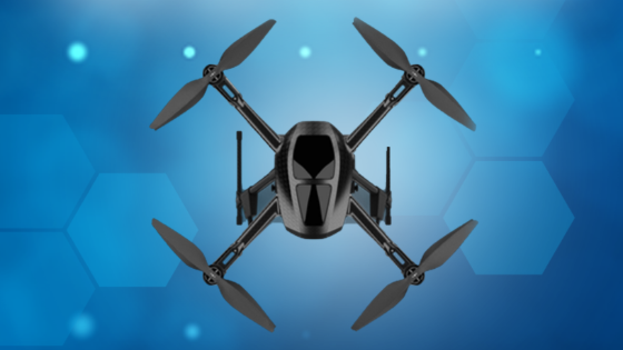
- Aerialtronics Altura Zenith is the world’s most versatile commercial drone.
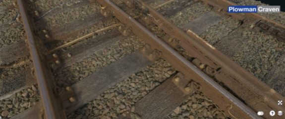
Vogel Point Cloud Data
The Altura Zenith as a Platform
The Altura Zenith commercial drone from Aerialtronics is equipped with a high-capacity battery, can fly for up to 40 minutes, has eight motors to ensure redundancy, is coupled with the largest payload compatibility, and has fast and simple “click and go” operations. Virtually any payload can be adapted to fit.
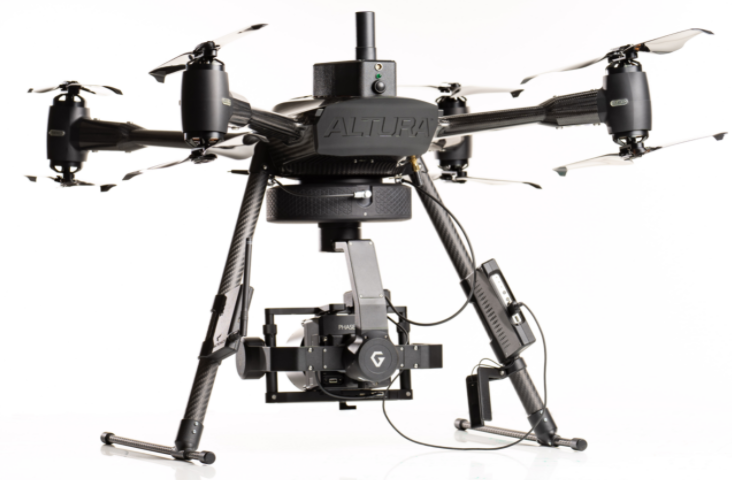
Altura Zenith commercial drone by Aerialtronics
Applanix DG Offers an Integrated Solution for Aerial Survey
For each client, Aerialtronics can build an integrated, custom payload and solution for specific requirements.
One such integration is with the Trimble APX-15 EI and POSPac UAV GNSS-Inertial post-processing SW. The APX15-EI is a compact solution comprising a survey-grade GNSS receiver and dual inertial measurement units, one embedded in the GNSS/Inertial board and one as an external unit connected remotely. With this feature, the APX-15 EI can automatically support the Zenith gimbaled platform. This, together with the POSPac UAV SW, enables pixels to be geolocated at the centimetre to millimetre level without GCPs while reducing the amount of sidelap flown, thus increasing the area flown permission.
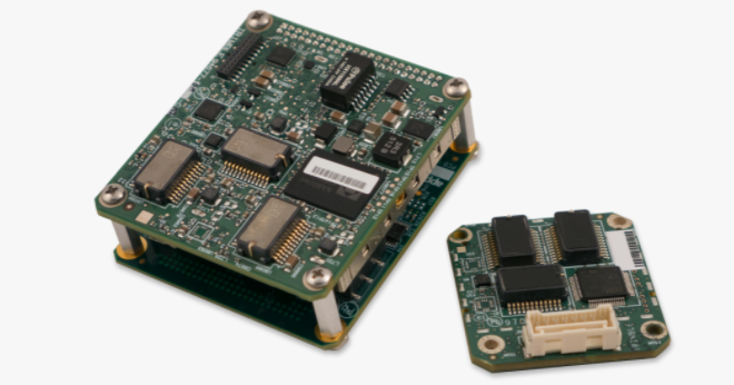
APX15-EI
Applanix DG Offers Solutions to the Following Applications
Used every day to obtain the most accurate UAV data collected from multispectral, hyperspectral, radar, LiDAR and RGB cameras. It enables a great variety of mapping products to be generated without ground control.
Examples of UAV applications include:
- Topographical Survey
- 3D Mapping
- Utility Inspections
- Asset Management
- Agriculture
The Applanix DG is the enabling technology for Corridor Mapping (one flight line), Large Area Mapping, Multi-flight missions or BVLOS operations.
The Challenge
Traditional rail surveys are more expensive due to rail closures while also requiring dangerous and difficult access to busy railways. For many years, Plowman Craven has been an industry leader in providing rail survey data. Plowman Craven sought a better solution, one where it will:
- Reduce the risk associated with accessing rail tracks
- Reduce the cost and time associated with ground control points
- Collect the data quickly
- Provide high accuracy
Introduction to the British Surveyor Plowman Craven Vogel R3D for Rail Infrastructure Survey
Plowman Craven provides integrated measurement and consultancy services to the property and infrastructure markets. Pioneering technical innovation to deliver proven expertise and trusted results throughout the project lifecycle, it plays a key role in some of the most prestigious construction and redevelopment projects in the UK and overseas.
Plowman Craven turned to Aerialtronics for a custom solution. Aerialtronics built a system comprised of the Aerialtronics Altura Zenith ATX8 drone with an integrated APX-15 EI with POSPac UAV SW and a Phase One iXM100 with an 80mm lens called the Vogel R3D.
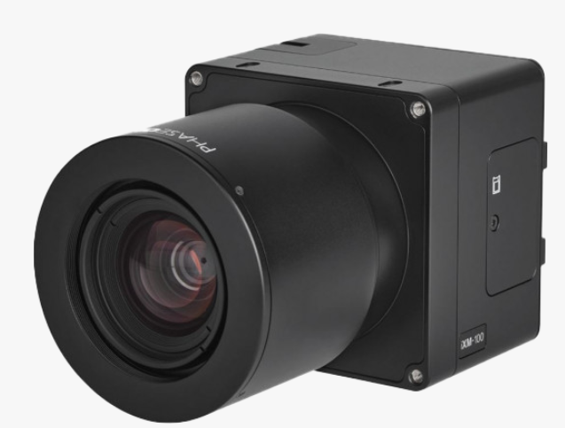
Plowman Craven uses the Phase One iXM100 with an 80mm lens.
“The Vogel R3D revolutionises rail survey and inspection. It removes the need to access the tracks physically and all of the expenses and time required. Fast data capture, data accuracy quality superior to traditional laser-scanning systems and a sub 5mm accuracy suitable for detailed track design make Vogel R3D a very attractive proposition with a wide range of applications. In addition, the high-definition photography we obtain effectively supplements current survey deliverables,” says Tom Wren, Technical Consultant – Infrastructure Services at Plowman Craven.
The Results
Plowman Craven’s solution, called the Vogel R3D, is a unique, UAV-based solution capable of comprehensive drone surveys of rail infrastructure to a sub-5mm accuracy in a fraction of the time of traditional methods. This ground-breaking system captures overlapping aerial images of an entire site. That imagery can be converted into 3D point cloud data that can be used to create a range of deliverables, including track alignments, detailed topographic surveys, 3D BIM models and interactive site visualisations. The Vogel R3D has been successfully trialled by Network Rail, with the survey accuracy results approved, and has now been utilised on over 70 live projects. The costs involved in closing an operational railway for maintenance or inspection can be incredibly expensive, costing thousands and taking many months to plan. Having this integrated solution is a considerable cost and programme saving!
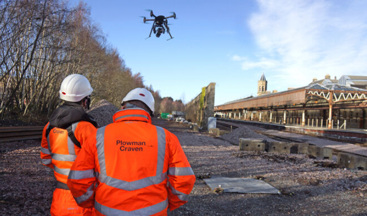
Plowman Craven survey crew
Centimetre accuracy in a fraction of the time of traditional methods
- No need for Ground Control Points (GCPs)
- No need to access tracks
- Increased safety
- Enables regular inspection of rail track condition
- Reduction in maintenance costs
- Increased reliability
- Compact, Easy-to-Operate and Cost-Effective solution
- Can produce 3D mapping products
- Improved Productivity - with optimized workflow means final
products are generated within hours
Do you have questions about this case study?
Get in touch with Trimble Applanix, and they would be happy to answer any questions you have about pricing, suitability, availability, specs, etc.


![Do-Giant-Tortoises-Make-Good-Neighbors-1[1].jpg](https://cdn.geo-matching.com/vRMO2Edp.jpg?w=320&s=a6108b2726133ff723670b57bc54c812)


