


Survey Master
Professional survey software designed for surveyors to work more efficiently
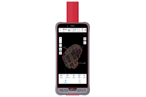
Survey Master is a professional software designed for strong functionality, high efficiency and reliability. Featuring multiple base/rover work modes, abundant import/export formats and complete survey methods, Survey Master will bring users an excellent experience.

ComNav Technology
Shanghai, CN
Description
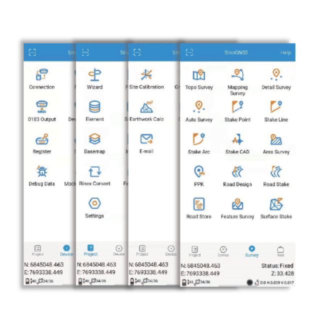
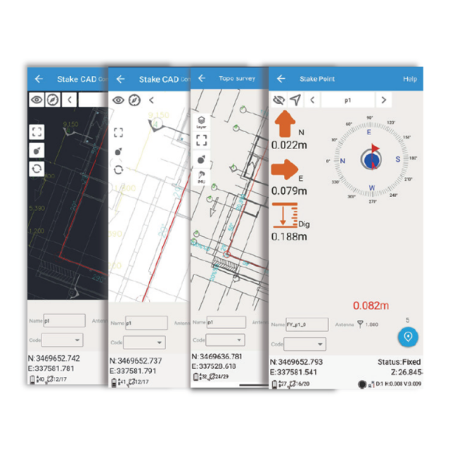
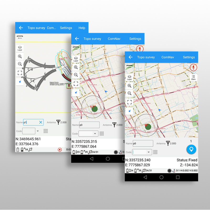
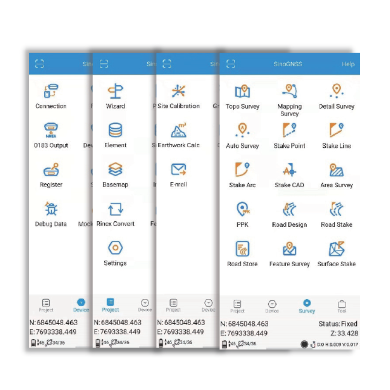
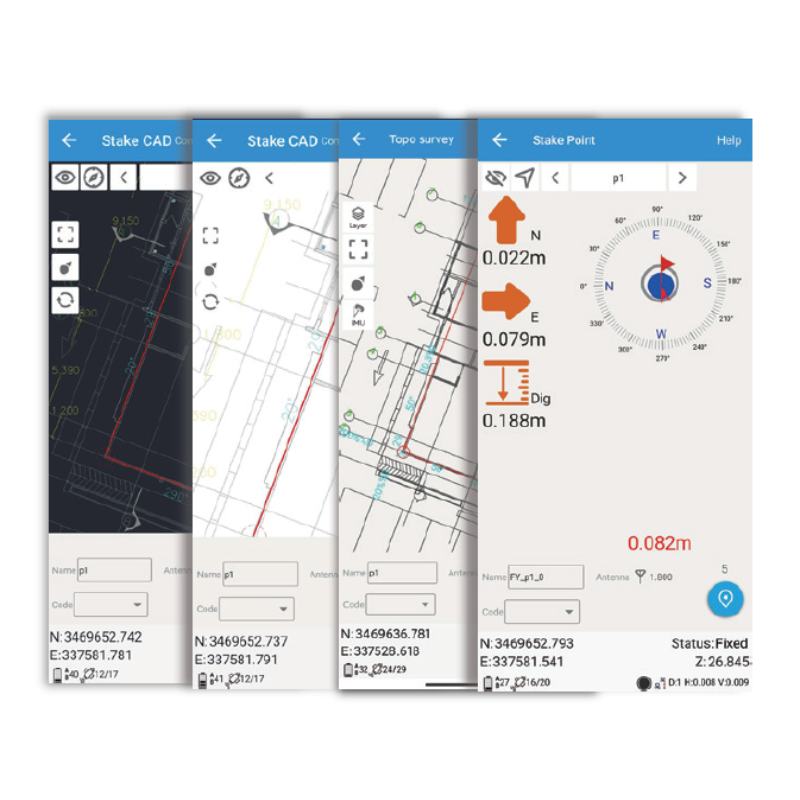
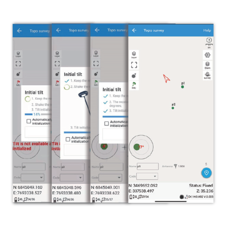
Survey Master is a professional software designed for surveyors to work more efficiently. With Survey Master, users can freely conduct the project through a simple click on commands such as Topo survey/Auto survey, Static and PPK modes, edit and stake points/lines. In addition, surveying data import/export becomes easier and more convenient via this software. It supports data formats, TXT, CSV, SHP and AutoCAD DXF.
- Compatible with most of Android devices
- Easier survey worflow via Wizard function
- Support up 60° IMU tilt compensation
- Support all survey modes, including Static, PPK and RTK
- Access to real-time open street maps
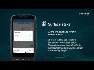
- Support Surface Stake, Mapping Survey and etc. to serve various survey tasks
- Support CAD import and directly use for stake out operations
- Support Convert function from ComNavBinary raw file to RINEX
- Collect users’ feedback through Cloud Service
- Free download from Google Play Store
Do you have questions about this product?
- Questions about price, availability, and/or retailers
- Questions about technical specifications and usage
- Questions about suitability for your project or application
Specifications
-
GNSS data and processing
-
GNSS static / RTK data collection
Y
GNSS setting out
Y
Input data formats supported
NMEA, RINEX, RTCM 2.X, RTCM 3.X
Static baseline post-processing
N
Output data for least squares adjustment with data from other sources
Y
Base and rover RTK
Y
Network RTK
VRS
Post processed kinematic
Y
-
CAD functions
-
CAD functions for Internal measured building surveys
N
CAD functions for open drainage modelling
N
CAD functions for Road applications
Y
Output formats supported
DXF, DWG
-
General
-
Software version
2.7.9
Mobile (real time connected to instrument)
Y
Laptop / Office computer (post processing)
N
-
Integrated environment for
-
GNSS data
Y
GNSS + dead reckoning data (Mobile Mapping)
N
TPS data
N
Point cloud data
N
Level data
N
Integrated least squares computation of control
N
Transformation between map projections
Y
Compute grid DTM
Y
Volume computation from sections
Y
Volume computation by substracting surfaces
Y
-
More information
-
Distinguishable features
Tilt survey, NMEA device support


