


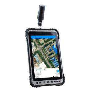
P6H Handhold
Robust GIS Device with Centimeter-Level Precision
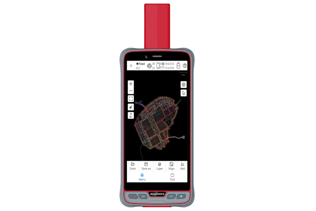
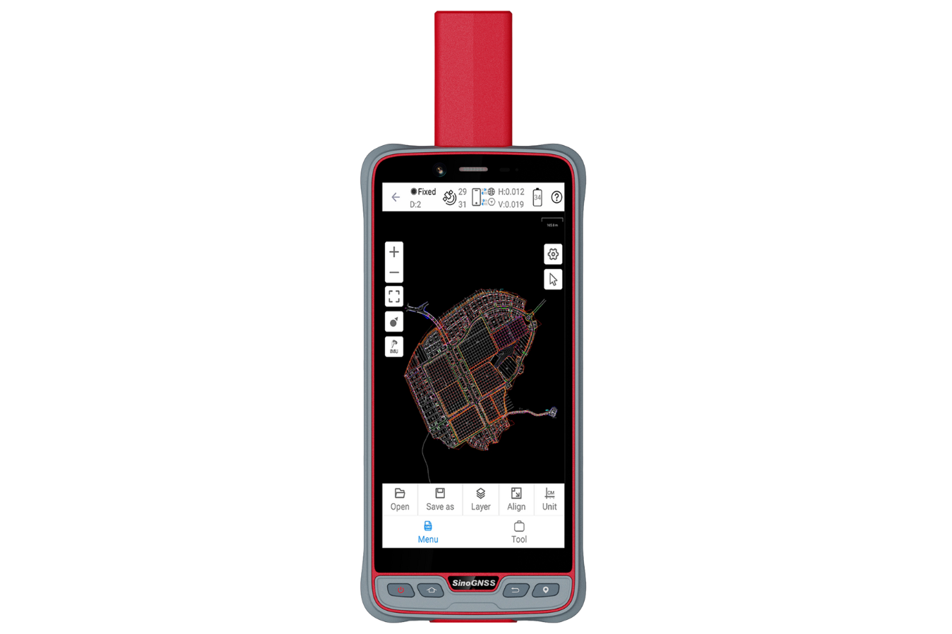
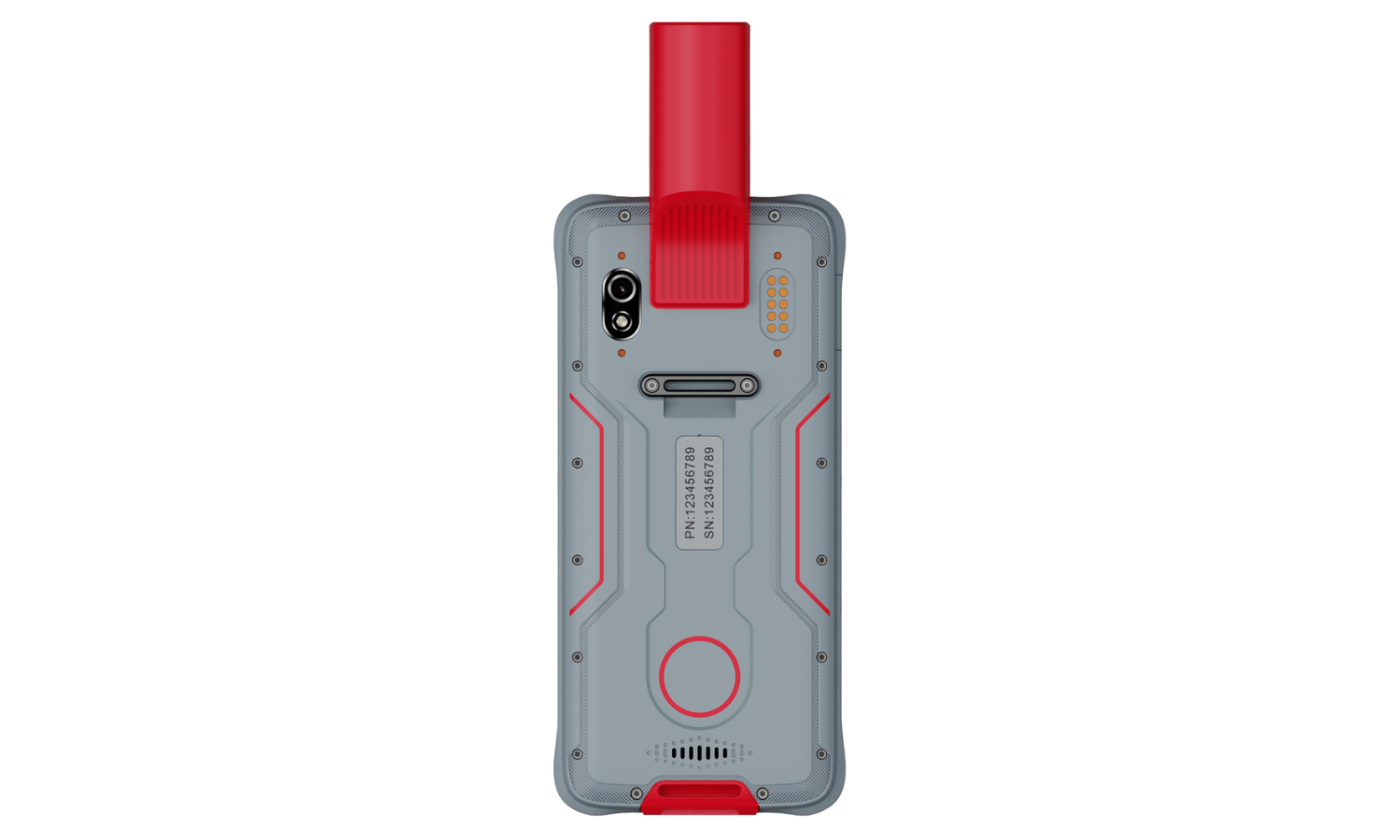
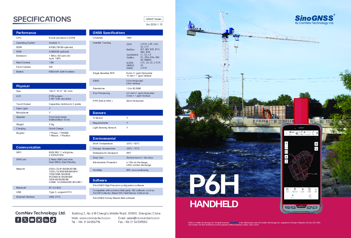
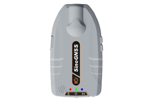
The P6H Handhold is an advanced, rugged device tailored for Geographic Information System (GIS). Equipped with SinoGNSS self-developed high precision K8 board and antenna, it tracks all running and planned constellations, including GPS, BDS, GLONASS, GALILEO, QZAA, IRNSS and SBAS. Its accuracy remains at centimeter or decimeter level. Its portability and durability make it reliable even in harsh conditions.

ComNav Technology
Shanghai, CN
Description
Features:
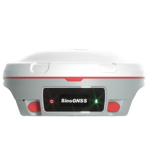
6” Sunlight Readable Screen
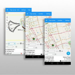
Compatible with common GIS software
Android™ 11 with GMS certified
Integrated High Precision GNSS Module and Antenna
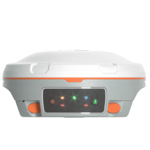
Integrated 4G LTE, Wi-Fi and Bluetooth® 5.0 BLE
IP67 Dustproof and Waterproof
Android 11: The P6H boasts an 8-core 2.0GHz processor paired with Android 11 OS, GMS-certified to guarantee smooth operation of Google's app ecosystem.
IP67 Certified: The IP67 dust and water proof rating ensure the P6H work in harsh environments.
Common GIS Software are Supported: Aside from Survey Master's GIS capabilities, the P6H is compatible with Common Third-Party GIS Software, such as ArcGIS, Mapit GIS, and Qfield.
Do you have questions about this product?
- Questions about price, availability, and/or retailers
- Questions about technical specifications and usage
- Questions about suitability for your project or application
Specifications
-
General
-
Depth [m]
0.0291
Display: width [m]
0.1363
Display: height [m]
0.0682
Height [m]
0.1655
Main design elements
hardware and software, software, hardware
Product Description
The P6H Handheld is an advanced, rugged device tailored for Geographic Information System (GIS). Equipped with SinoGNSS self-developed high precision K8 board and antenna, it tracks all running and planned constellations, including GPS, BDS, GLONASS, GALILEO, QZAA, IRNSS and SBAS. Its accuracy remains at centimeter or decimeter level. Its portability and durability make it reliable even in harsh conditions
Resolution: horizontal pixels
2160
Resolution: vertical pixels
1080
Touchscreen
Y
Total Weight [kg]
0.31
Width [m]
0.0816
Year of introduction
2024
Display Panel
6" HD sunlight readable
-
More information
-
Distinguishable features
Integrated High Precision GNSS Module,Robust Physical Build,Enhanced Connectivity Options,Advanced Display,Powerful Performance Specs,Extended Battery Life,Software Compatibility,RTK and PPP Technology
Main applications
Urban Planning & Management, Natural Resource Management, Emergency Response & Disaster Management, Geography & Environmental Science Research, Agriculture & Food Security, Navigation & Location-based Services
-
Software
-
Display of external data and photos
Y
-
Connectivity
-
Bluetooth
Y
Ports
USB, Type C, support OTG
User Interfaces
touchscreen
WiFi
Y
Wireless Data Transfer
Bluetooth, 4G, WiFi
-
GNSS Receiver
-
Compatible external GNSS receivers
ComNav Technology receivers and other manufacturers
Compatible GNSS correction signals
SBAS, RTK
GNSS Systems Supported
GPS, BDS, GLONASS, GALILEO, QZSS, IRNSS, SBAS
Integrated SBAS
Y
Multipath Mitigation
Y
Number of Channels
1590
Stand alone positional accuracy [m]
1.4
-
Computer
-
Audio: speaker
Y
Audio: microphone
Y
Built-in Camera: megapixels
13
Hard Disk [MB]
65536
Operating System
Android 11 OS
Processor
8-core processor 2.0GHz
RAM [MB]
4096
Types of Replaceable Memory
1 Mirco SD card slot up to 128G
-
Horizontal uncertainty
-
phase: RTK kinematic (variable part) [ppm]
1
phase: RTK kinematic (constant part) [m]
0.008
-
Operation Characteristics
-
Operating temperature: max. [°C]
55
Operating temperature: min. [°C]
-20
Integrated sensors
Barcode scanner, Compass
Water and dust proof [IP]
IP67
Humidity resistance
95% no-condensing
Shock proof
Survive from a 1.2m drop
Documents
Brochure
SinoGNSS P6 Handheld_High Precision Version.pdf
9.41 MB


