


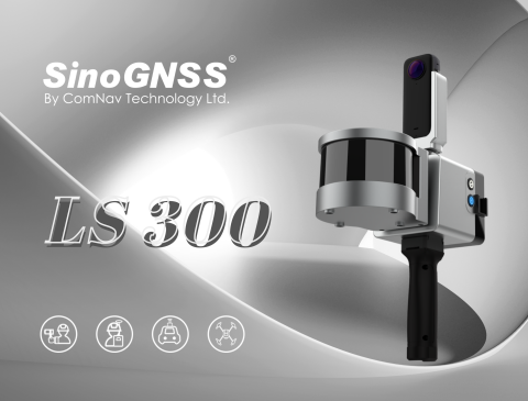
LS300 Laser Scanning
Precision Mobility, 3D Mapping Innovation
The LS300 Laser Scanning System uses SLAM technology (simultaneous localization and mapping), which is real-time positioning and mapping technology. It does not rely on GNSS positioning, and performs self positioning and incremental 3D mapping in unknown environments, including indoors and outdoors. Its lightweight design makes measurement work so easy. With synchronous data acquisition, simply walking around can complete the information data collection. ComNav Technology is committed to providing user-centered 3D laser mobile scanning measurement system product solutions, bringing users a better work experience.

ComNav Technology
Shanghai, CN
Description
LS300: Pioneering Efficiency in Laser Scanning
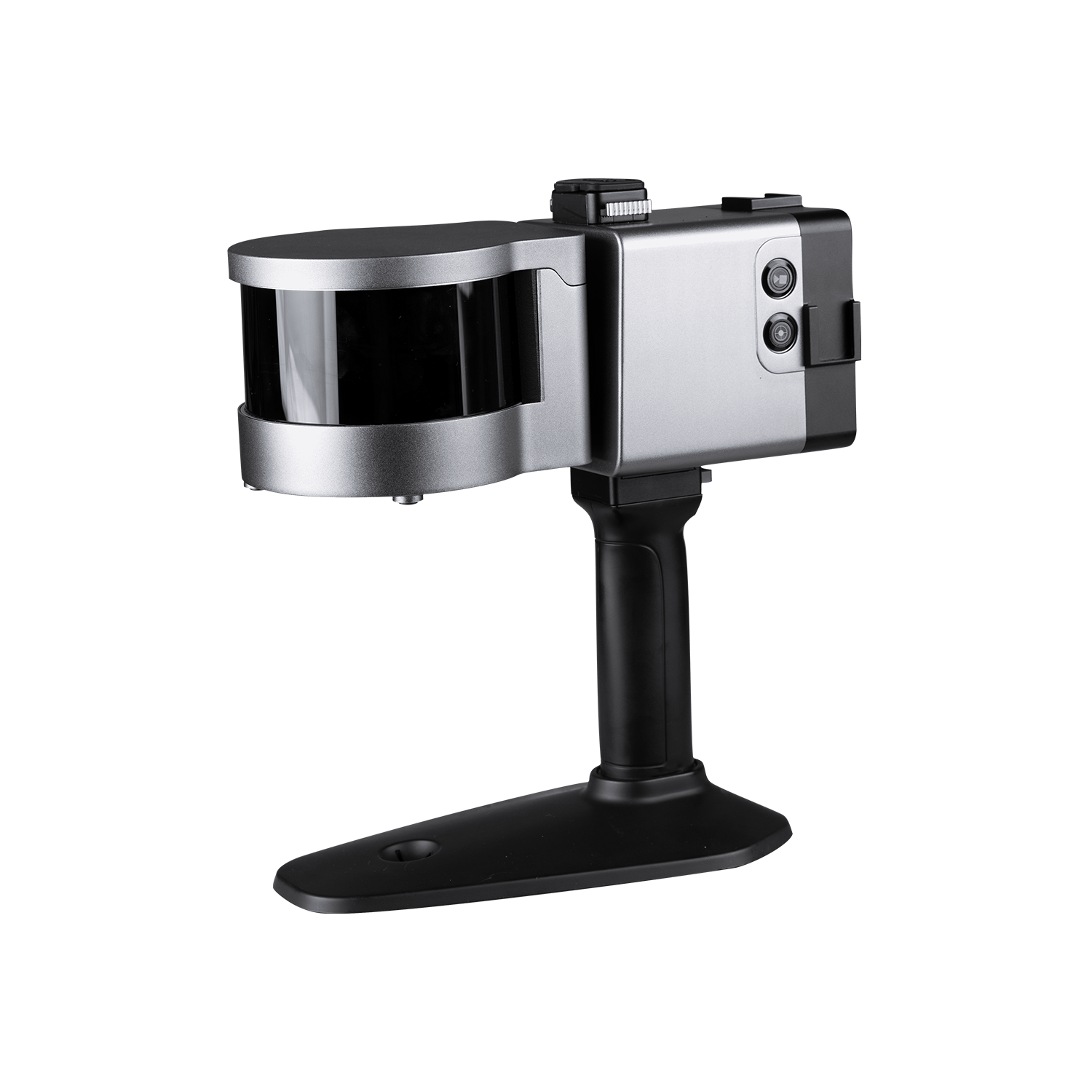
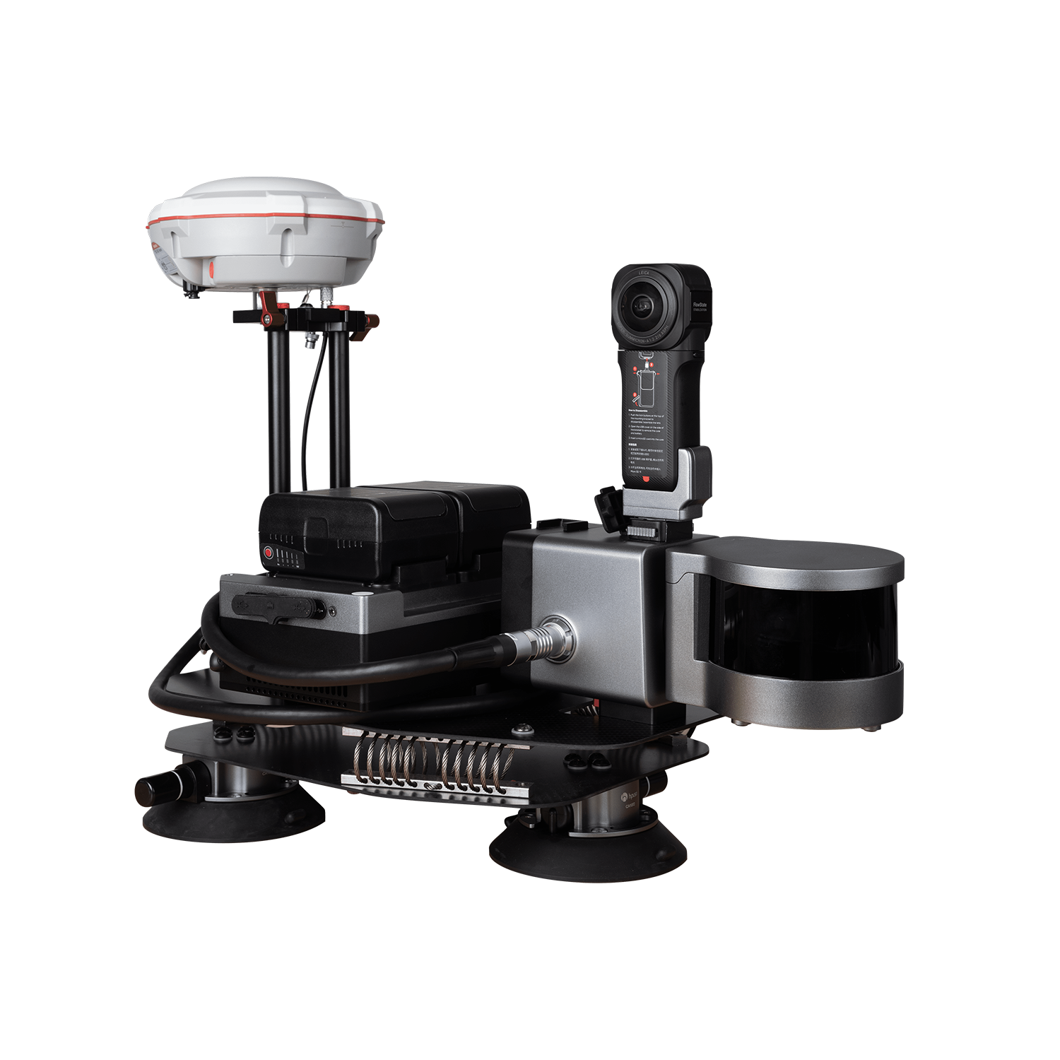
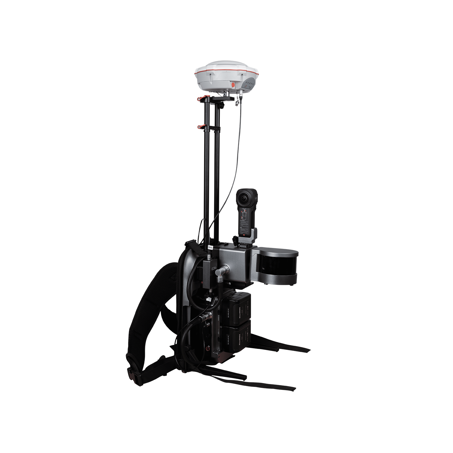
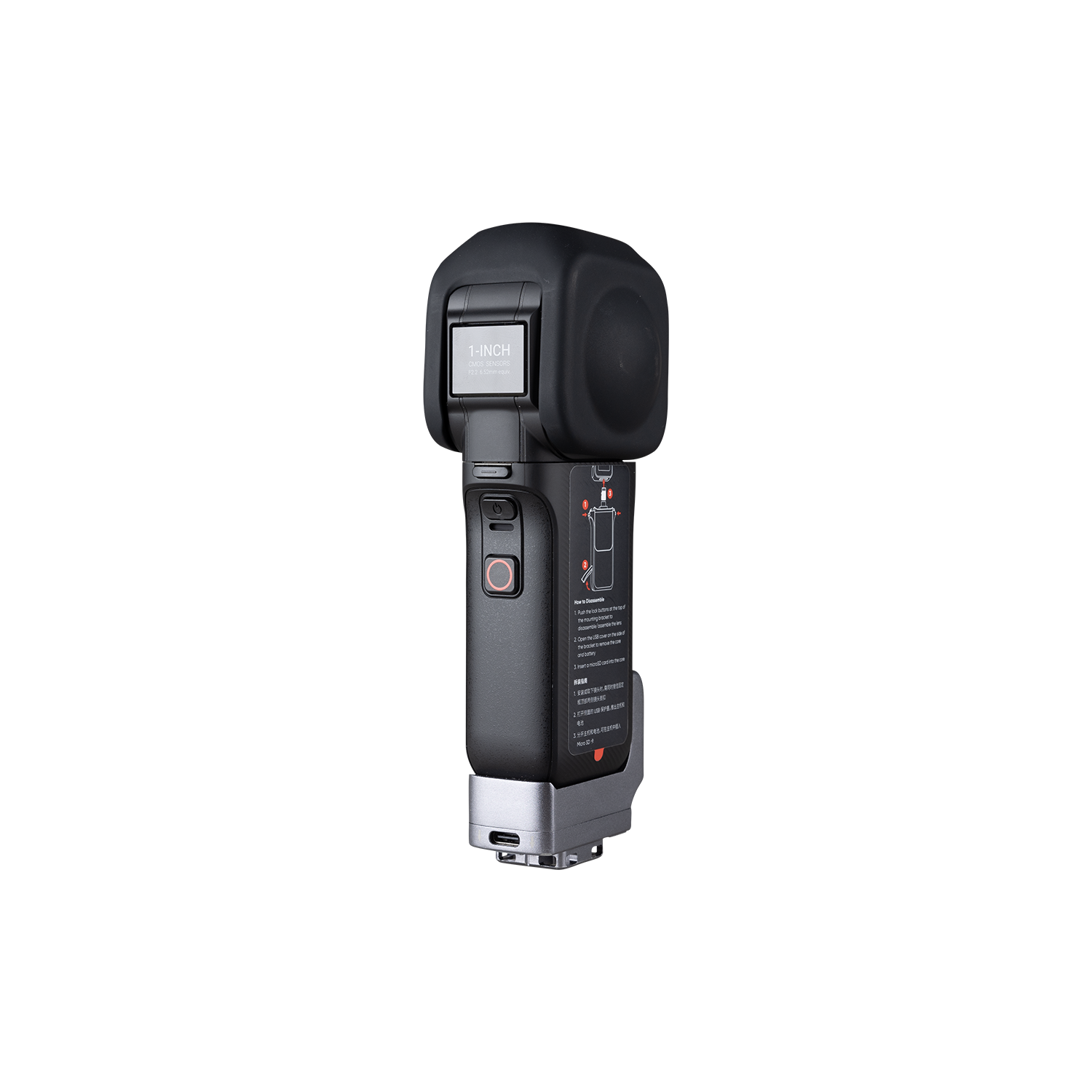
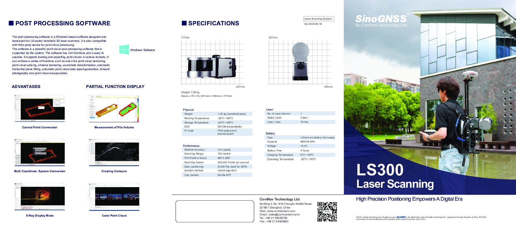
LS300 configures a rotating laser sensor probe with 120 meters working distance, offering excellent performance. It boasts a sample rate of up to 0.65M points per second and a large field of scan covering 360°×285°, ensuring exceptional data capture capabilities. Furthermore, it provides impressive point accuracy of up to 1.0cm, even in low reflectivity extended-range mode.
Versatile Scanning for Diverse Applications
The LS300 Laser Scanning System is a versatile tool for various applications. It can switch scanning modes quickly, offers 2 cm accuracy with GNSS integration, and supports third-party device integration, providing flexibility for diverse collaborative work and expanding application possibilities.
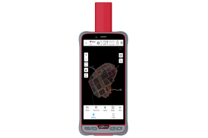
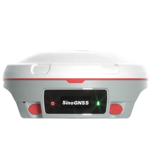
new color status display screen
A new color status display screen with a larger size supports more information display as well as operating instructions which making it easier to use and getting started.
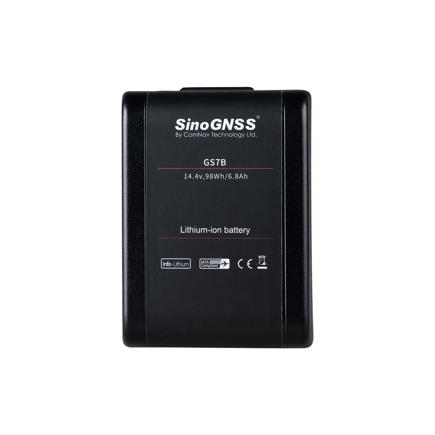
Hot Swappable Batteries
The LS300 adopts two batteries uninterruptible redundancy design, supports hot swapping and replacement of batteries, and has this technical patent.
APP Real Time Preview
During operation, APP can browse point cloud data in real time which support multiple browsing interaction modes and more humn-computer interaction content.
Innovative Hybrid Solving Technology
Experience a paradigm shift with the LS300, showcasing groundbreaking hybrid solving technology. This unique capability allows simultaneous post-processing of preceding data during scanning, resulting in a notable enhancement in the speed and efficiency of acquiring high-precision data like never before.
Anchor Point Process
An anchor point solution function ensures accuracy and stability when scanning data indoors and outdoors with large ranges, low characteristics, and high difficulty. During the data post process, input the absolute coordinates of control points, and control points can perform overall data adjustment on the data to obtain high-precision scanning results data.
New Visual Experience
The LS300 has more excellent point cloud color function which provides users with clear immersive color effects, clearer details, more bright colors and more realistic effects.
Do you have questions about this product?
- Questions about price, availability, and/or retailers
- Questions about technical specifications and usage
- Questions about suitability for your project or application
Specifications
-
General
-
Depth [cm]
22.7
Hardware Material
Metal
Height [cm]
11.7
Total Weight [kg]
1.35
Width [cm]
10.5
Year of introduction
2023
-
Application
-
Main applications
Smart City; Digitization of Underground Facilities; Agriculture, Forestry, Geology; Surveying and Mapping
Main users
Surveyors
-
Scanning Characteristics
-
Color registration
Y
Laser Class
Class I
Max. horizontal field of view [deg]
360
Max. Range [mm]
120000
Max. vertical field of view [deg]
285
Scanning Speed
320,000 Points per second
-
Operation Characteristics
-
Operating temperature: max. [°C]
60
Operating temperature: min. [°C]
-35
-
Power
-
Battery type
Lithium ion battery (hot swap)
-
More information
-
Distinguishable features
Capable of multiple scanning modes, include handheld RTK kit, backpack kit, car mount kit, drone kit
-
Functionality
-
Mesh as output
N
Real time visualization during scanning
Y
Safety Certification
IP54 waterproof and dustproof
-
Connectivity and Sensors
-
INS
Y
USB Port
Y
WiFi
Y
Documents
Brochure
LS300 Laser Scanning.pdf
45.41 MB
Videos
