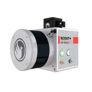

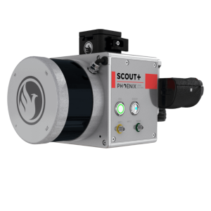
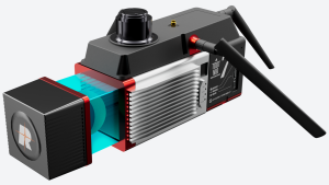
SCOUT-32
UAV LiDAR For Light Vegetation and Medium-Range Scanning
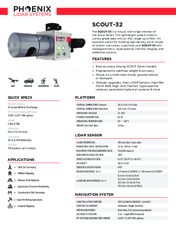
The SCOUT-32 is a robust, mid-range member of the Scout Series. This lightweight system collects survey-grade data with an AGL range up to 65m. An excellent option for building high-density point clouds of smaller scan areas, customize your SCOUT-32 with photogrammetry, hyperspectral, thermal imaging, and additional options.
Phoenix LiDAR Systems
Austin, US
Description
The Phoenix SCOUT-32 is a powerful, yet compact, mid-range member of the Scout Series. This lightweight system collects survey-grade data with an AGL range up to 65m and features multi-target capacity with up to 2 target echoes per laser shot. An excellent option for building high-density point clouds of smaller scan areas, the SCOUT-32 also features options for photogrammetry, hyperspectral, thermal imaging, and more. Flexibility in sensing and mounting options is a key benefit of this Phoenix system.
Features:
-
Best accuracy among SCOUT Series models
-
Engineered to optimize weight & accuracy
-
Mount on a multi-rotor drone, ground vehicle, or backpack
-
Modular upgrades: Dual LiDAR Sensors; High-Res DSLR; RGB GigE Cam; thermal, hyperspectral cameras; panoramic/spherical cameras & more
Quick Specs:
-
Absolute Accuracy = 35-55 mm RMSE @ 50 m Range
-
Weight = 2.4kg /5.3lbs.
-
Dimensions = 24.6 x 11.6 x 11.6 (cm)
-
Pulse Rate = 700 k points/s, up to 2 returns
-
Laser Range = 107 m @ 60% Reflectivity
Specifications
-
Application
-
Main applications
Light Vegetation, Power Utilities, Open Pit Mining, Railway Track Mapping, Agriculture and Forestry, Construction, General Mapping
Training, maintanence and support
1 year warranty on defective hardware or software issues. Training and support can be included with purchase.
-
Measurement Characteristics
-
Scanning Speed [measurements p second]
700000
Max. field of view [degrees]
360
Max. number of recorded echoes per pulse
2
Scanning method
rotating laser array
Range accuracy [mm]
20
multiple pulses in air
Y
Max. pulse frequency [Hz]
695,000
Recording of intensity of return signal [bits]
8
-
Physical Properties
-
Height [cm]
11.6
Length [cm]
24.6
Width [cm]
11.6
Weight [kg]
2.4
-
Laser Pulse Characteristics
-
Laser Class
Class 1
Wavelength [nm]
903
Beam divergence [mrad]
2.79
Min. range of laser pulse [m]
1
Max. range of laser pulse [m]
100
-
Power Supply
-
Power consumption
-50 W
Power requirements
12-28V
Type of battery
6S LiPO
-
Positioning System
-
Typical positioning accuracy [cm]
2
Number of GNSS positioning sensors
1
Type of GNSS positioning sensors
GNSS unit that supports mutli-band signal tracking for all constelations, dual antenna functionality, and up to 100 Hz data rate.
Heading, Pitch and Role internally captured
Y
Type of INS or IMU
several MEMS IMUs available
Gyroscopes Bias In-Run stability [deg p hr]
0.5
-
Operation Characteristics
-
Mounting
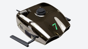
The SCOUT-32 is designed to fly on UAVs, including the DJI M600 Pro, and can also be adapted for vehicle and backpack configurations.Roof rack and suction cup accessories also available.
Camera included
Optional
Requirements for compatible UAVs
Phoenix Dovetail
Camera specifications
Depends on camera
Control and user interface
PC software interface capable of displaying real time, georeferenced returns via 5.8 GHz WiFi connection, or a more simplified push-button interface.
-
Data and Software
-
Type of storage
SSD
Max. storage space [mb]
500000
Included software
Includes software for point cloud creation and data acquisition - trajectory processing software can also be purchased.
Documents
Brochure
scout-32.pdf
527.4 KB
Other documents
-
Scout-32 SpecSheet527.4 KB


