

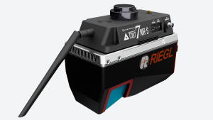
LiDAR SZT-R1000
● Multi-platform (Helicopter/SUV/ATV/Vessel) applications ● Point cloud density up to 550,000 points per second ● Accuracy control down to 5mm, applicable for 1:500 mapping ● Working range up to 920m with 330-degree FOV
SOUTH Surveying & Mapping
Guangzhou, CN
Description
Specifications
-
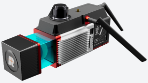
Physical Properties
-
Height [cm]
31
Length [cm]
51.5
Width [cm]
24.8
Weight [kg]
5.99
-
Power Supply
-
Power consumption
85W
-
Operation Characteristics
-
Camera included
-
General
-
Year of last update
2019
Year of introduction
2019
Documents
Brochure
5dccc8f9d2804.pdf


