
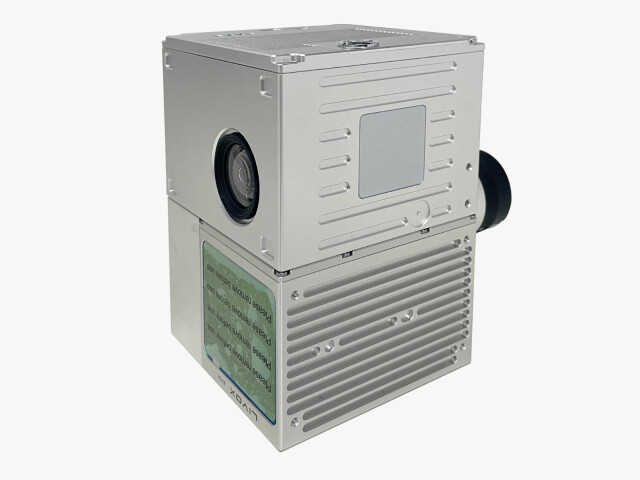
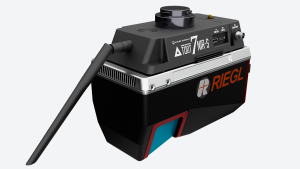
LiDAR GS-100C
This state-of-the-art lidar device is designed to seamlessly integrate with the H850-RTK drone, expanding the possibilities of your survey work.
YUNEEC - A Company of ATL Drone
Schlieren, CH
Description
Its streamlined setup process means it's ready to scan within just two minutes of switching on, maximizing efficiency and minimizing downtime. The Lidar GS100C has exceptional technical specifications, making it the perfect companion for surveyors with the highest demands on precision and reliability.
Whether you're conducting a classic topographic survey or engaging in agricultural and forestry applications, the GS100C delivers accurate and detailed results that meet the needs of even the most demanding projects.
720,000 points/sec.
Distance Effective Pixels: 24 MP
Scanning range: 1000 ha/hour
Precision: 2.0 cm
Weight: 1070g
Storage: supports up to 128GB Micro SD
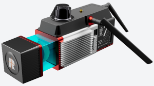
Laser unit: Measuring range: 230m@20%
Laser Class: 905nm Class1 (IEC 60825-1:2014)
Number of laser beams: Corresponds to 64 beams
Field of vision: 70° all-round vision
Data: 3x echo, 720,000 points/sec
Specifications
-
Application
-
Main applications
Survey Mapping
-
Measurement Characteristics
-
Max. field of view [degrees]
70
Max. number of recorded echoes per pulse
720000
Max. pulse frequency [Hz]
200
multiple pulses in air
Y
Range accuracy [mm]
20
-
Physical Properties
-
Height [cm]
13.8
Length [cm]
9.1
Weight [kg]
1.1
Width [cm]
9.4
-
Laser Pulse Characteristics
-
Laser Class
1
Max. range of laser pulse [m]
230
Wavelength [nm]
905
-
Positioning System
-
Typical positioning accuracy [cm]
10
-
Operation Characteristics
-
Mounting
X-connector
Requirements for compatible UAVs
Heavy Payload bracket
Camera included
Yes
Camera specifications
26MP, 16mm focal view, 83degrees FOV
-
Data and Software
-
Type of storage
flash card


